Towns & cities · West Midlands
Stanbridge
Stanbridge — village and civil parish in Bedfordshire, England, UK.
.jpg?width=1200)
Wikimedia Commons contributors — see linked file page for photographer and licence licence
.jpg)
Plan your visit
- Typical visit
- 3 h–6 h
- Nearest railway station
- Page's Park · 3.5 km
- Free entry
- Family-friendly
- Dog-friendly
About
Stanbridge is a town, city, village or settlement in the United Kingdom. Recent population estimates put it at around 713 people. Address: LU7. Wikidata describes it as: "village and civil parish in Bedfordshire, England, UK". Coordinates: 51.9076°, -0.5992°.
Photo gallery
Protected designations
- Area of Outstanding Natural Beauty: Chilterns
Designations sourced from Natural England open data under OGL v3.
From the Wikipedia article
Stanbridge is a village and civil parish in Bedfordshire which lies 3 miles (5 km) east of Leighton Buzzard. It also borders the Bedfordshire villages of Hockliffe, Eggington, Tilsworth, Totternhoe and Billington. There was a windmill to the east of Mill Road, in the north of the village, that is marked on early Ordnance Survey maps. To the west of Mill Road, still standing, is a later windmill that has been converted to a three-story house. This has recently had a new dome fitted to its roof. St John the Baptist Parish Church is also located in the village. Stanbridge had its own railway station, until it was closed in the 1960s by Lord Beeching. This was to the south of the village, at Stanbridgeford on the Leighton Buzzard to Dunstable LNWR line. The eastern part of the old line has been utilised as a footpath to Sewell and Dunstable; the western part is now part of the Leighton Buzzard Southern Bypass. RAF Stanbridge was built on land that was in the neighbouring parish of Billington, but the town of Leighton Buzzard has now expanded over much of the base. The village has a traditional English country public house called The Five Bells. Stanbridge is part of the political ward of 'Heath and Reach' which sends a Councillor to Central Bedfordshire Council. The ward includes the villages of Heath and Reach, Hockliffe, Eggington, Stanbridge, Tilsworth, Tebworth, and Wingrave. The ward was created in 2011 and has since been represented by Councillor Mark Versallion.
Excerpt from Wikipedia under CC BY-SA 4.0. See the source article linked in Sources below.
- Coordinates
- 51.9076, -0.5992
- District
- Central Bedfordshire
- Parish
- Stanbridge
- Postcode
- LU7
- Parliamentary constituency
- Dunstable and Leighton Buzzard
- Population
- 713
- Nearest railway station
- Page's Park — 3.5 km
Sources
- wikidata: Q1519991 (CC0)
- wikipedia: Stanbridge, Bedfordshire (CC BY-SA 4.0)
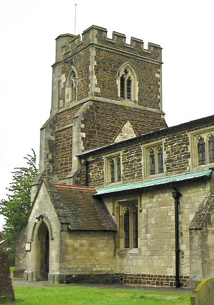
- commons: St. John the Baptist, Stanbridge, Bedfordshire (geograph 2254203).jpg (CC BY-SA 4.0)
Other places nearby
Loading nearby places…
Nearby
 📷 3
📷 3Historic churches · West Midlands
Church of St John the Baptist, Stanbridge
Church of St John the Baptist, Stanbridge — church in Stanbridge, Bedfordshire, England, UK.
 📷 3
📷 3Castles · East of England
Tilsworth Castle
Tilsworth Castle refers to both "Warren Knoll Motte" and "Tilsworth Manor", both built in the same general area, located in the civil parish of Tilsworth, in the county of Bedfordshire, England.
 📷 3
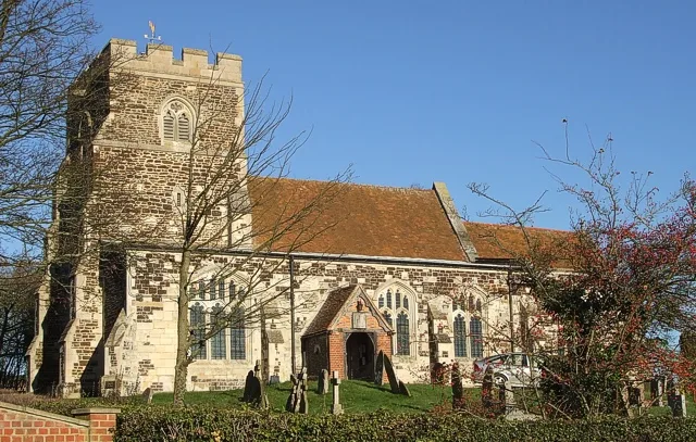
📷 3Historic churches · West Midlands
Church of All Saints, Tilsworth
Church of All Saints, Tilsworth — church in Tilsworth, Bedfordshire, England, UK.
 📷 5
📷 5Towns & cities · West Midlands
Tilsworth
Tilsworth — village and civil parish in Central Bedfordshire, Bedfordshire, England.
 📷 3
📷 3Farms (open to visitors) · West Midlands
Mead Open Farm
Mead Open Farm — a other in england-west-midlands, United Kingdom.
 📷 3
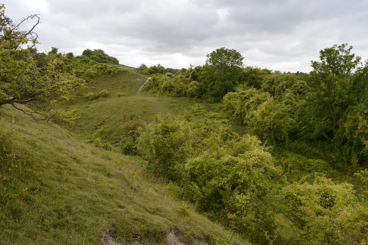
📷 3Wildlife reserves · West Midlands
Totternhoe nature reserve
Totternhoe nature reserve — nature reserve in the United Kingdom.
More towns in this region
 Flagship📷 3
Towns & cities · West Midlands
Adderbury
Adderbury — village and civil parish in Cherwell district, Oxfordshire, England.
 Flagship📷 3
Towns & cities · West Midlands
Admington
Admington — village in Warwickshire, England, UK.
 Flagship📷 3
Towns & cities · West Midlands
Aldington
Aldington — village in Worcestershire, United Kingdom.
 Flagship📷 5
Towns & cities · West Midlands
Anstey
Anstey — large village in Leicestershire, England.
Frequently asked questions
- Where is Stanbridge?
- Stanbridge is in the West Midlands, United Kingdom (postcode LU7), in the parish of Stanbridge.
- Is Stanbridge a protected site?
- Yes — Stanbridge is part of the Chilterns National Landscape (AONB).
- Is Stanbridge free to visit?
- Yes, Stanbridge is free to enter.
- How do I get to Stanbridge?
- The nearest railway station is Page's Park, about 3.5 km away. Drivers can navigate to postcode LU7.