Historic churches · West Midlands
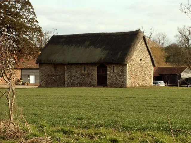
St Faith, Farmcote
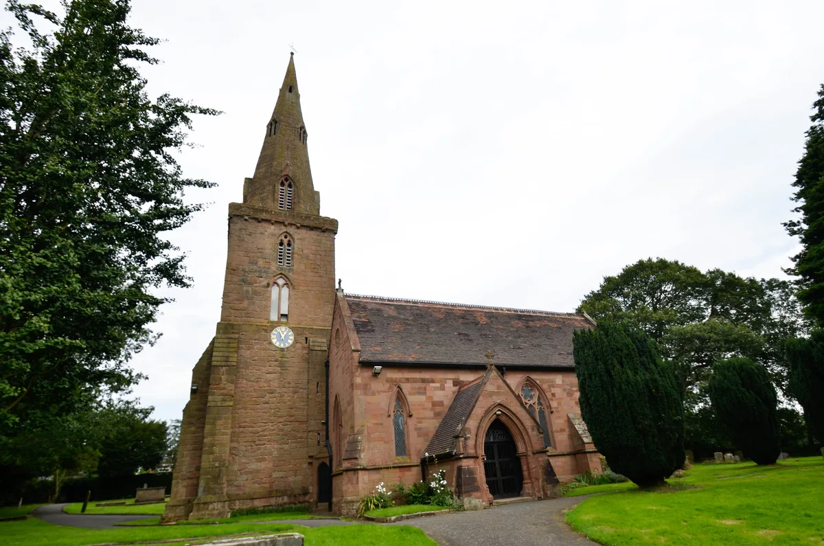
St Faith, Farmcote — church in Farmcote, Gloucestershire, England, UK.

Wikimedia Commons contributors — see linked file page for photographer and licence licence
Plan your visit
- Typical visit
- 30 min–1 h
- Nearest railway station
- Hayles Abbey Halt · 2.4 km
- Free entry
About
St Faith, Farmcote is a historic church in the United Kingdom. Records date its origin to 1050. Built in the Norman architecture style. Heritage designation: Grade I listed building. Affiliated with Anglicanism. Wikidata describes it as: "church in Farmcote, Gloucestershire, England, UK". Coordinates: 51.9579°, -1.9122°.
Photo gallery
Heritage listing
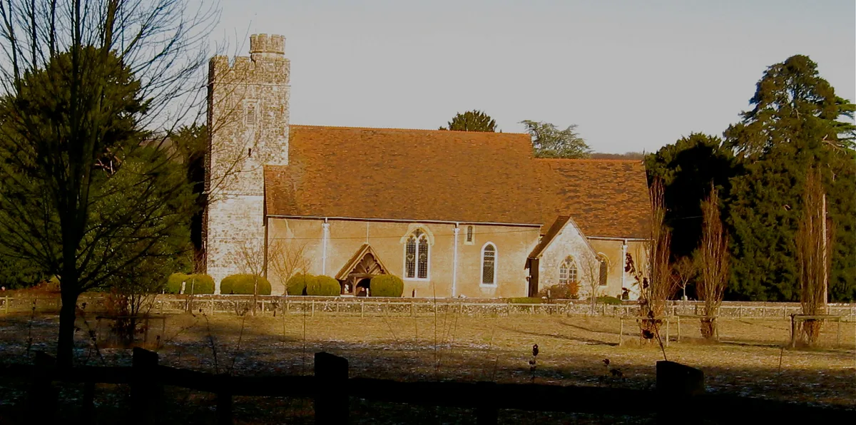
St Faith, Farmcote is a small chapel located in the hamlet of Farmcote, Gloucestershire, two miles north-west of Temple Guiting. The original building, constructed with limestone rubble, dates to the Anglo-Saxon or early Norman period. Its original layout consisted of a rectangular nave and chancel; the chancel was later demolished. The remains of the early church are the Saxo-Norman nave, the damaged doorway and a rare double bellcote.
From the Historic England List Entry under OGL v3.
Protected designations
- Area of Outstanding Natural Beauty: Cotswolds
Designations sourced from Natural England open data under OGL v3.
From the Wikipedia article
St Faith, Farmcote is a small chapel located in the hamlet of Farmcote, Gloucestershire, two miles north-west of Temple Guiting. The original building, constructed with limestone rubble, dates to the Anglo-Saxon or early Norman period. Its original layout consisted of a rectangular nave and chancel; the chancel was later demolished. The remains of the early church are the Saxo-Norman nave, the damaged doorway and a rare double bellcote. It has been designated by English Heritage as a Grade I listed building.
Excerpt from Wikipedia under CC BY-SA 4.0. See the source article linked in Sources below.
Background
History
St Faith's church dates to the late Saxon or early Norman period. The church began as a chapel of ease to the church at Guiting Power, five miles away.
Description
St Faith is a chapel of ease located in Farmcote, Gloucestershire, two miles north-west of Temple Guiting. It stands on a sloping hill overlooking the Severn Valley. The church was constructed in the late Anglo-Saxon or early Norman period with limestone rubble. The church has a limestone roof with limestone coping. Its original, simple layout consisted of a rectangular nave and chancel; the chancel was later removed. The surviving original features of the church are the Saxo-Norman nave, a damaged doorway and a double bellcote. The church has two 15th-century stone-mullioned windows with cinquefioil cusped heads. The studded plank door is original. On the west wall is an Early English font…
Sourced from Wikipedia under CC BY-SA 4.0.
- Coordinates
- 51.9579, -1.9122
- County
- Gloucestershire
- District
- Cotswold
- Parish
- Temple Guiting
- Postcode
- GL54 5AU
- Parliamentary constituency
- North Cotswolds
- Established
- 1050
- Nearest railway station
- Hayles Abbey Halt — 2.4 km
Sources
- wikidata: Q7593057 (CC0)
- wikipedia: St Faith, Farmcote (CC BY-SA 4.0)
- commons: St Faith's, Farmcote.JPG (CC BY-SA 4.0)
Other places nearby
Loading nearby places…
Nearby
Vineyards · West Midlands
Beckbury camp, Hailes
Beckbury camp, Hailes — a UK vineyard in england west midlands, producing English or Welsh wine from cool-climate grape varieties.
 📷 3
📷 3Archaeological sites · West Midlands
Beckbury Camp
Beckbury Camp — a archaeological in england-west-midlands, United Kingdom.
 📷 3
📷 3Memorials & monuments · West Midlands
Cromwell's Seat
Cromwell's Seat is a memorial in the United Kingdom.
 📷 3
📷 3Farms (open to visitors) · West Midlands
Hayles Fruit Farm
Hayles Fruit Farm — a other in england-west-midlands, United Kingdom.
Campsites · West Midlands
Hayles Fruit Farm Campsite
Hayles Fruit Farm Campsite — a campsite in england west midlands.
 📷 5
📷 5Abbeys & priories · West Midlands
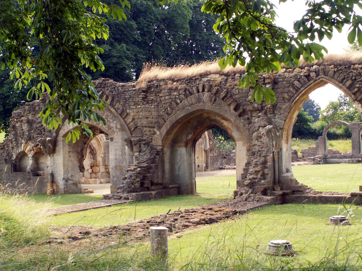
Hailes Abbey
Hailes Abbey — abbey in the Cotswolds, United Kingdom.
Other places from this era
 📷 5
📷 5Historic churches · London
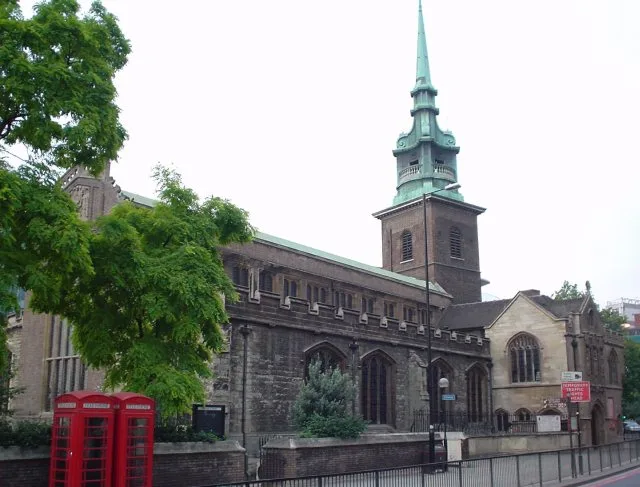
All Hallows-by-the-Tower
All Hallows-by-the-Tower — church in the City of London, United Kingdom.
 📷 5
📷 5Historic churches · London
All Saints Church, West Farleigh
All Saints Church, West Farleigh — Grade I listed church in West Farleigh, Maidstone, Kent, England, UK.
 📷 5
📷 5Historic churches · London
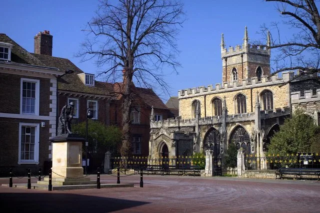
All Saints' Church, Huntingdon
All Saints' Church, Huntingdon — Grade I listed church in Huntingdonshire, United Kingdom.
 📷 5
📷 5Historic churches · London
Chapel of St Helen, Wicken Bonhunt
Chapel of St Helen, Wicken Bonhunt — church building in Wicken Bonhunt, Uttlesford, Essex, England, UK.
More places in this region
 📷 3
📷 3Historic churches · West Midlands
All Saints Chapel, Somerford
All Saints Chapel, Somerford — church in Cheshire East, Cheshire, England, UK.
 📷 4
📷 4Historic churches · West Midlands
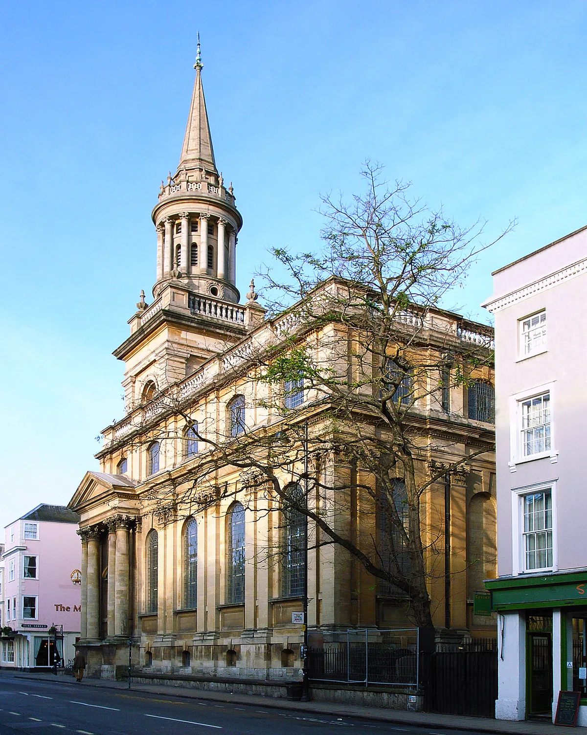
All Saints Church
All Saints Church — church building in Oxford, UK.
 📷 3
📷 3Historic churches · West Midlands
All Saints Church, Aldwincle
All Saints Church, Aldwincle — church in Aldwincle, Northamptonshire, UK.
 📷 3
📷 3Historic churches · West Midlands
All Saints Church, Allesley
All Saints Church, Allesley — Grade I listed church in Coventry, West Midlands, England, UK.
Frequently asked questions
- Where is St Faith, Farmcote?
- St Faith, Farmcote is in Gloucestershire, the West Midlands, United Kingdom (postcode GL54 5AU), in the parish of Temple Guiting.
- When was St Faith, Farmcote built?
- Built or established in 1050.
- Is St Faith, Farmcote a listed building?
- St Faith, Farmcote is officially recognised as Grade I listed building listed.
- Is St Faith, Farmcote a protected site?
- Yes — St Faith, Farmcote is part of the Cotswolds National Landscape (AONB).
- Is St Faith, Farmcote free to visit?
- Yes, St Faith, Farmcote is free to enter.
- How do I get to St Faith, Farmcote?
- The nearest railway station is Hayles Abbey Halt, about 2.4 km away. Drivers can navigate to postcode GL54 5AU.