Towns & cities · Central Scotland
Slamannan
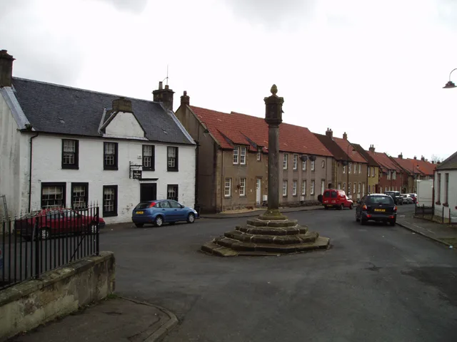
Slamannan — village in Falkirk, Scotland, UK.

Wikimedia Commons contributors — see linked file page for photographer and licence licence
Plan your visit
- Typical visit
- 3 h–6 h
- Nearest railway station
- Falkirk High · 6.5 km
- Free entry
- Family-friendly
- Dog-friendly
About
Slamannan is a town, city, village or settlement in the United Kingdom. Recent population estimates put it at around 1,310 people. Wikidata describes it as: "village in Falkirk, Scotland, UK". Coordinates: 55.9379°, -3.8333°.
Photo gallery
From the Wikipedia article
Slamannan (Scottish Gaelic: Sliabh Mhanainn) is a village in the south of the Falkirk council area in Central Scotland. It is 4.6 miles (7.4 km) south-west of Falkirk, 6.0 miles (9.7 km) east of Cumbernauld and 7.1 miles (11.4 km) north-east of Airdrie. Slamannan is located at the cross of the B803 and B8022 roads, near the banks of the River Avon, close to the border between Falkirk and North Lanarkshire councils. Slamannan had a population of around 1,360 residents. In 1755 the population was recorded as 1209. Fifty years later the population was around the 1000 in the Parish of Slamanan (although elsewhere in the same volume the usual spelling is used). The 19th-century parish church can accommodate upwards of 700 people.
Excerpt from Wikipedia under CC BY-SA 4.0. See the source article linked in Sources below.
Background
History
's map from 1654 based on Pont's original c.1596 "The East Central Lowlands (Stirling, Falkirk & Kilsyth) - Pont 32" map depicting Slamannenn and Slea-manann Moore]] The name relates to the Manaw Gododdin tribe about whom little is known. The name possibly means hill-face of Manan. The church at Slamannan used to be named after St Laurence. There is also a well which bears his name. It is recorded that in 1470 James II gave a charter to Lord Livingstone for the lands of Slamannan. James IV paid a guide sixpence to help him cross the moor of Slamannan in August 1491 during an excursion in the Bathgate area from Linlithgow Palace. The area was once well known for steam coal which was worked…
Sourced from Wikipedia under CC BY-SA 4.0.
- Coordinates
- 55.9379, -3.8333
- District
- Falkirk
- Postcode
- FK1 3EJ
- Parliamentary constituency
- Falkirk
- Population
- 1,310
- Nearest railway station
- Falkirk High — 6.5 km
- Official site
- www.falkirk.gov.uk
Sources
- wikidata: Q1016958 (CC0)
- wikipedia: Slamannan (CC BY-SA 4.0)
- commons: Time I headed home - geograph.org.uk - 150435.jpg (CC BY-SA 4.0)
Other places nearby
Loading nearby places…
Nearby
 📷 3
📷 3Memorials & monuments · Central Scotland
Alexander Penman MM Memorial
Alexander Penman MM Memorial — a memorial in scotland-central, United Kingdom.
📷 3Memorials & monuments · Central Scotland
Samuel Frickerton VC Memorial
Samuel Frickerton VC Memorial — a memorial in scotland-central, United Kingdom.
📷 3Memorials & monuments · Central Scotland
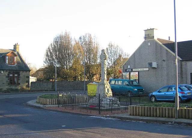
Slamannan Memorial Garden
Slamannan Memorial Garden — a memorial in scotland-central, United Kingdom.
📷 3Memorials & monuments · Central Scotland
John Tristram Silvester Memorial
John Tristram Silvester Memorial — a memorial in scotland-central, United Kingdom.
 📷 5
📷 5Historic churches · Central Scotland
Slamannan Parish Church and St Laurence's Well, Main Street, Slamannan
Slamannan Parish Church and St Laurence's Well, Main Street, Slamannan — category B listed building-listed church in scotland-central, United Kingdom.
 📷 3
📷 3Historic houses · Central Scotland
Easter Drumclair
Easter Drumclair — a historic house in scotland-central, United Kingdom.
More towns in this region
 Flagship📷 3
Towns & cities · Central Scotland
Airth
Airth — village in Falkirk, Scotland, UK.
 Flagship📷 5
Towns & cities · Central Scotland
Avonbridge
Avonbridge — village in Falkirk, Scotland, UK.
 Flagship📷 3
Towns & cities · Central Scotland
Banknock
Banknock — village in Falkirk, Scotland, UK.
 Flagship📷 3
Towns & cities · Central Scotland
Dundee
Dundee — city in Scotland, UK.
Frequently asked questions
- Where is Slamannan?
- Slamannan is in central Scotland, United Kingdom (postcode FK1 3EJ).
- Is Slamannan free to visit?
- Yes, Slamannan is free to enter.
- How do I get to Slamannan?
- The nearest railway station is Falkirk High, about 6.5 km away. Drivers can navigate to postcode FK1 3EJ.