Mountains & hills · Scottish Highlands
Sgùrr nan Eag
Sgùrr nan Eag — Named summit at 924 m.

Wikimedia Commons contributors — see linked file page for photographer and licence licence
Plan your visit
- Typical visit
- 3 h–8 h
- Best time of year
- Late spring – early autumn (May–Oct)
- Free entry
- Dog-friendly
About
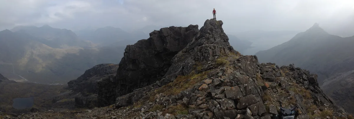
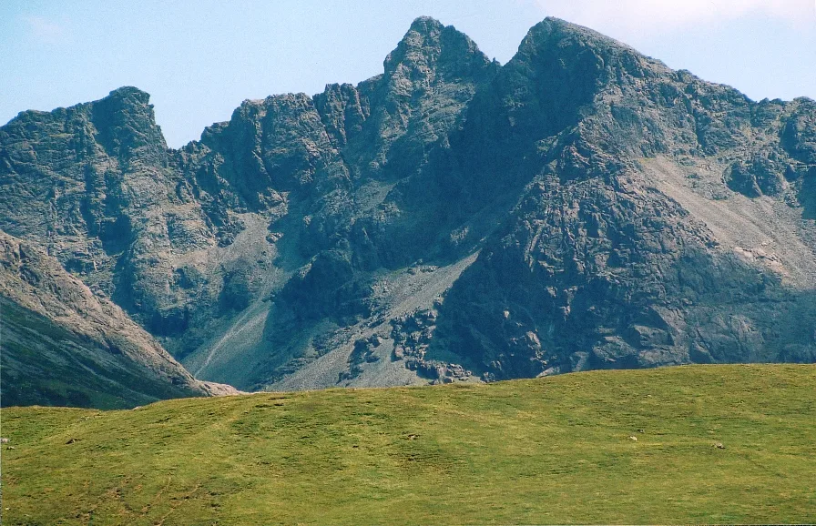
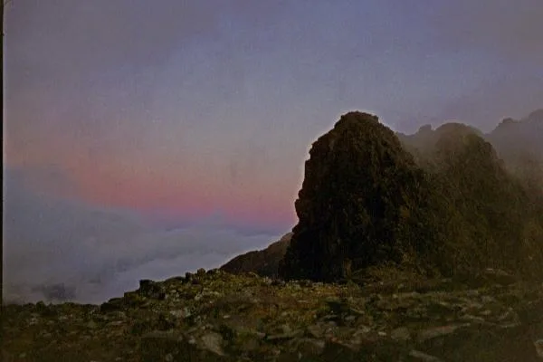
Sgùrr nan Eag is a named summit in the United Kingdom. Wikidata describes it as: "Named summit at 924 m.". Coordinates: 57.1958°, -6.2110°.
Photo gallery
From the Wikipedia article
Sgùrr nan Eag is a mountain 924 metres (3,031 ft) high in the Cuillin range on the Isle of Skye, Scotland. It is the southernmost Munro of the Cuillins and it lies between Coir' a' Ghrunnda to the west, Gars-bheinn to the east, and Garb-choire to the north.
Excerpt from Wikipedia under CC BY-SA 4.0. See the source article linked in Sources below.
- Coordinates
- 57.1958, -6.2110
- Address
- Black Cuillin, Scotland
- Official site
- web.archive.org
Sources
- osm: n388371684 (ODbL)
- wikipedia: Sgùrr nan Eag (CC BY-SA 4.0)
- commons: Looking W from Sgurr na Stri W top to Gars-bheinn and Sgurr nan Eag - geograph.org.uk - 874032.jpg (CC BY-SA 4.0)
Other places nearby
Loading nearby places…
Nearby
 📷 5
📷 5Mountains & hills · Scottish Highlands
Sgùrr Dubh Mòr
Sgùrr Dubh Mòr — Named summit at 944 m.
 📷 3
📷 3Mountains & hills · Scottish Highlands
Sgùrr Theàrlaich
Sgùrr Theàrlaich — a mountain in scotland-highlands, United Kingdom.
 📷 3
📷 3Mountains & hills · Scottish Highlands
Sgùrr Alasdair
Sgùrr Alasdair — Named summit at 992 m.
 📷 3
📷 3Natural landmarks · Scottish Highlands
Sgùrr Alasdair
Sgùrr Alasdair — 992m high mountain in Highland, Scotland, UK.
 📷 5
📷 5Natural landmarks · Scottish Highlands
Sgùrr Mhic Choinnich
Sgùrr Mhic Choinnich — 948m high mountain in Highland, Scotland, UK.
 📷 5
📷 5Mountains & hills · Scottish Highlands
Sgùrr Mhic Choinnich
Sgùrr Mhic Choinnich — Named summit at 948 m.
More mountains in this region
 📷 3
📷 3Mountains & hills · Scottish Highlands
A' Bhuidheanach Bheag
A' Bhuidheanach Bheag — Named summit at 936 m.
 📷 3
📷 3Mountains & hills · Scottish Highlands
A' Chailleach
A' Chailleach — Named summit at 997 m.
 📷 3
📷 3Mountains & hills · Scottish Highlands
A' Chailleach
A' Chailleach — Named summit at 930 m.
 📷 3
📷 3Mountains & hills · Scottish Highlands
A' Chaoirnich
A' Chaoirnich — Named summit at 875 m.
Frequently asked questions
- Where is Sgùrr nan Eag?
- Sgùrr nan Eag is in Scottish Highlands, in the United Kingdom — coordinates 57.1958°, -6.2110°.
- Is Sgùrr nan Eag free to visit?
- Yes — admission to Sgùrr nan Eag is free.