Natural landmarks · Scottish Highlands
Sgùrr na Sgine
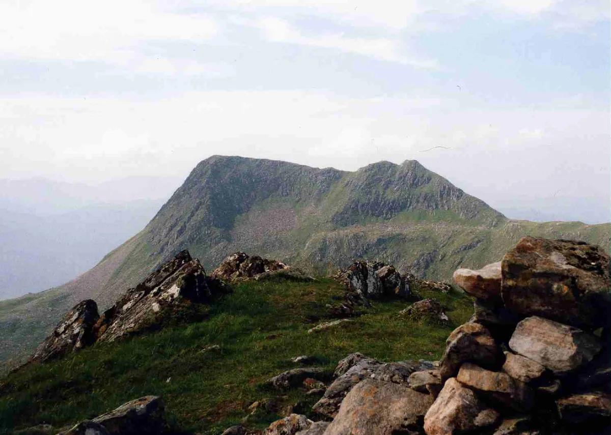
Sgùrr na Sgine — 946m high mountain in Highland, Scotland, UK.

Wikimedia Commons contributors — see linked file page for photographer and licence licence
Plan your visit
- Typical visit
- 1 h–2 h
- Free entry
- Dog-friendly
About
Sgùrr na Sgine is a named natural landmark in the United Kingdom. Part of Northwest Highlands. Wikidata describes it as: "946m high mountain in Highland, Scotland, UK". Coordinates: 57.1471°, -5.3966°.
Photo gallery
From the Wikipedia article
Sgùrr na Sgine (Scottish Gaelic for 'knife peak') is a mountain in the Northwest Highlands of Scotland. Its height is 946 metres (3,104 ft), making it a Munro. It lies eight kilometres south of Shiel Bridge in the Glenshiel Forest, between Glen Shiel and Loch Hourn.
Excerpt from Wikipedia under CC BY-SA 4.0. See the source article linked in Sources below.
Background
Description
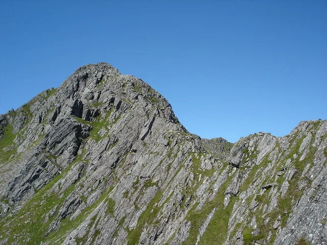
Sgùrr na Sgine is a Munro and Marilyn with a height of 946 metres (3104 feet). Though a fine mountain in its own right, it is overshadowed by its near neighbour The Saddle, regarded as one of the finest mountains in Scotland. Sgùrr na Sgine is not well seen from the A87 road to the north east. The best view from valley level is from the remote country to the south west. It looks particularly fine from the top of the Mam Barrisdale pass from where it takes on a more dramatic appearance than The Saddle. The mountain's name translates from the Gaelic as "Peak of the Knife". This is thought to refer to a wall of rock beneath the summit on its eastern flank which takes on a blade like appearance…
Sourced from Wikipedia under CC BY-SA 4.0.
- Coordinates
- 57.1471, -5.3966
- Address
- Glen Shiel, Scotland
- Official site
- www.munromagic.com
Sources
- wikidata: Q7459821 (CC0)
- wikipedia: Sgùrr na Sgine (CC BY-SA 4.0)
- commons: Sgurr na Sgine from Faochag.jpg (CC BY-SA 4.0)
Other places nearby
Loading nearby places…
Nearby
 📷 3
📷 3Mountains & hills · Scottish Highlands
Sgùrr na Sgine
Sgùrr na Sgine — Named summit at 946 m.
 📷 3
📷 3Mountains & hills · Scottish Highlands
Sgurr na Sgine NW Top
Sgurr na Sgine NW Top — a mountain in scotland-highlands, United Kingdom, 942 m.
 📷 3
📷 3Mountains & hills · Scottish Highlands
Faochag
Faochag — a mountain in scotland-highlands, United Kingdom.
 📷 3
📷 3Mountains & hills · Scottish Highlands
Sgùrr a' Bhac Chaolais
Sgùrr a' Bhac Chaolais — a mountain in scotland-highlands, United Kingdom.
 📷 3
📷 3Mountains & hills · Scottish Highlands
The Saddle - Sgurr na Forcan
The Saddle - Sgurr na Forcan — a mountain in scotland-highlands, United Kingdom.
 📷 4
📷 4Natural landmarks · Scottish Highlands
The Saddle
The Saddle — 1011m high mountain in Highland, Scotland, UK.
More natural landmarks in this region
 Flagship📷 3
Natural landmarks · Scottish Highlands
Dunalastair Water
Dunalastair Water — lake in Perth and Kinross, Scotland, UK, on the River Tummel.
 Flagship📷 3
Natural landmarks · Scottish Highlands
Loch Arkaig
Loch Arkaig — lake in Highland, Scotland, UK, outflows east to River Arkaig.
 Flagship📷 3
Natural landmarks · Scottish Highlands
Loch Assynt
Loch Assynt — lake in Highland, Scotland, UK, outflows to the River Inver and Loch na Garbh Uidhe.
 Flagship📷 3
Natural landmarks · Scottish Highlands
Loch Awe
Loch Awe — lake in Argyll and Bute, Scotland, UK, outflows to the River Awe.
Frequently asked questions
- Where is Sgùrr na Sgine?
- Sgùrr na Sgine is in Scottish Highlands, in the United Kingdom — coordinates 57.1471°, -5.3966°.
- Is Sgùrr na Sgine free to visit?
- Yes — admission to Sgùrr na Sgine is free.