Mountains & hills · Scottish Highlands
Sgùrr Mhurlagain
Sgùrr Mhurlagain — Named summit at 880 m.

Wikimedia Commons contributors — see linked file page for photographer and licence licence
Plan your visit
- Typical visit
- 3 h–8 h
- Best time of year
- Late spring – early autumn (May–Oct)
- Free entry
- Dog-friendly
About
Sgùrr Mhurlagain is a named summit in the United Kingdom. Wikidata describes it as: "Named summit at 880 m.". Coordinates: 56.9985°, -5.2737°.
Photo gallery
From the Wikipedia article
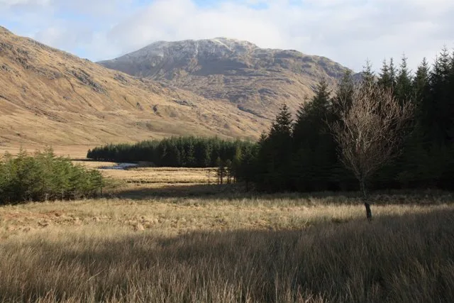
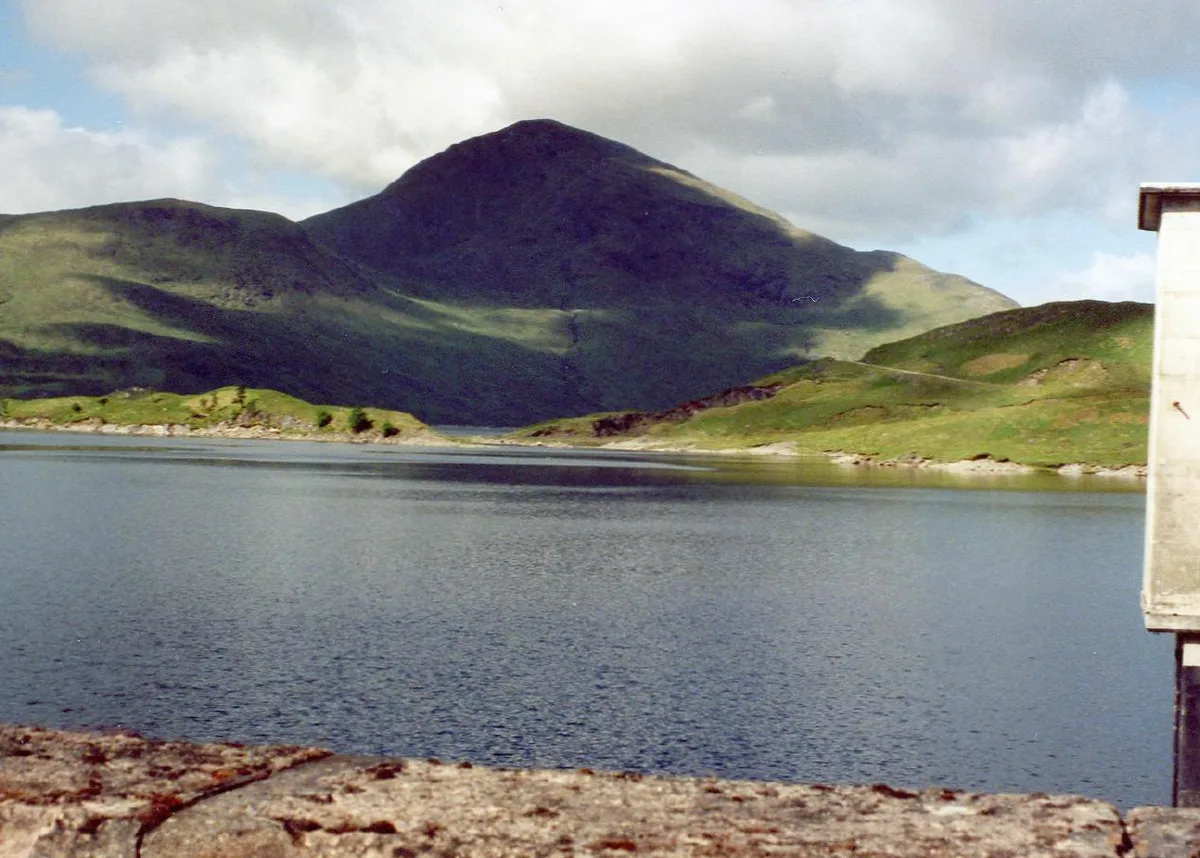
Sgùrr Mhurlagain (880 m) is a mountain in the Northwest Highlands, Scotland, west of the village of Spean Bridge in Lochaber. A large and bulky peak, it forms much of the southern wall of Glen Kingie, whereas Loch Arkaig lies to its south. Three ridges descend from its summit to the northeast.
Excerpt from Wikipedia under CC BY-SA 4.0. See the source article linked in Sources below.
- Coordinates
- 56.9985, -5.2737
- Address
- Lochaber, Scotland
- Official site
- www.hill-bagging.co.uk
Sources
- osm: n2704159107 (ODbL)
- wikipedia: Sgùrr Mhurlagain (CC BY-SA 4.0)
- commons: Glen and River Kingie - geograph.org.uk - 1424586.jpg (CC BY-SA 4.0)
Other places nearby
Loading nearby places…
Nearby
 📷 4
📷 4Reservoirs & lochs · Scottish Highlands
Murlagan
Murlagan in Scotland Islands, United Kingdom.
 📷 3
📷 3Mountains & hills · Scottish Highlands
Fraoch Bheinn
Fraoch Bheinn — Named summit at 858 m.
 📷 3
📷 3Natural landmarks · Scottish Highlands
Glen Kingie
Glen Kingie in Scotland Islands, United Kingdom.
 📷 3
📷 3Mountains & hills · Scottish Highlands
Sgùrr an Fhuarain
Sgùrr an Fhuarain — a mountain in scotland-highlands, United Kingdom.
 📷 3
📷 3Historic houses · Scottish Highlands
Taigh nan Saighdearan / The Soldiers' House
Taigh nan Saighdearan / The Soldiers' House — a historic house in scotland-highlands, United Kingdom.
 📷 3
📷 3Mountains & hills · Scottish Highlands
Gairich
Gairich — Named summit at 919 m.
More mountains in this region
 📷 3
📷 3Mountains & hills · Scottish Highlands
A' Bhuidheanach Bheag
A' Bhuidheanach Bheag — Named summit at 936 m.
 📷 3
📷 3Mountains & hills · Scottish Highlands
A' Chailleach
A' Chailleach — Named summit at 997 m.
 📷 3
📷 3Mountains & hills · Scottish Highlands
A' Chailleach
A' Chailleach — Named summit at 930 m.
 📷 3
📷 3Mountains & hills · Scottish Highlands
A' Chaoirnich
A' Chaoirnich — Named summit at 875 m.
Frequently asked questions
- Where is Sgùrr Mhurlagain?
- Sgùrr Mhurlagain is in Scottish Highlands, in the United Kingdom — coordinates 56.9985°, -5.2737°.
- Is Sgùrr Mhurlagain free to visit?
- Yes — admission to Sgùrr Mhurlagain is free.