Mountains & hills · Scottish Highlands
Sgorr na Cìche
Also known as: Sgurr na Cìche, Pap of Glencoe
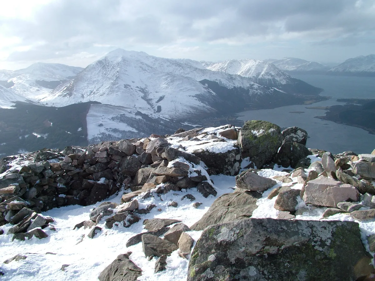
Sgorr na Cìche — Named summit at 742 m.

Wikimedia Commons contributors — see linked file page for photographer and licence licence
Plan your visit
- Typical visit
- 3 h–8 h
- Best time of year
- Late spring – early autumn (May–Oct)
- Free entry
- Dog-friendly
About
Sgorr na Cìche is a named summit in the United Kingdom. Also known as: Sgurr na Cìche, Pap of Glencoe. Wikidata describes it as: "Named summit at 742 m.". Coordinates: 56.6889°, -5.0629°.
Photo gallery
From the Wikipedia article
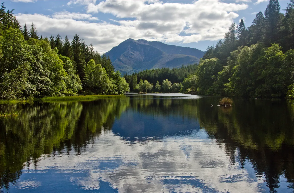
The Pap of Glencoe (Scottish Gaelic: Sgorr na Cìche) is a mountain on the northern side of Glen Coe, in the Highlands of Scotland. It lies at the western end of the Aonach Eagach ridge, directly above the point where the River Coe enters Loch Leven. The Pap is so named as it has a distinctive conical shape resembling a female breast (see: pap), particularly when viewed from the west. It forms part of the "classic" view of the entrance to Glen Coe. The simplest route of ascent starts from the unclassified road between Glencoe village and the Clachaig Inn. A pebble path leaves the road about 1 kilometre (5⁄8 mi) west of the youth hostel, and passes a white house on the left, reaching the bealach between the Pap and Sgor nam Fiannaidh, from where the Pap may be climbed. The final stretch up to the bealach forms a pathway by small gully; this section is often extremely muddy and boggy. The final 100 metres (330 ft) of ascent require some easy scrambling, and care is needed under winter conditions. The Pap may also be climbed from the Kinlochleven side, though this is far less common.
Excerpt from Wikipedia under CC BY-SA 4.0. See the source article linked in Sources below.
- Coordinates
- 56.6889, -5.0629
- District
- Highland
- Postcode
- PH49 4HX
- Parliamentary constituency
- Argyll, Bute and South Lochaber
Sources
- osm: n3497194562 (ODbL)
- wikipedia: Pap of Glencoe (CC BY-SA 4.0)
- commons: Summit, Sgorr na Ciche - geograph.org.uk - 1731430.jpg (CC BY-SA 4.0)
Other places nearby
Loading nearby places…
Nearby
 📷 3
📷 3Natural landmarks · Scottish Highlands
Pap of Glencoe
Pap of Glencoe — 742m high mountain in Highland, Scotland, UK.
 📷 3
📷 3Mountains & hills · Scottish Highlands
Sgorr nam Fiannaidh
Sgorr nam Fiannaidh — a mountain in scotland-highlands, United Kingdom, 968 m.
Hostels · Scottish Highlands
Glencoe Youth Hostel
Glencoe Youth Hostel — a hostel in scotland highlands.
Hostels · Scottish Highlands
Glencoe Independent Hostel
Glencoe Independent Hostel — a hostel in scotland highlands.
 📷 3
📷 3Archaeological sites · Scottish Highlands
Glencoe Lochan
Glencoe Lochan — tract of forest near the village.
 📷 4
📷 4Memorials & monuments · Scottish Highlands
Massacre of Glencoe Monument
Massacre of Glencoe Monument — a memorial in scotland-highlands, United Kingdom.
More mountains in this region
 📷 3
📷 3Mountains & hills · Scottish Highlands
A' Bhuidheanach Bheag
A' Bhuidheanach Bheag — Named summit at 936 m.
 📷 3
📷 3Mountains & hills · Scottish Highlands
A' Chailleach
A' Chailleach — Named summit at 997 m.
 📷 3
📷 3Mountains & hills · Scottish Highlands
A' Chailleach
A' Chailleach — Named summit at 930 m.
 📷 3
📷 3Mountains & hills · Scottish Highlands
A' Chaoirnich
A' Chaoirnich — Named summit at 875 m.
Frequently asked questions
- Where is Sgorr na Cìche?
- Sgorr na Cìche is in the Scottish Highlands, United Kingdom (postcode PH49 4HX).
- Is Sgorr na Cìche free to visit?
- Yes, Sgorr na Cìche is free to enter.
- How do I get to Sgorr na Cìche?
- Drivers can navigate to postcode PH49 4HX. It sits within the Argyll, Bute and South Lochaber parliamentary constituency.