Islands · Scottish Highlands
Seil
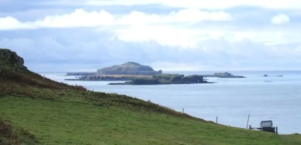
Seil — island on the east side of the Firth of Lorn, Argyll and Bute, Scotland, UK.

Wikimedia Commons contributors — see linked file page for photographer and licence licence
Plan your visit
- Typical visit
- 4 h–12 h
- Free entry
- Dog-friendly
About
Seil is a island in the United Kingdom. It covers approximately 1,300 km². Recent population estimates put it at around 551 people. Part of Slate Islands. Wikidata describes it as: "island on the east side of the Firth of Lorn, Argyll and Bute, Scotland, UK". Coordinates: 56.3000°, -5.6200°.
Photo gallery
From the Wikipedia article
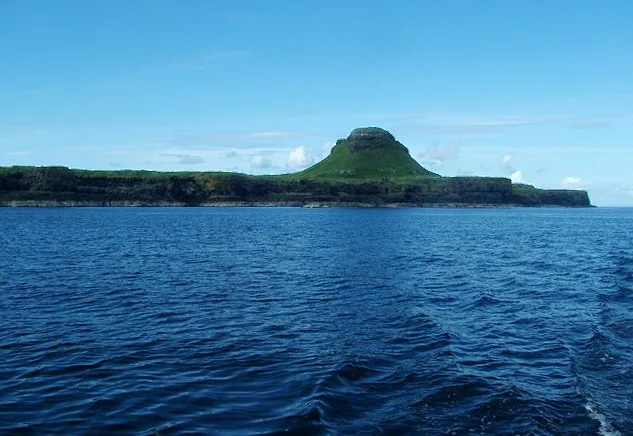
Seil (; Scottish Gaelic: Saoil, Scottish Gaelic pronunciation: [ˈs̪ɯːl]) is one of the Slate Islands, located on the east side of the Firth of Lorn, 7 miles (11 kilometres) southwest of Oban, in Scotland. Seil has been linked to the mainland by bridge since the late 18th century. The origins of the island's name are unclear and probably pre-Gaelic. It was a part of the kingdom of Dalriada in the 7th century but by the 16th century, Seil seemed to have been primarily agricultural in nature. It became part of the estates of the Breadalbane family and in the early 18th century they began to exploit the rich potential of the Neoproterozoic slate beds. The excavations from the island's quarries were exported all over the world during the course of the next two centuries. Today, the economy is largely dependent on agriculture and tourism. The "dangerous seas" of the Firth of Lorn have claimed many lives and there are several shipwrecks in the vicinity of Seil. Kilbrandon Church has fine examples of stained glass windows and an association with St Brendan.
Excerpt from Wikipedia under CC BY-SA 4.0. See the source article linked in Sources below.
Background
History
on mainland Scotland, seat of the government of Nether Lorn under the Breadalbane family]] The Cenél Loairn kindred controlled what is today known as Lorn in the kingdom of Dalriada. The 7th-century separates the Cenél Loairn into three subsidiary groups, of which the Cenél Salaich may have controlled Nether Lorn. In the mid-16th century Monro wrote of Seil: "" Ardfad Castle is a ruin in the northwest of Seil. It was the home of the Macdougalls of Ardencaple, but following the failure of King James VII to regain the thrones of England, Ireland and Scotland in the late 17th century the Macdougalls lost much of their lands to the Duke of Argyll. The castle was "a well-built structure of stone…
Sourced from Wikipedia under CC BY-SA 4.0.
- Coordinates
- 56.3000, -5.6200
- District
- Argyll and Bute
- Postcode
- PA34 4GH
- Parliamentary constituency
- Argyll, Bute and South Lochaber
- Population
- 551
Sources
Other places nearby
Loading nearby places…
Nearby
 📷 5
📷 5Islands · Scottish Islands
Balvicar
Balvicar in Scotland Islands, United Kingdom.
 📷 3
📷 3Memorials & monuments · Scottish Highlands
Kilbrandon War Memorial
Kilbrandon War Memorial — a memorial in scotland-highlands, United Kingdom.
 📷 3
📷 3Archaeological sites · Scottish Highlands
Camuslaich, dun site
Camuslaich, dun site — a archaeological in scotland-highlands, United Kingdom.
.jpg?width=1200) 📷 3
📷 3Gardens · Scottish Highlands
An Cala
An Cala — garden on Seil, Argyll and Bute, Scotland, UK.
 📷 3
📷 3Archaeological sites · Scottish Highlands
Dun Aorain, dun site
Dun Aorain, dun site — a archaeological in scotland-highlands, United Kingdom.
Vineyards · Scottish Highlands
Dùn Aorain
Dùn Aorain — a UK vineyard in scotland highlands, producing English or Welsh wine from cool-climate grape varieties.
More places in this region
 📷 5
📷 5Islands · Scottish Highlands
Bac Beag
Bac Beag — Scottish island, part of the Treshnish Isles in the Inner Hebrides.
 📷 5
📷 5Islands · Scottish Highlands
Bac Mòr
Bac Mòr — island in Argyll and Bute, Scotland, UK, one of the Treshnish Isles.
 Flagship📷 3
Islands · Scottish Highlands
Baleshare
Baleshare — flat tidal island in the Outer Hebrides, Scotland, UK.
 Flagship📷 5
Islands · Scottish Highlands
Barra
Barra — island in Outer Hebrides, Scotland, UK.
Frequently asked questions
- Where is Seil?
- Seil is in the Scottish Highlands, United Kingdom (postcode PA34 4GH).
- Is Seil free to visit?
- Yes, Seil is free to enter.
- How do I get to Seil?
- Drivers can navigate to postcode PA34 4GH. It sits within the Argyll, Bute and South Lochaber parliamentary constituency.