Towns & cities · East Midlands
Scrooby
Scrooby — village in Nottinghamshire, England, UK.

Wikimedia Commons contributors — see linked file page for photographer and licence licence
Plan your visit
- Typical visit
- 3 h–6 h
- Free entry
- Family-friendly
- Dog-friendly
About
Scrooby is a town, city, village or settlement in the United Kingdom. Recent population estimates put it at around 307 people. Address: DN10. Wikidata describes it as: "village in Nottinghamshire, England, UK". Coordinates: 53.4101°, -1.0207°.
Photo gallery
From the Wikipedia article
Scrooby is a small village on the River Ryton in the Bassetlaw district of Nottinghamshire, England, near Bawtry in South Yorkshire. At the time of the 2001 census it had a population of 329, in 2011 the count was 315 and by the 2021 census this had fallen further to 307 residents. Until 1766, it was on the Great North Road so became a stopping-off point for numerous important figures including Elizabeth I and Cardinal Wolsey on their journeys. The latter stayed at the Manor House briefly, after his fall from favour.
Excerpt from Wikipedia under CC BY-SA 4.0. See the source article linked in Sources below.
Background
History
In 958, King Edgar granted an estate including land at Scroppenþorpe, including an area now in the modern Scrooby, to Oscytel, Archbishop of York. The Manor House belonged to the Archbishops of York and so was sometimes referred to as a palace. (A nearby former farmhouse is still called Palace Farm.) At the end of the sixteenth century, the house was occupied by William Brewster, the Archbishop's bailiff, who was also postmaster. His son, also named William Brewster, took that post in the 1590s after a job as an assistant to the Secretary of State under Elizabeth I. The junior William had been schooled in Peterhouse, Cambridge University, at the same time as the infamous Welsh Protestant…
Sourced from Wikipedia under CC BY-SA 4.0.
- Coordinates
- 53.4101, -1.0207
- County
- Nottinghamshire
- District
- Bassetlaw
- Parish
- Scrooby
- Postcode
- DN10
- Parliamentary constituency
- Bassetlaw
- Population
- 307
- Official site
- www.scrooby.net
Sources
- wikidata: Q864742 (CC0)
- wikipedia: Scrooby (CC BY-SA 4.0)
- commons: Scrooby village addison.PNG (CC BY-SA 4.0)
Other places nearby
Loading nearby places…
Nearby
 📷 3
📷 3Memorials & monuments · East Midlands
Scrooby War Memorial
Scrooby War Memorial — Grade II listed building-listed memorial in england-east-midlands, United Kingdom.
 📷 5
📷 5Historic churches · East Midlands
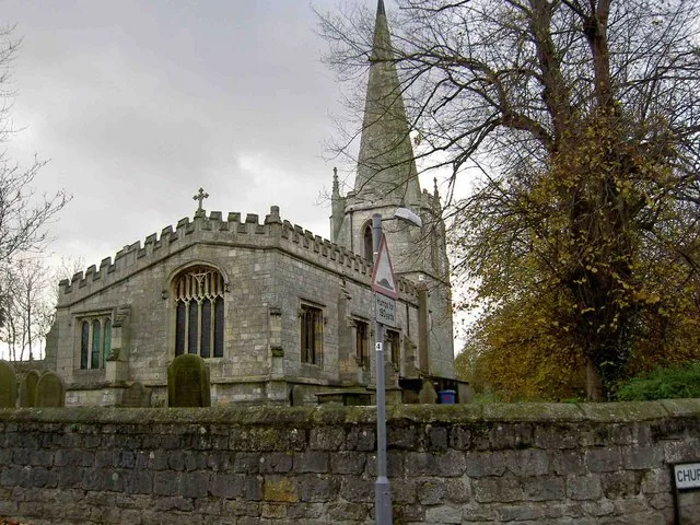
St Wilfrid's Church, Scrooby
St Wilfrid's Church, Scrooby — church in Bassetlaw, UK.
Campsites · East Midlands
Pilgrim Fathers Camping Site
Pilgrim Fathers Camping Site — a campsite in england east midlands.
 📷 3
📷 3Public art & sculpture · East Midlands
Harworth & Bircotes Village Sign
Harworth & Bircotes Village Sign — a public art in england-east-midlands, United Kingdom.
 📷 3
📷 3Historic bridges · East Midlands
Bridge over River Ryton, west of Laundry Cottage, Serlby Park
Bridge over River Ryton, west of Laundry Cottage, Serlby Park — Grade II listed building-listed bridge in england-east-midlands, United Kingdom.
 📷 3
📷 3Historic bridges · East Midlands
Bawtry Bridge
Bawtry Bridge — Grade II listed building-listed bridge in england-east-midlands, United Kingdom.
More towns in this region
 Flagship📷 3
Towns & cities · East Midlands
Aldborough
Aldborough — village in Norfolk, England, UK.
 Flagship📷 4
Towns & cities · East Midlands
Alderford
Alderford — village and civil parish in Norfolk, UK.
 Flagship📷 5
Towns & cities · East Midlands
Ashmanhaugh
Ashmanhaugh — village in Norfolk, England, UK.
 Flagship📷 3
Towns & cities · East Midlands
Attlebridge
Attlebridge — a village located in Broadland, United Kingdom.
Frequently asked questions
- Where is Scrooby?
- Scrooby is in Nottinghamshire, the East Midlands, United Kingdom (postcode DN10), in the parish of Scrooby.
- Is Scrooby free to visit?
- Yes, Scrooby is free to enter.
- How do I get to Scrooby?
- Drivers can navigate to postcode DN10. It sits within the Bassetlaw parliamentary constituency.