Beaches · South West England
Saunton Sands
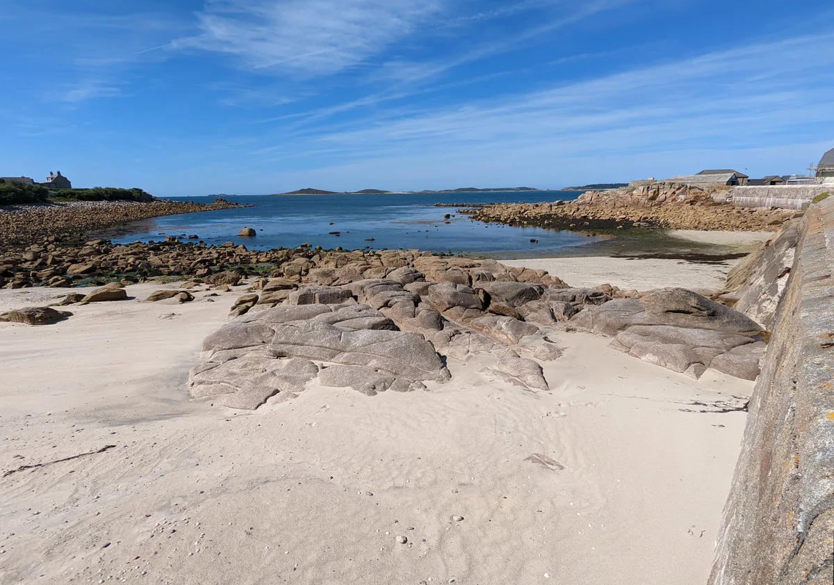
Saunton Sands — beach in the English village of Saunton on the North Devon coast.

Wikimedia Commons contributors — see linked file page for photographer and licence licence
Plan your visit
- Typical visit
- 1 h–3 h
- Best time of year
- Summer (Jun–Aug)
- Free entry
- Family-friendly
- Dog-friendly
About
Saunton Sands is a named beach on the United Kingdom coastline. Wikidata describes it as: "beach in the English village of Saunton on the North Devon coast". Coordinates: 51.1000°, -4.2258°.
Photo gallery
Protected designations
- Site of Special Scientific Interest: Braunton Burrows SSSI
- Area of Outstanding Natural Beauty: North Devon
Designations sourced from Natural England open data under OGL v3.
From the Wikipedia article
Saunton Sands is a beach near the English village of Saunton on the North Devon coast near Braunton, popular for longboard surfing. Beyond its southern end, Crow Point, England is the mouth of the River Taw estuary. It is part of the Taw-Torridge estuary Area of Outstanding Natural Beauty and is at the centre of the UNESCO-designated North Devon's Biosphere Reserve, where Braunton Burrows lies at the heart. Saunton Sands Hotel overlooks the beach at the northern end. The beach is cordoned off a few times a year and the beach used as an airstrip for military transport planes, usually Lockheed C-130 Hercules of the Royal Air Force, to practise STOL beach landings and take offs. Flying kites is prohibited, accordingly, on part of the beach. Saunton Sands is popular with surfers because the beach is long, an unusually exposed westerly, and provides space for large groups. The beach has no life guards and is known to have dangerous riptides. Swimming here is dangerous and has resulted in many coast guard call outs. On 3 August 1990, a temperature of 35.4 °C (95.7 °F) was recorded at Saunton Sands, which is the highest temperature recorded in the Devon and Cornwall region.
Excerpt from Wikipedia under CC BY-SA 4.0. See the source article linked in Sources below.
- Coordinates
- 51.1000, -4.2258
Sources
- wikidata: Q7427501 (CC0)
- wikipedia: Saunton Sands (CC BY-SA 4.0)
- commons: Saunton Sands - Panorama-8453-54.jpg (CC BY-SA 4.0)
Other places nearby
Loading nearby places…
Nearby
 📷 3
📷 3Natural landmarks · South West England
Remains of a Matilda tank from World War II
Remains of a Matilda tank from World War II — a other in england-south-west, United Kingdom.
 📷 5
📷 5Viewpoints · South West England
Flagpole Dune (37m originally)
Flagpole Dune (37m originally) is a viewpoint in the United Kingdom.
 📷 5
📷 5Beaches · South West England
North Tail
North Tail is a beach in the United Kingdom.
 📷 5
📷 5Museums · South West England
River Taw
River Taw — a museum in england-south-west, United Kingdom.
 📷 3
📷 3Natural landmarks · South West England
Hawker Hunter jet
Hawker Hunter jet — a other in england-south-west, United Kingdom.
 📷 5
📷 5Beaches · South West England
South Tail
South Tail is a beach in the United Kingdom.
More beaches in this region
 📷 5
📷 5Beaches · South West England
Amy's Cove
Amy's Cove is a beach in the United Kingdom.
 📷 5
📷 5Beaches · South West England
Arlo Porth
Arlo Porth is a beach in the United Kingdom.
 📷 5
📷 5Beaches · South West England
Arthur's Beach (Sunny Cove)
Arthur's Beach (Sunny Cove) is a beach in the United Kingdom.
 📷 5
📷 5Beaches · South West England
Ayrmer Cove
Ayrmer Cove is a beach in the United Kingdom.
Frequently asked questions
- Where is Saunton Sands?
- Saunton Sands is in South-West England, United Kingdom.
- Is Saunton Sands a protected site?
- Yes — Saunton Sands is part of the Braunton Burrows SSSI Site of Special Scientific Interest and the North Devon National Landscape (AONB).
- Is Saunton Sands free to visit?
- Yes, Saunton Sands is free to enter.