Towns & cities · South West England
Rodney Stoke
Rodney Stoke — village and civil parish in Mendip, Somerset, England, United Kingdom.

Wikimedia Commons contributors — see linked file page for photographer and licence licence
Plan your visit
- Typical visit
- 3 h–6 h
- Free entry
- Family-friendly
- Dog-friendly
About
Rodney Stoke is a town, city, village or settlement in the United Kingdom. Recent population estimates put it at around 1,260 people. Address: BS27. Wikidata describes it as: "village and civil parish in Mendip, Somerset, England, United Kingdom". Coordinates: 51.2476°, -2.7357°.
Photo gallery
Protected designations
- National Nature Reserve: MENDIP
- Area of Outstanding Natural Beauty: Mendip Hills
Designations sourced from Natural England open data under OGL v3.
From the Wikipedia article
Rodney Stoke is a small village and civil parish, located at grid reference ST486501, 5 miles north-west of Wells, in the English county of Somerset. The village is on the A371 between Draycott and Westbury-sub-Mendip. The parish includes the larger village of Draycott. South of the A371 the parish includes an area of the Somerset Levels, extending to the River Axe. North of the A371 the southern slopes of the Mendip Hills rise to an area of the parish on the Mendip plateau. The parish is therefore an area of high biodiversity supporting local rare species of plants and animal life.
Excerpt from Wikipedia under CC BY-SA 4.0. See the source article linked in Sources below.
Background
History
Close to the village is Westbury Camp, which represents the remains of an Iron Age enclosed settlement and has been designated as a Scheduled Ancient Monument. Rodney Stoke was listed in the Domesday Book of 1086 as Stoches, meaning 'a stockaded settlement' from the Old English stoc. In 1291 the place name was recorded as Stokgifford. The Giffords were Saxon nobility at the time of Edward the Confessor with Walter Gifford (then spelt Gifard) as the Earl of Buckingham. The parish was part of the Winterstoke Hundred. The village was the home of, and is probably named after, Sir John Rodney (d. 1400). However Ekwall indicates that Stoke Gifford was held by Richard de Rodene in 1303. The first…
Sourced from Wikipedia under CC BY-SA 4.0.
- Coordinates
- 51.2476, -2.7357
- District
- Somerset
- Parish
- Rodney Stoke
- Postcode
- BS27
- Parliamentary constituency
- Wells and Mendip Hills
- Population
- 1,260
- Official site
- neighbourhood.statistics.gov.uk
Sources
- wikidata: Q663629 (CC0)
- wikipedia: Rodney Stoke (CC BY-SA 4.0)
- commons: Rodney Stoke church.jpg (CC BY-SA 4.0)
Other places nearby
Loading nearby places…
Nearby
Caravan parks · South West England
Bucklegrove Caravan Park
Bucklegrove Caravan Park — a caravan park in england south west.
 📷 5
📷 5Historic churches · South West England
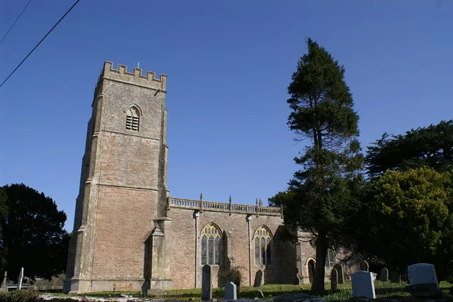
Church of St Leonard, Rodney Stoke
Church of St Leonard, Rodney Stoke — church in Rodney Stoke, Somerset, England, UK.
Vineyards · South West England
Westbury Camp
Westbury Camp — a UK vineyard in england south west, producing English or Welsh wine from cool-climate grape varieties.
Archaeological sites · South West England
ROC Nuclear fallout shelter (site of)
ROC Nuclear fallout shelter (site of) — a archaeological in england-south-west, United Kingdom.
Hostels · South West England
Sharon’s house
Sharon’s house — a hostel in england south west.
 📷 3
📷 3Historic houses · South West England
Westbury village cross
Westbury village cross — a Grade II*-listed historic house in england-south-west, United Kingdom.
More towns in this region
 Flagship📷 10
Towns & cities · South West England
All Saints
All Saints — village and civil parish in Devon, England, UK.
 Flagship📷 10
Towns & cities · South West England
Axmouth
Axmouth — village and civil parish in Devon, England, UK.
 ★ Iconic📷 10
Towns & cities · South West England
Beer
Beer — village and civil parish in Devon, UK.
 Flagship📷 10
Towns & cities · South West England
Branscombe
Branscombe — village and civil parish in Devon, UK.
Frequently asked questions
- Where is Rodney Stoke?
- Rodney Stoke is in South-West England, United Kingdom (postcode BS27), in the parish of Rodney Stoke.
- Is Rodney Stoke a protected site?
- Yes — Rodney Stoke is part of the MENDIP National Nature Reserve and the Mendip Hills National Landscape (AONB).
- Is Rodney Stoke free to visit?
- Yes, Rodney Stoke is free to enter.
- How do I get to Rodney Stoke?
- Drivers can navigate to postcode BS27. It sits within the Wells and Mendip Hills parliamentary constituency.