Beaches · South West England
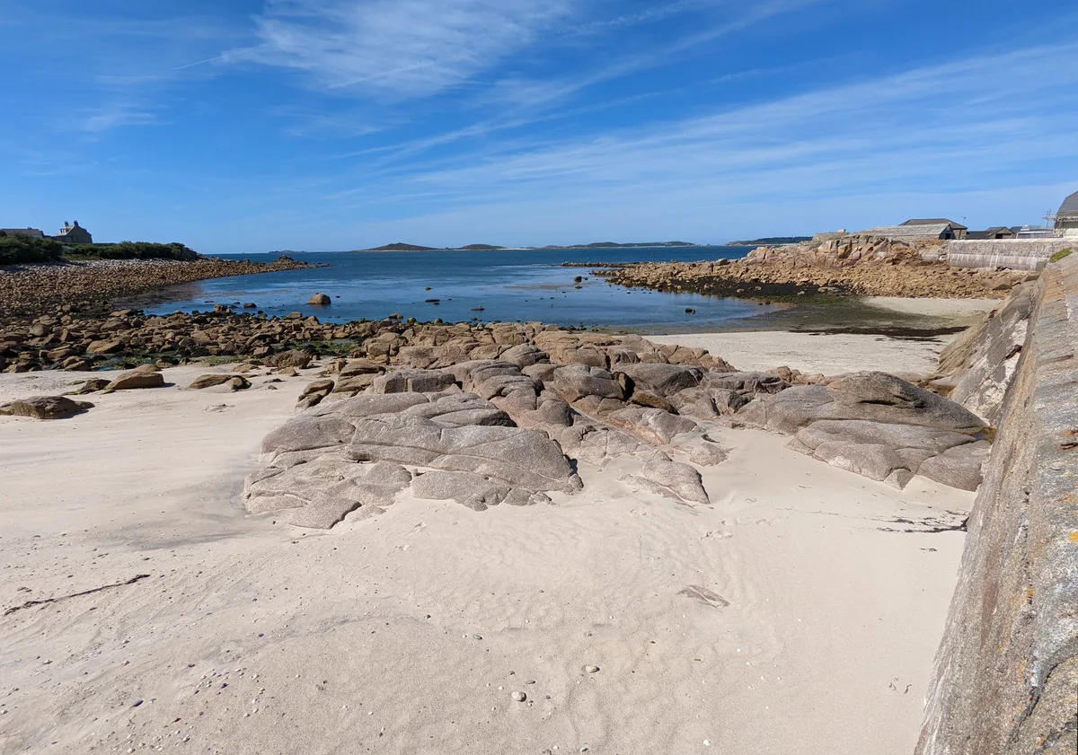
Rinsey
Also known as: Porthcew
Rinsey is a beach in the United Kingdom.

Richard Law — CC BY-SA 2.0 via Wikimedia Commons licence
Plan your visit
- Typical visit
- 1 h–3 h
- Best time of year
- Summer (Jun–Aug)
- Nearest railway station
- Trevarno · 6.5 km
- Free entry
- Family-friendly
- Dog-friendly
About
Rinsey is a beach on the coast of South-West England. The site is within the Cornwall National Landscape (AONB), and is a designated Site of Special Scientific Interest. It sits within the St Ives parliamentary constituency. The nearest railway station is Trevarno, about 6.5 km away. Postcode area TR13.
Photo gallery
Protected designations
- Site of Special Scientific Interest: Porthcew SSSI
- Area of Outstanding Natural Beauty: Cornwall
Designations sourced from Natural England open data under OGL v3.
From the Wikipedia article
Rinsey (Cornish: Rynnji) is a hamlet in the civil parish of Breage, in Cornwall, England, United Kingdom. It is located off the main A394 road between Helston and Penzance. The nearby hamlet of Rinsey Croft is located 1 km to the north-east. The nearby cliffs and beach are owned and managed by the National Trust and part of Rinsey East Cliff is designated as the Porthcew Site of Special Scientific Interest (SSSI) for its geological interest. The South West Coast Path passes through the property. Rinsey lies within the Cornwall Area of Outstanding Natural Beauty (AONB). The name Rinsey is an anglicisation of the Cornish language Rynnji, which contains the words rynn 'point of land' (as in Penryn), and chi 'house'.
Excerpt from Wikipedia under CC BY-SA 4.0. See the source article linked in Sources below.
Background
History
Rinsey, in the Hundred of Kerrier, is mentioned in the Domesday Book as one of four manors in the parish of Breage, under the name of 'Rentis'. The population in 1086 was 9.5 households. In the 29 April 1880 edition of The Cornishman Rinsey was listed as one of the places in the Helston area with a fishing fleet.
Sourced from Wikipedia under CC BY-SA 4.0.
- Coordinates
- 50.0932, -5.3668
- District
- Cornwall
- Parish
- Breage
- Postcode
- TR13 9TS
- Parliamentary constituency
- St Ives
- Nearest railway station
- Trevarno — 6.5 km
Sources
- osm: w232389004 (ODbL)
- wikipedia: Rinsey (CC BY-SA 4.0)
Other places nearby
Loading nearby places…
Nearby
 📷 3
📷 3Historic houses · South West England
Wheal Propser Engine House
Wheal Propser Engine House — a historic house in england-south-west, United Kingdom.
Climbing & bouldering crags · South West England
Bashers Harbour
Bashers Harbour — a climbing crag in england south west.
Climbing & bouldering crags · South West England
The Island
The Island — a climbing crag in england south west.
 📷 3
📷 3Historic houses · South West England
Old Shaft Engine House and Capstan Platform
Old Shaft Engine House and Capstan Platform — a historic house in england-south-west, United Kingdom.
 📷 3
📷 3Historic houses · South West England
New Shaft Engine House
New Shaft Engine House — a historic house in england-south-west, United Kingdom.
Climbing & bouldering crags · South West England
Trewavas
Trewavas — a climbing crag in england south west.
More beaches in this region
 📷 5
📷 5Beaches · South West England
Amy's Cove
Amy's Cove is a beach in the United Kingdom.
 📷 5
📷 5Beaches · South West England
Arlo Porth
Arlo Porth is a beach in the United Kingdom.
 📷 5
📷 5Beaches · South West England
Arthur's Beach (Sunny Cove)
Arthur's Beach (Sunny Cove) is a beach in the United Kingdom.
 📷 5
📷 5Beaches · South West England
Ayrmer Cove
Ayrmer Cove is a beach in the United Kingdom.
Frequently asked questions
- Where is Rinsey?
- Rinsey is in South-West England, United Kingdom (postcode TR13 9TS), in the parish of Breage.
- Is Rinsey a protected site?
- Yes — Rinsey is part of the Porthcew SSSI Site of Special Scientific Interest and the Cornwall National Landscape (AONB).
- Is Rinsey free to visit?
- Yes, Rinsey is free to enter.
- How do I get to Rinsey?
- The nearest railway station is Trevarno, about 6.5 km away. Drivers can navigate to postcode TR13 9TS.