Cemeteries · East Midlands
Retford Cemetery
Also known as: Retford
Retford Cemetery is a cemetery in the United Kingdom.

Graham Hogg — CC BY-SA 2.0 via Wikimedia Commons licence
Plan your visit
- Typical visit
- 30 min–1 h
- Nearest railway station
- Retford · 1.4 km
- Free entry
- Dog-friendly
About
Retford Cemetery is a named cemetery in the United Kingdom. Coordinates: 53.3249°, -0.9559°. This entry is part of The Great Britain Guide, a free, ad-free, open-data tourist directory.
Photo gallery
From the Wikipedia article
Retford (), also known as East Retford, is a market town in the Bassetlaw District in Nottinghamshire, England. It lies on the River Idle and the Chesterfield Canal. Retford is located 26 miles (42 km) east of Sheffield, 23 miles (37 km) west of Lincoln and 31 miles (50 km) north-east of Nottingham. The population at the 2021 census was 23,740. The town is bypassed by the A1 road.
Excerpt from Wikipedia under CC BY-SA 4.0. See the source article linked in Sources below.
Background
History
Evidence of early human activity around Retford stretches back to the Mesolithic period, with archaeological evidence of human activity in the area including a Mesolithic flint tool found in Ordsall, an axe from the Neolithic era (New Stone Age) from Little Morton, and a Neolithic polished flint axe discovered near the River Idle at Tiln. A Bronze Age spearhead was found near Whinney Moor Lane, and Romano-British crop marks are visible around Babworth. The area Retford is situated in was on the border of the territories of the Brigantes and the Corieltauvi during the Iron Age period. It is likely that the existence of Retford is partly due to its water resources, in the form of both the…
Description
Women have played an important role in the economy of Nottinghamshire particularly in certain industries (such as lace making and farming). In Retford women were always economically active and some businesses relied heavily on female labour (such as Clark's of Retford). Until the Black Death, most beer in the UK was produced by women brewers (called 'brewsters'). Brewing was an important industry in Nottinghamshire from hop growing, to brewing to selling beer. Nottinghamshire women have had considerable involvement in all aspects of the brewing trade, with many historic Retford pubs being recorded as having female managers. Women-owned businesses were also relatively common in Retford. For…
Sourced from Wikipedia under CC BY-SA 4.0.
- Coordinates
- 53.3249, -0.9559
- County
- Nottinghamshire
- District
- Bassetlaw
- Parish
- Bassetlaw, unparished area
- Postcode
- DN22 7ED
- Parliamentary constituency
- Bassetlaw
- Nearest railway station
- Retford — 1.4 km
- Official site
- www.bassetlaw.gov.uk
Sources
Other places nearby
Loading nearby places…
Nearby
 📷 4
📷 4Gardens · East Midlands
Holy Trinity Hospital (Almshouses)
Holy Trinity Hospital (Almshouses) — a garden in england-east-midlands, United Kingdom.
 📷 3
📷 3Manor houses · East Midlands
Trinity Hospital
Trinity Hospital — a manor in england-east-midlands, United Kingdom.
 📷 3
📷 3Manor houses · East Midlands
West Wetford Hall
West Wetford Hall — a manor in england-east-midlands, United Kingdom.
 📷 3
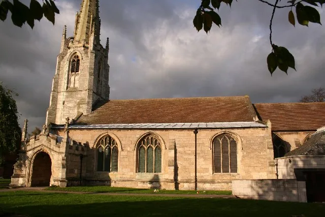
📷 3Historic churches · East Midlands
St Michael the Archangel's Church, Retford
St Michael the Archangel's Church, Retford — church in Bassetlaw, UK.
 📷 5
📷 5Historic houses · East Midlands
Ordsall Hall School
Ordsall Hall School — a school heritage in england-east-midlands, United Kingdom.
 📷 3
📷 3Escape rooms · East Midlands
Enigma Rooms
Enigma Rooms — a escape room in england-east-midlands, United Kingdom.
More cemeteries in this region
 📷 3
📷 3Cemeteries · East Midlands
Abbey Lane Cemetery
Abbey Lane Cemetery is a cemetery in the United Kingdom.
 📷 4
📷 4Cemeteries · East Midlands
All Saints Parish Church
All Saints Parish Church is a cemetery in the United Kingdom.
 📷 3
📷 3Cemeteries · East Midlands
Attercliffe Cemetery
Attercliffe Cemetery is a cemetery in the United Kingdom.
 📷 3
📷 3Cemeteries · East Midlands
Basford Cemetery
Basford Cemetery is a cemetery in the United Kingdom.
Frequently asked questions
- Where is Retford Cemetery?
- Retford Cemetery is in East Midlands, in the United Kingdom — coordinates 53.3249°, -0.9559°. The nearest railway station is Retford, around 1.4 km away.
- Is Retford Cemetery free to visit?
- Yes — admission to Retford Cemetery is free.