Towns & cities · London
Renhold
Renhold — village and civil parish in Bedfordshire, UK.

Wikimedia Commons contributors — see linked file page for photographer and licence licence
Plan your visit
- Typical visit
- 3 h–6 h
- Nearest railway station
- Bedford St Johns · 5.6 km
- Free entry
- Family-friendly
- Dog-friendly
About
Renhold is a town, city, village or settlement in the United Kingdom. Recent population estimates put it at around 1,448 people. Address: MK41. Wikidata describes it as: "village and civil parish in Bedfordshire, UK". Coordinates: 52.1640°, -0.4072°.
Photo gallery
From the Wikipedia article
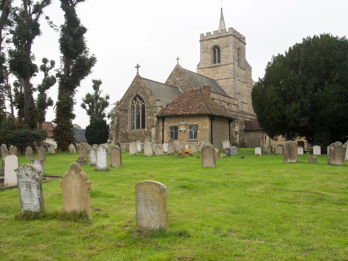
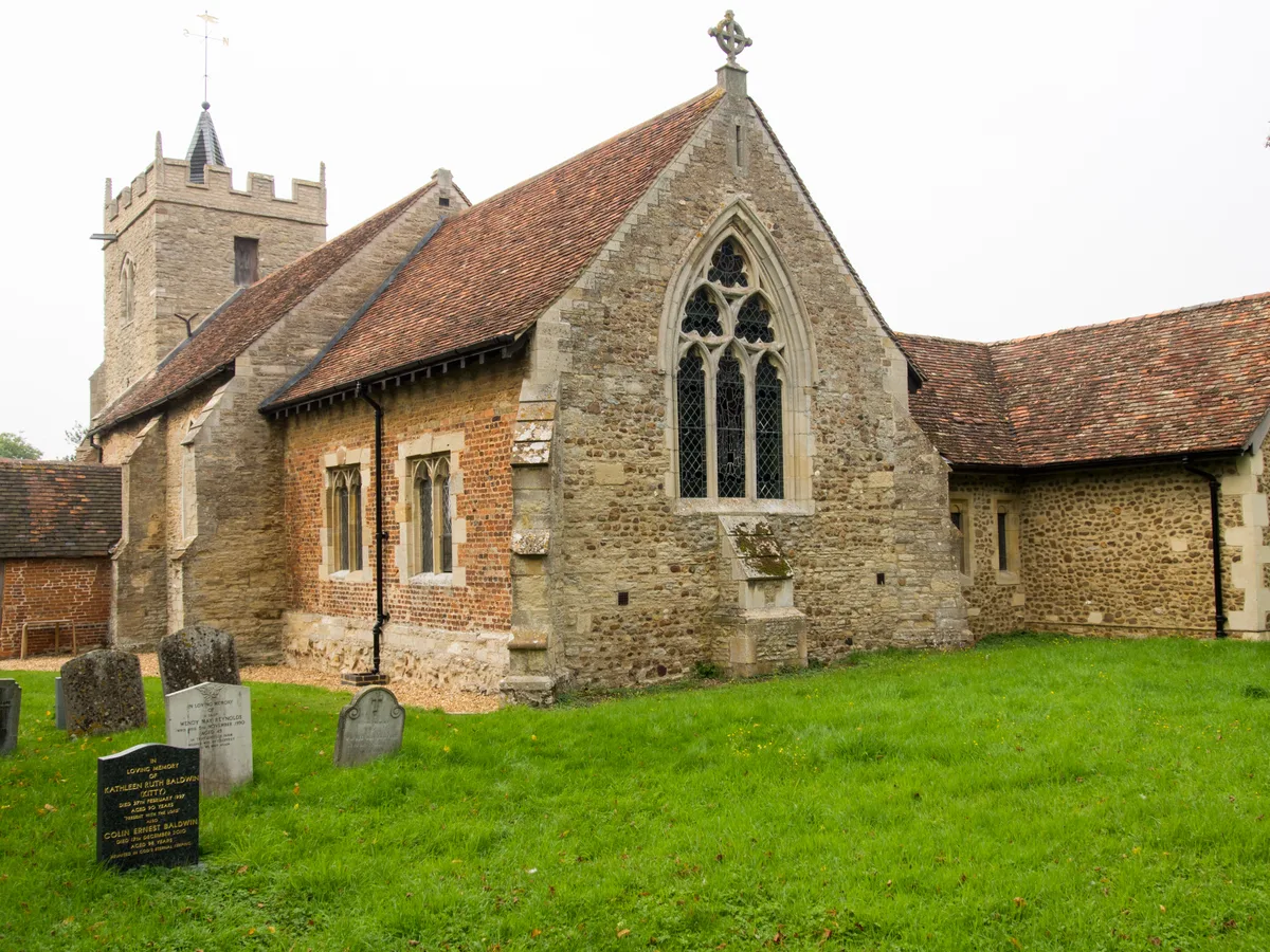
Renhold is a village and civil parish located on the River Ouse, in the Borough of Bedford, Bedfordshire, England. The parish church is situated some 4 miles (6.5 km) east-north-east of Bedford town centre. The former Bedfordshire County Council estimated the population of Renhold to be 1,800 in 2005, and forecast an increase to 2,320 by 2010. The parish is made up of several hamlets ("Ends" in local parlance) including Salph End, Church End, Lane End, Top End, Workhouse End, and Water End. In the 2000s, two new housing estates were constructed on the southern boundary of Renhold parish. The Spires and Cranbourne Gardens estates have been established off Norse Road in Bedford, with vehicular access from the Goldington area of the town. The new estates remain part Renhold village for electoral purposes. The parish is home to Renhold Chapel, All Saints Church at Church End (not to be confused with Church of All Saints, Ravensden), and the ruins of Renhold Castle. There is a country house called Howbury Hall in the southern part of the parish. It was rebuilt in 1849, and remains a private home.
Excerpt from Wikipedia under CC BY-SA 4.0. See the source article linked in Sources below.
- Coordinates
- 52.1640, -0.4072
- District
- Bedford
- Parish
- Renhold
- Postcode
- MK41
- Parliamentary constituency
- North Bedfordshire
- Population
- 1,448
- Nearest railway station
- Bedford St Johns — 5.6 km
Sources
- wikidata: Q1520304 (CC0)
- wikipedia: Renhold (CC BY-SA 4.0)
- commons: Renhold Church of All Saints-1-2.jpg (CC BY-SA 4.0)
Other places nearby
Loading nearby places…
Nearby
 📷 5
📷 5Historic churches · London
All Saints' Church, Renhold
All Saints' Church, Renhold — Grade I listed church in Renhold, Bedford, Bedfordshire, England, UK.
 📷 5
📷 5Cemeteries · London
Norse Road Cemetery and Crematorium
Norse Road Cemetery and Crematorium is a cemetery in the United Kingdom.
.jpg?width=1200) 📷 5
📷 5Towns & cities · London
Salph End
Salph End — village in Bedfordshire, England, UK.
 📷 5
📷 5Castles · London
Great Barford Castle
Great Barford Castle — castle in Great Barford in United Kingdom.
 📷 5
📷 5Historic churches · London
Church of All Saints, Ravensden
Church of All Saints, Ravensden — Grade I listed church in Ravensden, Bedford, Bedfordshire, England, UK.
 📷 5
📷 5Castles · London
Risinghoe Castle
Risinghoe Castle — mound in Bedfordshire, England.
More towns in this region
 Flagship📷 10
Towns & cities · London
Aldenham
Aldenham — village and civil parish in Hertfordshire, England.
 Flagship📷 10
Towns & cities · London
Ashdon
Ashdon — village and civil parish in Essex, UK.
 Flagship📷 10
Towns & cities · London
Betchworth
Betchworth — village and civil parish in the Mole Valley district of Surrey, England.
 Flagship📷 10
Towns & cities · London
Boxley
Boxley — village and civil parish in Maidstone District, Kent, England, UK.
Frequently asked questions
- Where is Renhold?
- Renhold is in London, United Kingdom (postcode MK41), in the parish of Renhold.
- Is Renhold free to visit?
- Yes, Renhold is free to enter.
- How do I get to Renhold?
- The nearest railway station is Bedford St Johns, about 5.6 km away. Drivers can navigate to postcode MK41.