Historic churches · South Wales
Redland, Bristol
Redland is a neighbourhood in Bristol, England. The neighbourhood is situated between Clifton, Cotham, Bishopston and Westbury Park. The boundaries of the district are not precisely defined, but are

Derek Harper — CC BY-SA 2.0 via Wikimedia Commons licence
Plan your visit
- Typical visit
- 30 min–1 h
- Free entry
About
Redland is a neighbourhood in Bristol, England. The neighbourhood is situated between Clifton, Cotham, Bishopston and Westbury Park. The boundaries of the district are not precisely defined, but are generally taken to be Whiteladies Road in the west, the Severn Beach railway line in the south and Cranbrook Road in the east. Redland is also the name of a council ward, which covers a slightly different area. Redland ward extends to the southern part of Bishopston, and does not include the part of Redland south of Redland Road, which is in Cotham ward. Redland is primarily residential, and is known as a popular student accommodation area, particularly with second and third year students from the city's university. Compared to Bristol averages, Redland ward has lower levels of deprivation, relative child poverty, premature mortality and crime. It has higher than average educational attainment, life expectancy, home ownership and car ownership.
Photo gallery
From the Wikipedia article
Redland is a neighbourhood in Bristol, England. The neighbourhood is situated between Clifton, Cotham, Bishopston and Westbury Park. The boundaries of the district are not precisely defined, but are generally taken to be Whiteladies Road in the west, the Severn Beach railway line in the south and Cranbrook Road in the east. Redland is also the name of a council ward, which covers a slightly different area. Redland ward extends to the southern part of Bishopston, and does not include the part of Redland south of Redland Road, which is in Cotham ward. Redland is primarily residential, and is known as a popular student accommodation area, particularly with second and third year students from the city's university. Compared to Bristol averages, Redland ward has lower levels of deprivation, relative child poverty, premature mortality and crime. It has higher than average educational attainment, life expectancy, home ownership and car ownership.
Excerpt from Wikipedia under CC BY-SA 4.0. See the source article linked in Sources below.
Background
History
There are different views of the origin of the name Redland. One source says that in the 11th century it was known as Rudeland, possibly from Old English rudding, meaning "cleared land". Another source points to a mention in 1209 as Thriddeland, probably meaning "the third part of an estate". Yet another source refers to a mention in 1230 of Rubea Terra and a later mention as la Rede Londe, derived from the red colour of the soil. For many centuries Redland was in the large parish of Westbury-on-Trym in Gloucestershire. It became a separate civil parish in 1894, being formed from the part of Westbury on Trym in the county borough of Bristol, on 30 September 1896 the civil parish was…
Sourced from Wikipedia under CC BY-SA 4.0.
- Coordinates
- 51.4724, -2.6032
- District
- Bristol, City of
- Parish
- Bristol, City of, unparished area
- Postcode
- BS6 7EQ
- Parliamentary constituency
- Bristol Central
Sources
- wikipedia: Redland, Bristol (CC BY-SA 4.0)
Other places nearby
Loading nearby places…
Nearby
 📷 3
📷 3Public art & sculpture · South Wales
Sgt Reginald Incledon
Sgt Reginald Incledon — a public art in wales-south, United Kingdom.
 📷 5
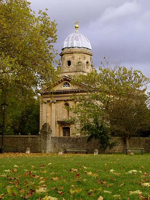
📷 5Historic churches · South Wales
Redland Chapel
Redland Chapel — church in Bristol, England, UK.
 📷 3
📷 3Memorials & monuments · South Wales
Emily & Elizabeth Sturge
Emily & Elizabeth Sturge — a memorial in wales-south, United Kingdom.
 📷 3
📷 3Memorials & monuments · South West England
Second Lieutenant Hardy Parsons VC
Second Lieutenant Hardy Parsons VC — a memorial in england-south-west, United Kingdom.
 📷 3
📷 3Parks · South Wales
Redland Green
Redland Green — Park in Bristol, England.
 📷 4
📷 4Public art & sculpture · South Wales
monkey
monkey — a public art in wales-south, United Kingdom.
More places in this region
 📷 3
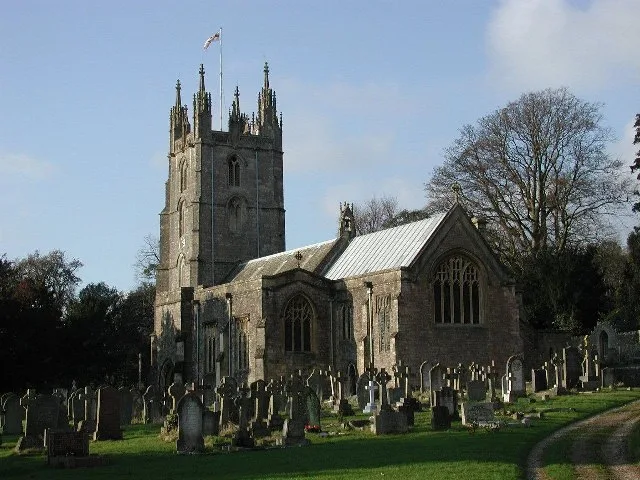
📷 3Historic churches · South Wales
All Saints Church, Wraxall
All Saints Church, Wraxall — church in Wraxall, North Somerset, England, UK.
 📷 4
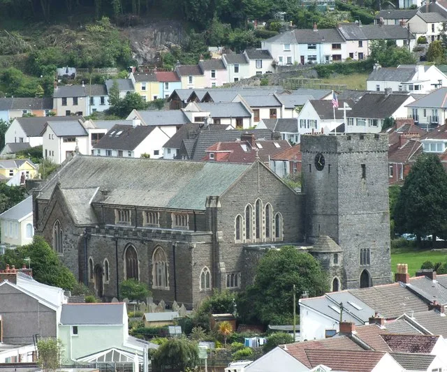
📷 4Historic churches · South Wales
All Saints' Church
All Saints' Church — church in Oystermouth, Swansea, Wales.
 📷 3
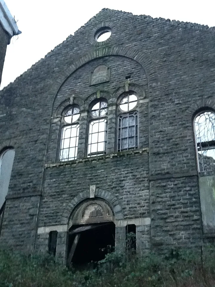
📷 3Historic churches · South Wales
Bethania Presbyterian Church
Bethania Presbyterian Church — Calvinistic Methodist chapel in Aberdare.
 📷 3
📷 3Historic churches · South Wales
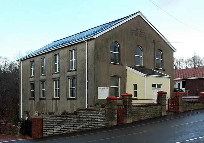
Bethel, Abernant
Bethel, Abernant — church in Rhondda Cynon Taf, UK.
Frequently asked questions
- Where is Redland, Bristol?
- Redland, Bristol is in South Wales, United Kingdom (postcode BS6 7EQ), in the parish of Bristol, City of, unparished area.
- Is Redland, Bristol free to visit?
- Yes, Redland, Bristol is free to enter.
- How do I get to Redland, Bristol?
- Drivers can navigate to postcode BS6 7EQ. It sits within the Bristol Central parliamentary constituency.