Viewpoints · Scottish Highlands
Queen's View
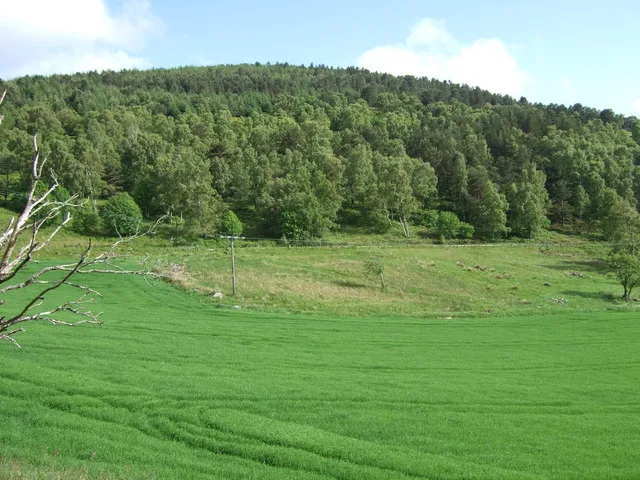
Queen's View is a viewpoint in the United Kingdom.

Stanley Howe — CC BY-SA 2.0 via Wikimedia Commons licence
Plan your visit
- Typical visit
- 20 min–45 min
- Best time of year
- Clear days year-round
- Free entry
- Dog-friendly
About
Queen's View is a named viewpoint in the United Kingdom. Coordinates: 57.1443°, -2.7894°. This entry is part of The Great Britain Guide, a free, ad-free, open-data tourist directory.
Photo gallery
From the Wikipedia article
Loch Tummel (Scottish Gaelic: Loch Teimheil) is a long, narrow loch, seven kilometres (4+1⁄2 miles) northwest of Pitlochry in the council area of Perth and Kinross, Scotland. It is fed and drained by the River Tummel, which flows into the River Tay about 13 km (8 mi) south-east of the Clunie Dam at the loch's eastern end. The loch is traversed by roads to both north and south. Along the northern side the road is numbered as the B8019, and runs from the Pass of Killiecrankie on the A9 in the east to Tummel Bridge at the head of the loch. The road on the southern side is unclassified, and meets the A9 further south, near to Pitlochry. The loch gives its name to the Loch Tummel National Scenic Area (NSA), one of 40 such areas in Scotland, which are defined so as to identify areas of exceptional scenery and to ensure its protection by restricting certain forms of development. The Loch Tummel Lyon NSA covers 9,013 hectares (22,272 acres), all of which lies within Perth and Kinross. The NSA covers the hills surrounding the loch, and extends along the River Tummel to also take in the area surrounding the Pass of Killiecrankie on the River Garry.
Excerpt from Wikipedia under CC BY-SA 4.0. See the source article linked in Sources below.
- Coordinates
- 57.1443, -2.7894
- District
- Aberdeenshire
- Postcode
- AB34 4TL
- Parliamentary constituency
- West Aberdeenshire and Kincardine
Sources
- osm: n3804143504 (ODbL)
- wikipedia: The Queen's View (CC BY-SA 4.0)
Other places nearby
Loading nearby places…
Nearby
 📷 3
📷 3Mountains & hills · Scottish Highlands
Craiglich
Craiglich — Named summit at 476 m.
 📷 3
📷 3Memorials & monuments · Scottish Highlands
Farquharson of Finzean Tenantry Memorial
Farquharson of Finzean Tenantry Memorial — a memorial in scotland-highlands, United Kingdom.
 📷 3
📷 3Archaeological sites · Scottish Highlands
Culsh Earth House
Culsh Earth House — a archaeological in scotland-highlands, United Kingdom.
Mountain bike trails · Scottish Highlands
Crowd Surfin'
Crowd Surfin' — a mtb trail in scotland highlands.
Mountain bike trails · Scottish Highlands
Pete's Ladder
Pete's Ladder — a mtb trail in scotland highlands.
Mountain bike trails · Scottish Highlands
Fool's Gold
Fool's Gold — a mtb trail in scotland highlands.
More viewpoints in this region
 📷 3
📷 3Viewpoints · Scottish Highlands
Achtercairn
Achtercairn is a viewpoint in the United Kingdom.
 📷 3
📷 3Viewpoints · Scottish Highlands
An Ceann Mòr - Inveruglas Pyramid
An Ceann Mòr - Inveruglas Pyramid is a viewpoint in the United Kingdom.
 📷 3
📷 3Viewpoints · Scottish Highlands
An Torr
An Torr is a viewpoint in the United Kingdom.
 📷 3
📷 3Viewpoints · Scottish Highlands
Balmashanner Hill
Balmashanner Hill is a viewpoint in the United Kingdom.
Frequently asked questions
- Where is Queen's View?
- Queen's View is in the Scottish Highlands, United Kingdom (postcode AB34 4TL).
- Is Queen's View free to visit?
- Yes, Queen's View is free to enter.
- How do I get to Queen's View?
- Drivers can navigate to postcode AB34 4TL. It sits within the West Aberdeenshire and Kincardine parliamentary constituency.