Reservoirs & lochs · London
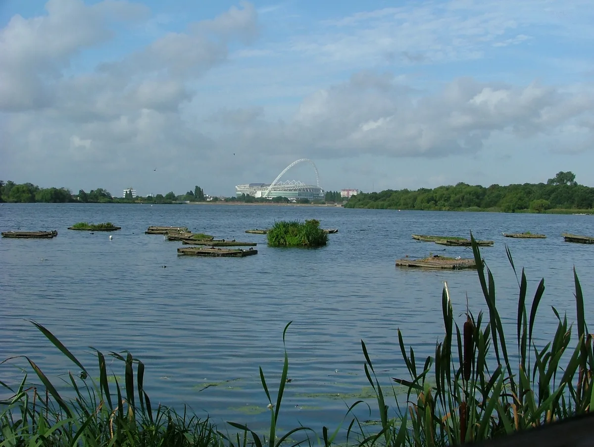
Queen Mary Reservoir
Queen Mary Reservoir — lake in the United Kingdom.

Wikimedia Commons contributors — see linked file page for photographer and licence licence
Plan your visit
- Typical visit
- 1 h–2.5 h
- Nearest railway station
- Upper Halliford · 1.4 km
- Free entry
- Dog-friendly
About
Queen Mary Reservoir is a reservoir in the United Kingdom. It covers approximately 3 km². Named after Mary of Teck. Wikidata describes it as: "lake in the United Kingdom". Coordinates: 51.4167°, -0.4500°.
Photo gallery
From the Wikipedia article
The Queen Mary Reservoir is one of the largest of London's reservoirs supplying fresh water to London and parts of surrounding counties, and is located in the Borough of Spelthorne in Surrey. The reservoir covers 707 acres (2.86 km2) and is 45 ft (14 m) above the surrounding area.
Excerpt from Wikipedia under CC BY-SA 4.0. See the source article linked in Sources below.
Background
History
Construction of the Littleton Reservoir was authorised under the provisions of the Metropolitan Water Board (Various Powers) Act 1921 (11 & 12 Geo. 5, c.cxv). It was designed by the Board’s Chief Engineer Henry Stilgoe (1867-1943) and was completed in December 1924. Some sources state that the reservoir was designed by John Watson Gibson for the Metropolitan Water Board. It was formally opened by King George V in June 1925 as the Queen Mary Reservoir, renamed for the Queen Consort, Mary of Teck; a plaque commemorates the event. It was the largest reservoir in the world at that time. In 1943, during World War II, the reservoir was used for testing submersibles. The submersible was nicknamed…
Architecture
The reservoir embankment has a puddle clay core extending down into the underlying London Clay and gravel/earth shoulders at a slope of 1 in 3. The top of the embankment is 12 m above the surrounding land. The key engineering parameters are: {| class="wikitable" |+Queen Mary Reservoir !Parameter !Value |- |Maximum embankment height |12 m |- |Length of Embankment |6,324 m |- |Total capacity |30.4 million m<sup>3</sup> 30,400 megalitres |- |Surface area |2.863 km<sup>2</sup> |- |Inflow capacity |770 Ml/d |- |Emergency drawdown |0.75 metres within 24hrs |} The reservoir has a 1 km central gravel/earth embankment breakwater running north–south and designed to reduce wave action.
Sourced from Wikipedia under CC BY-SA 4.0.
- Coordinates
- 51.4167, -0.4500
- County
- Surrey
- District
- Spelthorne
- Parish
- Spelthorne, unparished area
- Postcode
- TW15 1XB
- Parliamentary constituency
- Spelthorne
- Nearest railway station
- Upper Halliford — 1.4 km
- Official site
- web.archive.org
Sources
- wikidata: Q7270464 (CC0)
- wikipedia: Queen Mary Reservoir (CC BY-SA 4.0)
- commons: Queen Mary Reservoir - geograph.org.uk - 144566.jpg (CC BY-SA 4.0)
Other places nearby
Loading nearby places…
Nearby
 📷 5
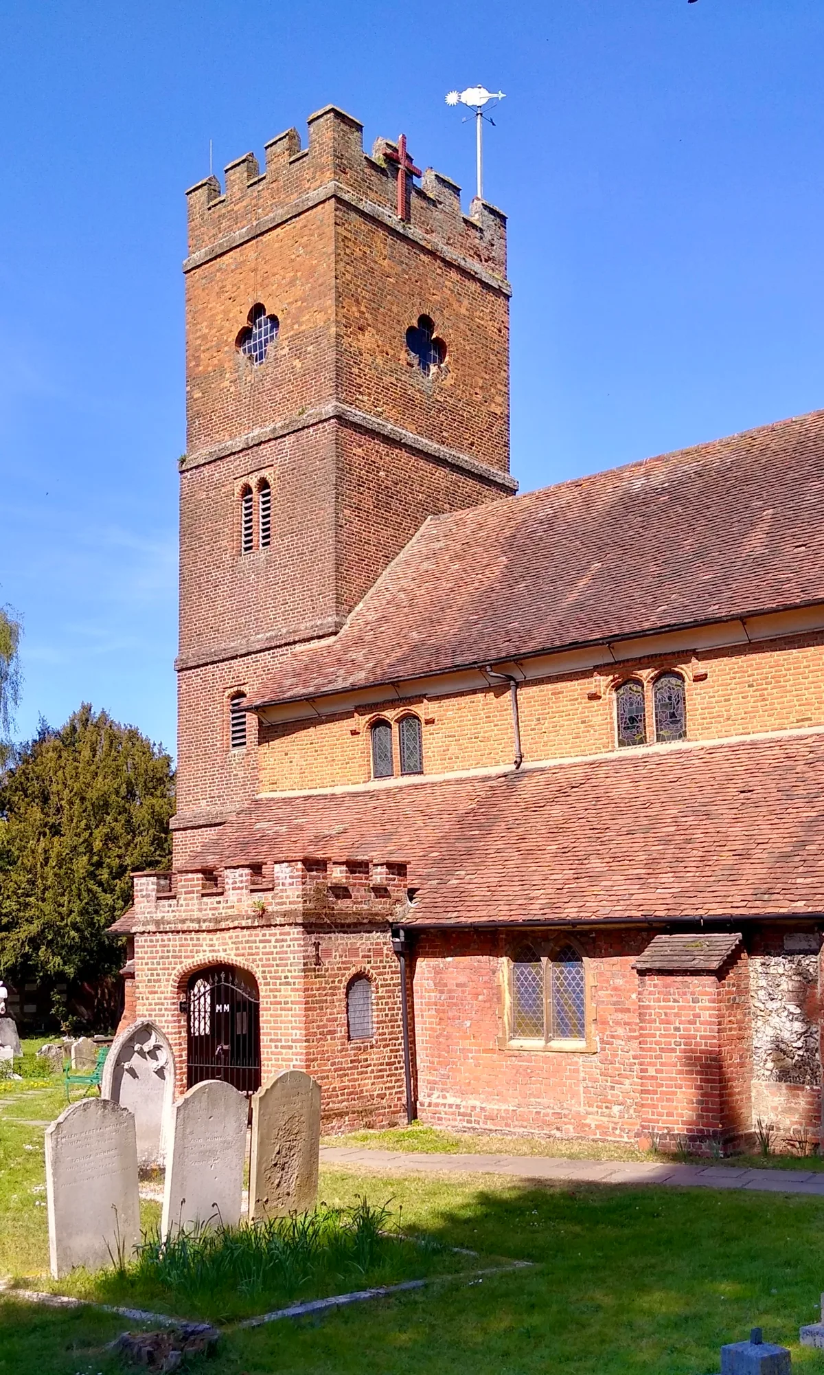
📷 5Historic churches · London
Church of St Mary Magdalene
Church of St Mary Magdalene — church in Littleton, Surrey, England, UK.
 📷 5
📷 5Theatres · London
Pinewood Cinema at Shepperton Studios
Pinewood Cinema at Shepperton Studios in England London, United Kingdom.
 📷 5
📷 5Historic bridges · London
Squire's Bridge
Squire's Bridge — Grade II listed building-listed bridge in england-london, United Kingdom.
 📷 5
📷 5Museums · London
Sunbury-on-Thames
Sunbury-on-Thames — a museum in england-london, United Kingdom.
 📷 5
📷 5Memorials & monuments · London
Ashford War Memorial
Ashford War Memorial is a memorial in the United Kingdom.
 📷 5
📷 5Manor houses · London
Sunbury Manor School
Sunbury Manor School — a school heritage in england-london, United Kingdom.
More places in this region
 Flagship📷 10
Reservoirs & lochs · London
Brent Reservoir
Brent Reservoir — reservoir which straddles the boundary between the London boroughs of Brent and Barnet, in England.
 📷 5
📷 5Reservoirs & lochs · London
Aldenham Reservoir
Aldenham Reservoir — reservoir in Hertfordshire, England, UK.
 📷 5
📷 5Reservoirs & lochs · London
Banbury Reservoir
Banbury Reservoir — reservoir in the London Borough of Waltham Forest, England, United Kingdom.
 📷 5
📷 5Reservoirs & lochs · London
Bessborough Reservoir
Bessborough Reservoir — lake in the United Kingdom.
Frequently asked questions
- Where is Queen Mary Reservoir?
- Queen Mary Reservoir is in London, in the United Kingdom — coordinates 51.4167°, -0.4500°. The nearest railway station is Upper Halliford, around 1.4 km away.
- Is Queen Mary Reservoir free to visit?
- Yes — admission to Queen Mary Reservoir is free.