Other places · Mid Wales
Principality of Wales
Also known as: Tywysogaeth Cymru
Principality of Wales in Wales Mid, United Kingdom.

David Smith — CC BY-SA 2.0 via Wikimedia Commons licence
Plan your visit
- Typical visit
- 1 h–2 h
About
Principality of Wales is a place of interest in Wales Mid, United Kingdom — drawn from open-data sources for visitor reference. See the linked Wikipedia article for the full description.
Photo gallery
From the Wikipedia article
The Principality of Wales (Welsh: Tywysogaeth Cymru) was originally the territory of the native Welsh princes of the House of Aberffraw from 1216 to 1283, encompassing two-thirds of modern Wales during its height of 1267–1277. Following the conquest of Wales by Edward I of England of 1277 to 1283, those parts of Wales retained under the direct control of the English crown, principally in the north and west of the country, were re-constituted as a new Principality of Wales and ruled either by the monarch or the monarch's heir though not formally incorporated into the Kingdom of England. This was ultimately accomplished with the Laws in Wales Acts 1535–1542 when the Principality ceased to exist as a separate entity. The Principality was formally founded in 1216 by native Welshman and King of Gwynedd, Llywelyn the Great who gathered other leaders of pura Wallia at the Council of Aberdyfi. The agreement was later recognised by the 1218 Treaty of Worcester between Llywelyn the Great of Wales and Henry III of England. The treaty gave substance to the political reality of 13th-century Wales and England, and the relationship of the former with the Angevin Empire. The principality retained a great degree of autonomy, characterized by a separate legal jurisprudence based on the well-established laws of Cyfraith Hywel, and by the increasingly sophisticated court of the House of Aberffraw. Although it owed fealty to the Angevin king of England, the principality was de facto independent, with a similar status in the empire to the Kingdom of Scotland. Its existence has been seen as proof that all the elements necessary for the growth of Welsh statehood were in place. The period of de facto independence ended with Edward I's conquest of the principality between 1277 and 1283. Under the Statute of Rhuddlan, the principality lost its independence and became effectively an annexed territory of the English crown. From 1301, the crown's lands in north and west Wales formed part of the…
Excerpt from Wikipedia under CC BY-SA 4.0. See the source article linked in Sources below.
Background
History
Between 1277 and 1283, Edward I of England conquered the territories of Llywelyn ap Gruffudd and the other last remaining native Welsh princes. The governance and constitutional position of the principality after its conquest was set out in the Statute of Rhuddlan of 1284. In the words of the statute, the principality was "annexed and united" to the English crown. The principality's administration was overseen by the Prince of Wales's council comprising between 8 and 15 councillors sitting in London or, later, Ludlow in Shropshire. The council acted as the principality's final court of appeal. By 1476, the council, which became known as the Council of Wales and the Marches, began taking…
Description
At the end of the twelfth century, and beginning of the thirteenth century, Llywelyn ab Iorwerth (Llywelyn Fawr or Llywelyn the Great), built a royal home at Abergwyngregyn (known as Tŷ Hir, the Long House, in later documents) on the site of the subsequent manor house of Pen y Bryn. To the east was the newly endowed Cistercian Monastery of Aberconwy; to the west the cathedral city of Bangor. In 1211, King John of England brought an army across the river Conwy, and occupied the royal home for a brief period; his troops went on to burn Bangor. Llywelyn's wife, John's daughter Joan, also known as Joanna, negotiated between the two men, and John withdrew. Joan died at Abergwyngregyn in 1237;…
Sourced from Wikipedia under CC BY-SA 4.0.
- Coordinates
- 52.3000, -3.6000
- Established
- 1216
Sources
- wikidata: Q1483510 (CC0)
- wikipedia: Principality of Wales (CC BY-SA 4.0)
Other places nearby
Loading nearby places…
Nearby
 📷 3
📷 3Reservoirs & lochs · Mid Wales
Craig Goch Reservoir
Craig Goch Reservoir — reservoir near Rhayader, Powys, Wales, UK.
 📷 5
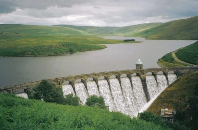
📷 5Reservoirs & lochs · Mid Wales
Craig Goch Dam
Craig Goch Dam in Wales Mid, United Kingdom.
 📷 3
📷 3Mountains & hills · Mid Wales
Esgair Penygarreg
Esgair Penygarreg — a mountain in wales-mid, United Kingdom, 533 m.
 📷 3
📷 3Mountains & hills · Mid Wales
Esgair Perfedd
Esgair Perfedd — a mountain in wales-mid, United Kingdom, 504 m.
 📷 3
📷 3Archaeological sites · Mid Wales
Esgair Perfedd Roman Camp
Esgair Perfedd Roman Camp — a archaeological in wales-mid, United Kingdom.
 📷 5
📷 5Windmills · Mid Wales
Maen Gwyn Gweddw
Maen Gwyn Gweddw — a post mill in wales-mid, United Kingdom.
More places in this region
 📷 3
📷 3Other places · Mid Wales
Chain Links
Chain Links — Public artwork (sculpture) by Joss Smith.
 📷 3
📷 3Other places · Mid Wales
David Davies
David Davies — Public artwork (statue).
 📷 3
📷 3Other places · Mid Wales
Dwrgi Aberteifi / Teifi Otter
Dwrgi Aberteifi / Teifi Otter — Public artwork (statue) by Geoffrey Powell and Fiorini Foundry.
 📷 3
📷 3Other places · Mid Wales
Ffenestr Ffug
Ffenestr Ffug — Public artwork (mural).
Frequently asked questions
- Where is Principality of Wales?
- Principality of Wales is in Mid Wales, in the United Kingdom — coordinates 52.3000°, -3.6000°.
- When was Principality of Wales built?
- Principality of Wales dates to 1216.