Archaeological sites · London
Prince's Coverts
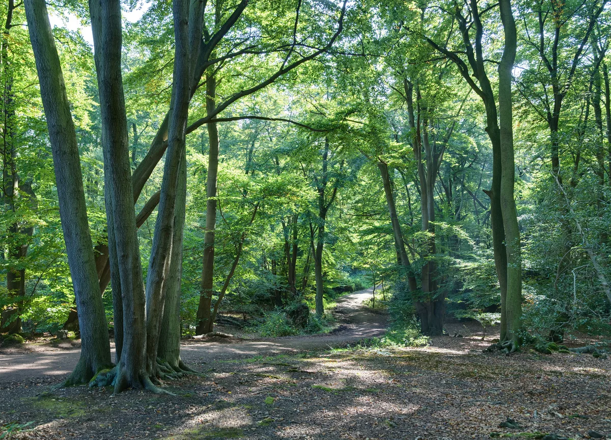
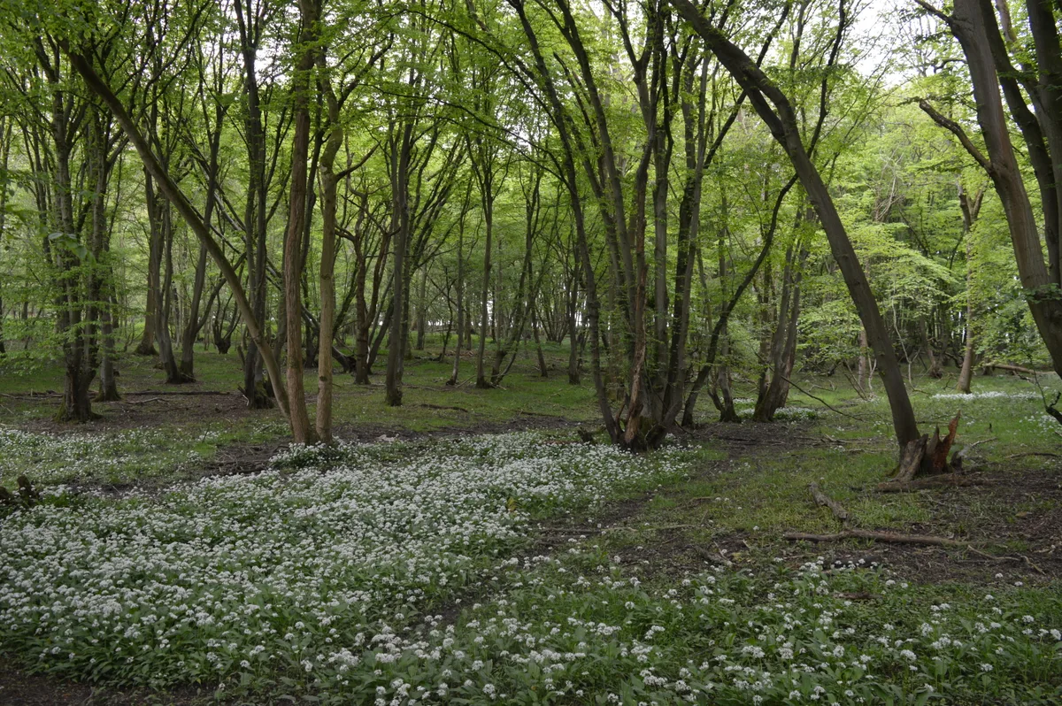
Prince's Coverts — woodland in Surrey, England.

Wikimedia Commons licence
Plan your visit
- Typical visit
- 45 min–1.5 h
- Nearest railway station
- Oxshott · 2.0 km
- Free entry
- Dog-friendly
About
Prince's Coverts is an archaeological site in the United Kingdom. Wikidata describes it as: "woodland in Surrey, England". Coordinates: 51.3330°, -0.3340°.
Photo gallery
From the Wikipedia article
Prince's Coverts is an area of 864 acres (3.50 km2; 1.350 sq mi) of managed woodland in Oxshott, Surrey, England, to which there is public access. It is owned and managed by the Crown Estate who refer to the area as Oxshott Woods. It adjoins Malden Rushett in Greater London, the Pachesham Park estate and Leatherhead Golf Course to the east.
Excerpt from Wikipedia under CC BY-SA 4.0. See the source article linked in Sources below.
Background
History
Prince's Coverts is named after Prince (later King) Leopold I of Belgium, who lived at Claremont Park, Esher 1 mi north-west, which remains linked by a bridleway across Arbrook Common and Farm which has two white-painted metal coal tax posts. The Claremont Estate was purchased for him in 1816. He later acquired nearby common land which became a shooting estate. This area became known as Prince's Coverts. Following his death, the estate was repurchased by the Crown since which it has been managed by the Crown Estate.
Visiting
The Crown Estate leaflet mentioned below was scanned in 2008, when the Coverts were fenced in, requiring a key for access, but since 2014, access for walkers no longer requires a key and signs indicate that walkers are welcome. Horse riders require a permit. There are many paths through the woodland. There is a 3.5 mile waymarked trail starting at Prince's Gate. The entrances are:
Sourced from Wikipedia under CC BY-SA 4.0.
- Coordinates
- 51.3330, -0.3340
- County
- Surrey
- District
- Mole Valley
- Parish
- Mole Valley, unparished area
- Postcode
- KT22 0DN
- Parliamentary constituency
- Epsom and Ewell
- Nearest railway station
- Oxshott — 2 km
Sources
- wikidata: Q7243732 (CC0)
- wikipedia: Prince's Coverts (CC BY-SA 4.0)
Other places nearby
Loading nearby places…
Nearby
Mountain bike trails · London
The Avenue
The Avenue — a mtb trail in england london.
Mountain bike trails · London
The Avenue
The Avenue — a mtb trail in england london.
Mountain bike trails · London
Single Track
Single Track — a mtb trail in england london.
Mountain bike trails · London
The Avenue
The Avenue — a mtb trail in england london.
 📷 5
📷 5Chapels · London
Malden Rushett
Malden Rushett — a methodist chapel in england-london, United Kingdom.
Mountain bike trails · London
Public Bridleway 29
Public Bridleway 29 — a mtb trail in england london.
More archaeological sites in this region
 Flagship📷 10
Archaeological sites · London
Epping Forest
Epping Forest — royal forest in England.
 Flagship📷 10
Archaeological sites · London
Grangewood Park
Grangewood Park — park in the United Kingdom.
 Flagship📷 10
Archaeological sites · London
Nunn Wood
Nunn Wood — woods in Essex, England, a Site of Special Scientific Interest.
 📷 5
📷 5Archaeological sites · London
A Bronze Age post alignment and timber platform at Flag Fen and associated Bronze Age and later field systems and settlement to
A Bronze Age post alignment and timber platform at Flag Fen and associated Bronze Age and later field systems and settlement to — archaeological site in Thorney, City of Peterborough, England, UK.
Frequently asked questions
- Where is Prince's Coverts?
- Prince's Coverts is in London, in the United Kingdom — coordinates 51.3330°, -0.3340°. The nearest railway station is Oxshott, around 2 km away.
- Is Prince's Coverts free to visit?
- Yes — admission to Prince's Coverts is free.