Towns & cities · West Midlands
Potsgrove
Potsgrove — village and civil parish in Bedfordshire, UK.

Wikimedia Commons contributors — see linked file page for photographer and licence licence
Plan your visit
- Typical visit
- 3 h–6 h
- Nearest railway station
- Stonehenge Works · 1.8 km
- Free entry
- Family-friendly
- Dog-friendly
About
Potsgrove is a town, city, village or settlement in the United Kingdom. Recent population estimates put it at around 31 people. Address: MK17. Wikidata describes it as: "village and civil parish in Bedfordshire, UK". Coordinates: 51.9500°, -0.6167°.
Photo gallery
Protected designations
- Area of Outstanding Natural Beauty: Chilterns
Designations sourced from Natural England open data under OGL v3.
From the Wikipedia article
Potsgrove is a small village and civil parish located in the Central Bedfordshire district of Bedfordshire, England. The parish includes the hamlet of Sheep Lane. The first reference to the village appears in the Domesday Book of 1086. The village is first recorded as "Potesgraue". Later references record the village as "Pottesgrove", which is still used in the name of the local ecclesiastical parish. Manor Farm in Potsgrove for many years was run by the G Hunter and son. The farm organisation had a successful syndicate shoot for many years also included a dairy milk herd along with beef stock. Woburn Abbey owned land in Potsgrove. The village held an annual clay shoot which included team guns vs. beaters, plus an open free-to-all shoot off at the end of the day Prominent local families included the McClurg's who lived at the old school house and worked at manor farm for many years (1970–2013), the Hodges, Bentley's and Grahams. Potsgrove had its own school until the early 1900s, along with a pub called the Sow and Pigs.
Excerpt from Wikipedia under CC BY-SA 4.0. See the source article linked in Sources below.
- Coordinates
- 51.9500, -0.6167
- District
- Central Bedfordshire
- Parish
- Heath and Reach
- Postcode
- MK17
- Parliamentary constituency
- Dunstable and Leighton Buzzard
- Population
- 31
- Nearest railway station
- Stonehenge Works — 1.8 km
Sources
- wikidata: Q1519701 (CC0)
- wikipedia: Potsgrove (CC BY-SA 4.0)
- commons: St. Mary's Potsgrove - southern side - geograph.org.uk - 370570.jpg (CC BY-SA 4.0)
Other places nearby
Loading nearby places…
Nearby
 📷 3
📷 3Historic churches · West Midlands
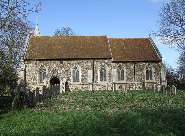
Church of St Peter & All Saints, Battlesden
Church of St Peter & All Saints, Battlesden — church in Battlesden, Bedfordshire, England, UK.
 📷 3
📷 3Historic churches · West Midlands
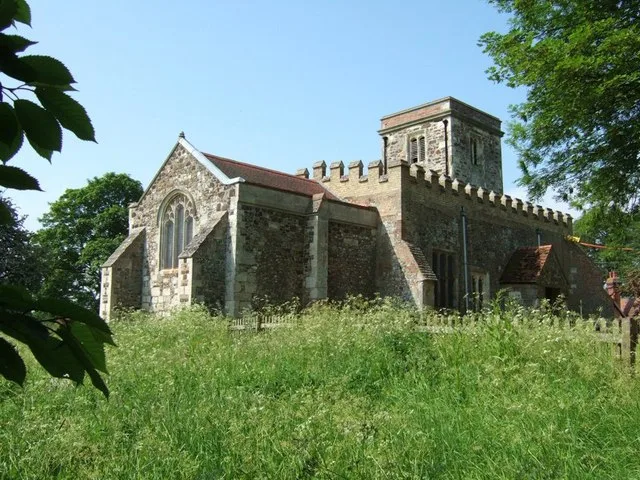
St Mary's Church, Potsgrove
St Mary's Church, Potsgrove — church in Potsgrove, Bedfordshire, England, UK.
 📷 5
📷 5Towns & cities · West Midlands
Battlesden
Battlesden — village and civil parish in Bedfordshire, UK.
 📷 5
📷 5Memorials & monuments · West Midlands
PENLEE
PENLEE — a memorial in england-west-midlands, United Kingdom.
 📷 3
📷 3Historic churches · West Midlands
Church of St Peter, Milton Bryan
Church of St Peter, Milton Bryan — church in Milton Bryan, Bedfordshire, England, UK.
 📷 3
📷 3Wildlife reserves · West Midlands
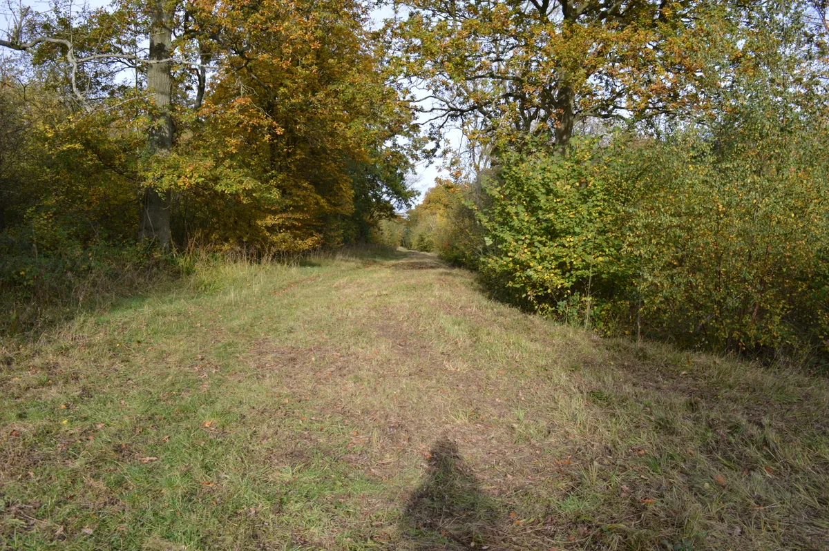
Kings and Bakers Woods and Heaths
Kings and Bakers Woods and Heaths — nature reserve in the United Kingdom.
More towns in this region
 Flagship📷 3
Towns & cities · West Midlands
Adderbury
Adderbury — village and civil parish in Cherwell district, Oxfordshire, England.
 Flagship📷 3
Towns & cities · West Midlands
Admington
Admington — village in Warwickshire, England, UK.
 Flagship📷 3
Towns & cities · West Midlands
Aldington
Aldington — village in Worcestershire, United Kingdom.
 Flagship📷 5
Towns & cities · West Midlands
Anstey
Anstey — large village in Leicestershire, England.
Frequently asked questions
- Where is Potsgrove?
- Potsgrove is in the West Midlands, United Kingdom (postcode MK17), in the parish of Heath and Reach.
- Is Potsgrove a protected site?
- Yes — Potsgrove is part of the Chilterns National Landscape (AONB).
- Is Potsgrove free to visit?
- Yes, Potsgrove is free to enter.
- How do I get to Potsgrove?
- The nearest railway station is Stonehenge Works, about 1.8 km away. Drivers can navigate to postcode MK17.