Beaches · North Wales
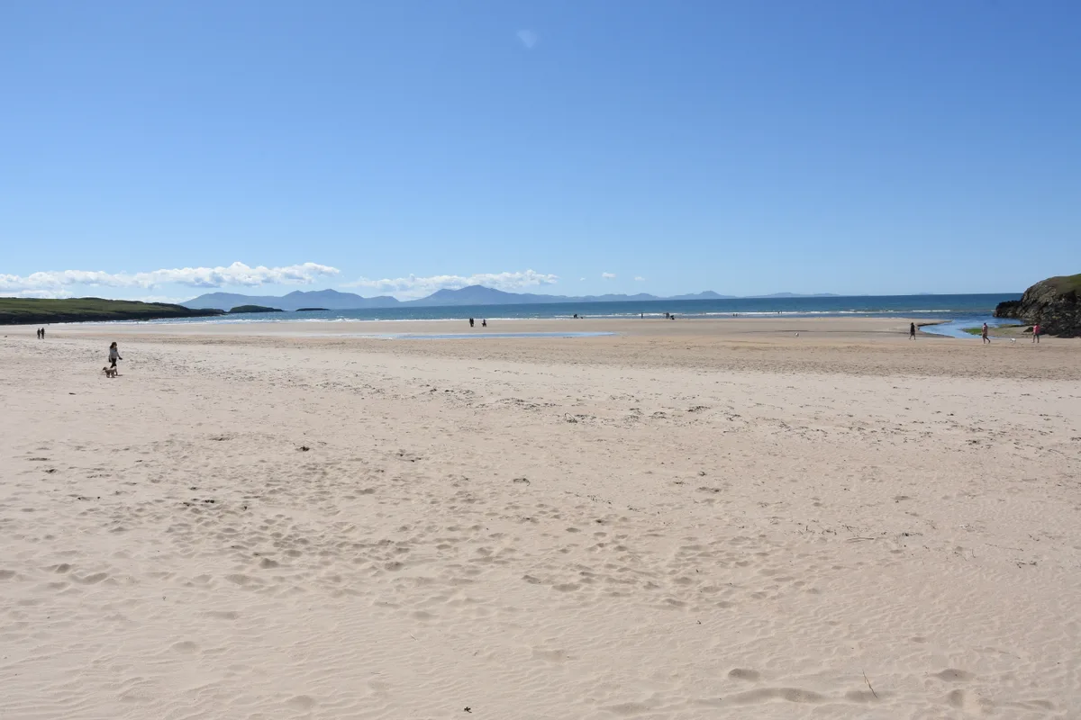
Porth Dafarch
Porth Dafarch is a beach in the United Kingdom.

Wikimedia Commons contributors — see linked file page for photographer and licence licence
Plan your visit
- Typical visit
- 1 h–3 h
- Best time of year
- Summer (Jun–Aug)
- Nearest railway station
- Holyhead · 2.6 km
- Free entry
- Family-friendly
- Dog-friendly
About
Porth Dafarch is a named beach on the United Kingdom coastline. Coordinates: 53.2873°, -4.6512°. This entry is part of The Great Britain Guide, a free, ad-free, open-data tourist directory.
Photo gallery
From the Wikipedia article
Porth Dafarch is a small bay on the west coast of Anglesey in North Wales. The inlet is on the west side of Holy Island, Anglesey about 2 mi (3.2 km) southwest of Holyhead and 1.5 mi (2.4 km) northwest of Trearddur Bay. It has a sandy beach and is a popular visitor destination. In 2021 Porth Dafarch beach awarded as Blue Flag beach.
Excerpt from Wikipedia under CC BY-SA 4.0. See the source article linked in Sources below.
Background
History
Porth Dafarch was used from the mid-17th to early-19th century as an alternative to the main port of Holyhead when it was affected by adverse weather conditions in the Irish Sea. Passengers would use the sheltered bay to set sail for Dublin in Ireland. However, with the commencement of a steam service in 1822 (and the construction of the Holyhead Breakwater), Porth Dafarch was no longer required as an alternative port. The old customs post can still be seen, dating from 1819. It allowed mail and passengers to be landed on Holyhead Island when Northerly winds made landing at Holyhead impossible. By 1873, the new harbour was completed at Holyhead making the customs post redundant. The Grade…
Sourced from Wikipedia under CC BY-SA 4.0.
- Coordinates
- 53.2873, -4.6512
- District
- Isle of Anglesey
- Parish
- Trearddur
- Postcode
- LL65 2LS
- Parliamentary constituency
- Ynys Môn
- Nearest railway station
- Holyhead — 2.6 km
Sources
- osm: w227397529 (ODbL)
- commons: Porth dafac at low tide.jpg (CC BY-SA 4.0)
- wikipedia: Porth Dafarch (CC BY-SA 4.0)
Other places nearby
Loading nearby places…
Nearby
 📷 3
📷 3Archaeological sites · North Wales
Cytiau'r Gwyddelod Hut Circles
Cytiau'r Gwyddelod Hut Circles — a archaeological in wales-north, United Kingdom.
Campsites · North Wales
Valley Of The Rocks Campsite
Valley Of The Rocks Campsite — a campsite in wales north.
Caravan parks · North Wales
Valley Of The Rocks Caravan Park
Valley Of The Rocks Caravan Park — a caravan park in wales north.
Campsites · North Wales
Tan-y-Graig
Tan-y-Graig — a campsite in wales north.
Campsites · North Wales
Blackthorn Farm Campsite
Blackthorn Farm Campsite — a campsite in wales north.
Caravan parks · North Wales
Blackthorn Farm Caravan Park
Blackthorn Farm Caravan Park — a caravan park in wales north.
More beaches in this region
 📷 3
📷 3Beaches · North Wales
Aberffraw Sands
Aberffraw Sands — sandy beach on west coast of Anglesey, in Wales, UK.
 📷 3
📷 3Beaches · North Wales
Banc Sidan
Banc Sidan is a beach in the United Kingdom.
 📷 3
📷 3Beaches · North Wales
Benllech Sands
Benllech Sands is a beach in the United Kingdom.
 📷 3
📷 3Beaches · North Wales
Bennar Beach
Bennar Beach is a beach in the United Kingdom.
Frequently asked questions
- Where is Porth Dafarch?
- Porth Dafarch is in North Wales, United Kingdom (postcode LL65 2LS), in the parish of Trearddur.
- Is Porth Dafarch free to visit?
- Yes, Porth Dafarch is free to enter.
- How do I get to Porth Dafarch?
- The nearest railway station is Holyhead, about 2.6 km away. Drivers can navigate to postcode LL65 2LS.