Museums · South West England
Porlock Hill
Porlock Hill is a road west of Porlock, Somerset. It is part of the A39, connecting Porlock to Lynmouth and Barnstaple in Devon and is the steepest A-road in the United Kingdom, approaching 1 in 4 (25

Geoff Royle — CC BY-SA 2.0 via Wikimedia Commons licence
Plan your visit
- Typical visit
- 1.5 h–3 h
- Best time of year
- Year-round
- Family-friendly
- Limited wheelchair access
About
Porlock Hill is a road west of Porlock, Somerset. It is part of the A39, connecting Porlock to Lynmouth and Barnstaple in Devon and is the steepest A-road in the United Kingdom, approaching 1 in 4 (25%) in places. A toll road is available which connects the same two endpoints at the top and bottom of the hill at an easier gradient.
Photo gallery
From the Wikipedia article
Porlock Hill is a road west of Porlock, Somerset. It is part of the A39, connecting Porlock to Lynmouth and Barnstaple in Devon and is the steepest A-road in the United Kingdom, approaching 1 in 4 (25%) in places. A toll road is available which connects the same two endpoints at the top and bottom of the hill at an easier gradient.
Excerpt from Wikipedia under CC BY-SA 4.0. See the source article linked in Sources below.
Background
History
There was no practical transport west of Porlock in the 18th century. In 1794, the poet Robert Southey wrote that such a route was considered "the end of the world". In 1812, the local community was fined for not maintaining a good road, and builders were employed to construct a suitable route. The road opened in 1843 when a stagecoach travelled from Lynton to Porlock successfully. Shortly after the road opened, a local landowner, Mr Blathwayt, decided to build a toll road further north at a more relaxed gradient of 1 in 14 (7%). The toll road was not successful initially as horse-drawn traffic could cope with Porlock Hill, but became popular owing to the increased popularity of the motor…
Sourced from Wikipedia under CC BY-SA 4.0.
- Coordinates
- 51.2069, -3.6054
- District
- Somerset
- Parish
- Porlock
- Postcode
- TA24 8QH
- Parliamentary constituency
- Tiverton and Minehead
- Official site
- explore.osmaps.com
Sources
- wikipedia: Porlock Hill (CC BY-SA 4.0)
Other places nearby
Loading nearby places…
Nearby
 📷 3
📷 3Galleries · South West England
Porlock Phone Box Gallery
Porlock Phone Box Gallery — a gallery in england-south-west, United Kingdom.
 📷 3
📷 3Galleries · South West England
Porlock Art Den
Porlock Art Den — a gallery in england-south-west, United Kingdom.
 📷 5
📷 5Historic churches · South West England
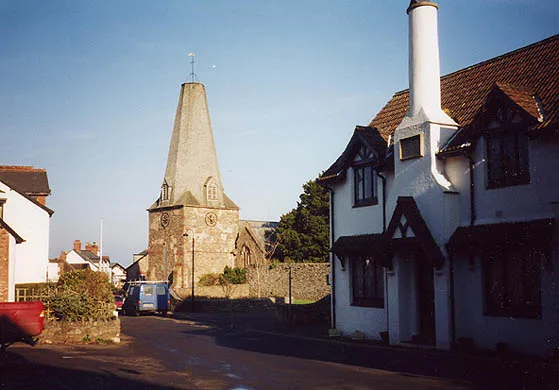
Church of St Dubricius, Porlock
Church of St Dubricius, Porlock — church in West Somerset, England, UK.
 📷 3
📷 3Galleries · South West England
Churchgate Gallery & Framing
Churchgate Gallery & Framing — a gallery in england-south-west, United Kingdom.
 📷 5
📷 5Towns & cities · South West England
Porlock
Porlock — village and civil parish in Somerset, England.
Caravan parks · South West England
Porlock Caravan Park
Porlock Caravan Park — a caravan park in england south west.
More museums in this region
 📷 5
📷 5Museums · South West England
Allhallows Museum
Allhallows Museum — museum in Honiton, Devon, England, United Kingdom.
 📷 5
📷 5Museums · South West England
Axe Valley Heritage Museum
Axe Valley Heritage Museum — museum in Seaton, England, UK.
 📷 5
📷 5Museums · South West England
Bakelite Museum
Bakelite Museum is a museum in the United Kingdom.
 📷 5
📷 5Museums · South West England
Barometer World
Barometer World — former museum in Devon, England.
Frequently asked questions
- Where is Porlock Hill?
- Porlock Hill is in South West England, in the United Kingdom — coordinates 51.2069°, -3.6054°.
- Is Porlock Hill wheelchair accessible?
- Partially — OpenStreetMap notes limited wheelchair access at Porlock Hill. Check ahead for specific facilities.