Mountains & hills · South West England
Pilsdon Pen
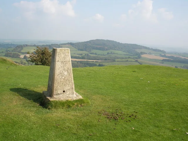
Pilsdon Pen — Named summit at 277 m.

Wikimedia Commons contributors — see linked file page for photographer and licence licence
Plan your visit
- Typical visit
- 3 h–8 h
- Best time of year
- Late spring – early autumn (May–Oct)
- Nearest railway station
- Crewkerne · 8.4 km
- Free entry
- Dog-friendly
About
Pilsdon Pen is a named summit in the United Kingdom. Wikidata describes it as: "Named summit at 277 m.". Coordinates: 50.8068°, -2.8337°.
Photo gallery
Protected designations
- Area of Outstanding Natural Beauty: Dorset
Designations sourced from Natural England open data under OGL v3.
From the Wikipedia article
Pilsdon Pen is a 277-metre (909 ft) hill in Dorset in South West England, situated at the north end of the Marshwood Vale, approximately 4.5 miles (7.2 km) west of Beaminster. It is Dorset's second highest point and has panoramic views extending for many miles. It was bequeathed to the National Trust by the Pinney family in 1982. For many years it was thought to be Dorset's highest hill, until modern survey revealed that nearby Lewesdon Hill was 2 metres higher.
Excerpt from Wikipedia under CC BY-SA 4.0. See the source article linked in Sources below.
- Coordinates
- 50.8068, -2.8337
- District
- Dorset
- Parish
- Broadwindsor
- Postcode
- DT6 5NX
- Parliamentary constituency
- West Dorset
- Nearest railway station
- Crewkerne — 8.4 km
- Official site
- www.nationaltrust.org.uk
Sources
- osm: n1986564679 (ODbL)
- wikipedia: Pilsdon Pen (CC BY-SA 4.0)
- commons: Pilsdon.jpg (CC BY-SA 4.0)
Other places nearby
Loading nearby places…
Nearby
Vineyards · South West England
Pilsdon Pen hillfort and associated remains
Pilsdon Pen hillfort and associated remains — a UK vineyard in england south west, producing English or Welsh wine from cool-climate grape varieties.
 📷 3
📷 3Historic churches · South West England
Church of St Mary, Pilsdon
Church of St Mary, Pilsdon — Grade I listed building-listed church in england-south-west, United Kingdom.
Vineyards · South West England
Lewesdon hillfort, 525m north east of Brimbley Coombe Farm
Lewesdon hillfort, 525m north east of Brimbley Coombe Farm — a UK vineyard in england south west, producing English or Welsh wine from cool-climate grape varieties.
 📷 3
📷 3Memorials & monuments · South West England
The Lost Pilot
The Lost Pilot — a memorial in england-south-west, United Kingdom.
 📷 5
📷 5Mountains & hills · South West England
Lewesdon Hill
Lewesdon Hill — Named summit at 279 m.
 📷 3
📷 3Memorials & monuments · South West England
Marshwood War Memorial
Marshwood War Memorial — Grade II listed building-listed memorial in england-south-west, United Kingdom.
More mountains in this region
 📷 5
📷 5Mountains & hills · South West England
Alex Tor
Alex Tor — Named summit at 291 m.
 📷 5
📷 5Mountains & hills · South West England
Ash Hole Cavern
Ash Hole Cavern — cave in Brixham, Devon, England, UK.
 📷 5
📷 5Mountains & hills · South West England
Babbacombe Bay
Babbacombe Bay — bay in Devon, England.
 📷 5
📷 5Mountains & hills · South West England
Barley Bay
Barley Bay — bay in the United Kingdom.
Frequently asked questions
- Where is Pilsdon Pen?
- Pilsdon Pen is in South-West England, United Kingdom (postcode DT6 5NX), in the parish of Broadwindsor.
- Is Pilsdon Pen a protected site?
- Yes — Pilsdon Pen is part of the Dorset National Landscape (AONB).
- Is Pilsdon Pen free to visit?
- Yes, Pilsdon Pen is free to enter.
- How do I get to Pilsdon Pen?
- Drivers can navigate to postcode DT6 5NX. It sits within the West Dorset parliamentary constituency.