Towns & cities · South West England
Perranuthnoe
Perranuthnoe — village in Cornwall, England, UK.

Wikimedia Commons contributors — see linked file page for photographer and licence licence
Plan your visit
- Typical visit
- 3 h–6 h
- Nearest railway station
- St Erth · 6.2 km
- Free entry
- Family-friendly
- Dog-friendly
About
Perranuthnoe is a town, city, village or settlement in the United Kingdom. Recent population estimates put it at around 2,200 people. Address: TR20. Wikidata describes it as: "village in Cornwall, England, UK". Coordinates: 50.1150°, -5.4450°.
Photo gallery
Protected designations
- Area of Outstanding Natural Beauty: Cornwall
Designations sourced from Natural England open data under OGL v3.
From the Wikipedia article
Perranuthnoe (; Cornish: Peranudhnow) is a civil parish and a village in southwest Cornwall, England, United Kingdom. The parish population at the 2011 census was 2,184. The Parish includes the settlements of Goldsithney, Perran Downs, Perranuthnoe and part of Rosudgeon. The village of Perranuthnoe itself is situated on the east side of Mount's Bay approximately one mile (1.6 km) east of Marazion and four miles (6.5 km) east of Penzance.
Excerpt from Wikipedia under CC BY-SA 4.0. See the source article linked in Sources below.
Background
History
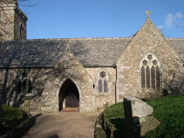
The first historical mention of Perranuthnoe can be found in the Domesday Book of 1086, as Odenol. By 1235 this had become Hutheno, and was recorded as Udno in 1308 and 1373. Finally taking the form Uthnoe-veor in 1839. There is still a farm in the village called Ednoe-vean. The parish church is first mentioned in 1348, by which time transepts with pointed arches had been added. Like most churches in Cornwall, the original church was probably a small building with two cells, a chancel and nave and is one of three churches in Cornwall dedicated to St Piran. By around 1500 a three-stage unbuttressed tower and aisle on the north side had been added and the bells are dated 1636, 1688 and 1832.…
Sourced from Wikipedia under CC BY-SA 4.0.
- Coordinates
- 50.1150, -5.4450
- District
- Cornwall
- Parish
- Perranuthnoe
- Postcode
- TR20
- Parliamentary constituency
- St Ives
- Population
- 2,200
- Nearest railway station
- St Erth — 6.2 km
- Official site
- www.perranuthnoe.com
Sources
- wikidata: Q753554 (CC0)
- wikipedia: Perranuthnoe (CC BY-SA 4.0)
- commons: DSCN0854Perranuthnoe3.jpg (CC BY-SA 4.0)
Other places nearby
Loading nearby places…
Nearby
 📷 5
📷 5Beaches · South West England
Perranuthnoe Beach
Perranuthnoe Beach is a beach in the United Kingdom.
 📷 5
📷 5Historic churches · South West England
Goldsithney
Goldsithney — a church in england-south-west, United Kingdom.
 📷 3
📷 3Gardens · South West England
Chymorvah House
Chymorvah House — a garden in england-south-west, United Kingdom.
 📷 5
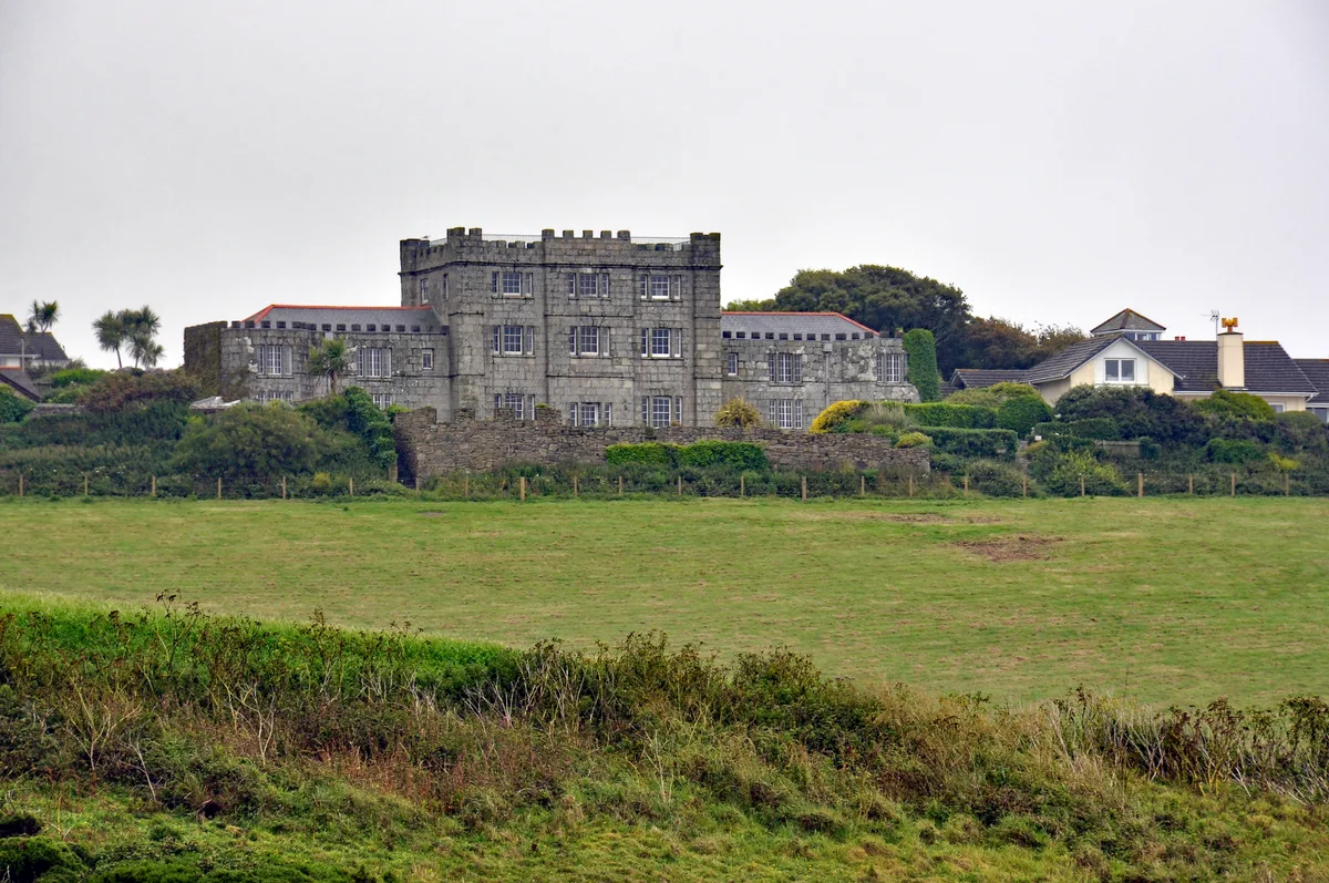
📷 5Castles · South West England
Acton Castle
Acton Castle — Cornish historic building.
 📷 5
📷 5Towns & cities · South West England
St Hilary
St Hilary — village in Cornwall, England.
 📷 5
📷 5Historic churches · South West England
St Hilary Church, Cornwall
St Hilary Church, Cornwall — church in Cornwall, England, UK.
More towns in this region
 Flagship📷 10
Towns & cities · South West England
All Saints
All Saints — village and civil parish in Devon, England, UK.
 Flagship📷 10
Towns & cities · South West England
Axmouth
Axmouth — village and civil parish in Devon, England, UK.
 ★ Iconic📷 10
Towns & cities · South West England
Beer
Beer — village and civil parish in Devon, UK.
 Flagship📷 10
Towns & cities · South West England
Branscombe
Branscombe — village and civil parish in Devon, UK.
Frequently asked questions
- Where is Perranuthnoe?
- Perranuthnoe is in South-West England, United Kingdom (postcode TR20), in the parish of Perranuthnoe.
- Is Perranuthnoe a protected site?
- Yes — Perranuthnoe is part of the Cornwall National Landscape (AONB).
- Is Perranuthnoe free to visit?
- Yes, Perranuthnoe is free to enter.
- How do I get to Perranuthnoe?
- The nearest railway station is St Erth, about 6.2 km away. Drivers can navigate to postcode TR20.