Historic churches · North Wales
Pentir
Pentir is a community and electoral ward in the county of Gwynedd, Wales, and is 124 miles (199.9 km) from Cardiff and 205 miles (329.4 km) from London. In 2011 the population of Pentir was 2450 with

Meirion — CC BY-SA 2.0 via Wikimedia Commons licence
Plan your visit
- Typical visit
- 30 min–1 h
- Free entry
About
Pentir is a community and electoral ward in the county of Gwynedd, Wales, and is 124 miles (199.9 km) from Cardiff and 205 miles (329.4 km) from London. In 2011 the population of Pentir was 2450 with 58.7% of them able to speak Welsh. It includes the Penrhosgarnedd suburbs of Bangor, Glasinfryn, Caerhun and the hamlet of Pentir. The Faenol Hall (Vaenol Estate) is a Grade II* Listed Building within the community, as well as a number of other buildings on the estate, e.g., Chapel of St. Mary. Pentir was historically part of the parish of Bangor. The Local Government Act 1894 directed that parishes could no longer straddle borough boundaries, and so the part of Bangor parish outside the boundary of the municipal borough (city) of Bangor became a separate parish, which took the name Pentir from one of the hamlets it contained. Rural parishes such as Pentir were converted into communities in 1974 under the Local Government Act 1972.
Photo gallery
From the Wikipedia article
Pentir is a community and electoral ward in the county of Gwynedd, Wales, and is 124 miles (199.9 km) from Cardiff and 205 miles (329.4 km) from London. In 2011 the population of Pentir was 2450 with 58.7% of them able to speak Welsh. It includes the Penrhosgarnedd suburbs of Bangor, Glasinfryn, Caerhun and the hamlet of Pentir. The Faenol Hall (Vaenol Estate) is a Grade II* Listed Building within the community, as well as a number of other buildings on the estate, e.g., Chapel of St. Mary. Pentir was historically part of the parish of Bangor. The Local Government Act 1894 directed that parishes could no longer straddle borough boundaries, and so the part of Bangor parish outside the boundary of the municipal borough (city) of Bangor became a separate parish, which took the name Pentir from one of the hamlets it contained. Rural parishes such as Pentir were converted into communities in 1974 under the Local Government Act 1972.
Excerpt from Wikipedia under CC BY-SA 4.0. See the source article linked in Sources below.
- Coordinates
- 53.1808, -4.1359
- District
- Gwynedd
- Parish
- Pentir
- Postcode
- LL57 4EA
- Parliamentary constituency
- Bangor Aberconwy
Sources
- wikipedia: Pentir (CC BY-SA 4.0)
Other places nearby
Loading nearby places…
Nearby
 📷 5
📷 5Historic churches · North Wales
Church of St Cedol
Church of St Cedol — Grade II listed building-listed church in wales-north, United Kingdom.
 📷 3
📷 3Archaeological sites · North Wales
T'yn Llidiard Round Hut
T'yn Llidiard Round Hut — a archaeological in wales-north, United Kingdom.
📷 3Archaeological sites · North Wales
Ty'n Llidiart Round Hut
Ty'n Llidiart Round Hut — a archaeological in wales-north, United Kingdom.
 📷 3
📷 3Historic houses · North Wales
Carnedd Moelyci
Carnedd Moelyci — a historic house in wales-north, United Kingdom.
Vineyards · North Wales
Caer Pencraig, Ty'n y Caeau
Caer Pencraig, Ty'n y Caeau — a UK vineyard in wales north, producing English or Welsh wine from cool-climate grape varieties.
 📷 3
📷 3Mountains & hills · North Wales
Moel y Ci
Moel y Ci — a mountain in wales-north, United Kingdom, 410 m.
More places in this region
 📷 3
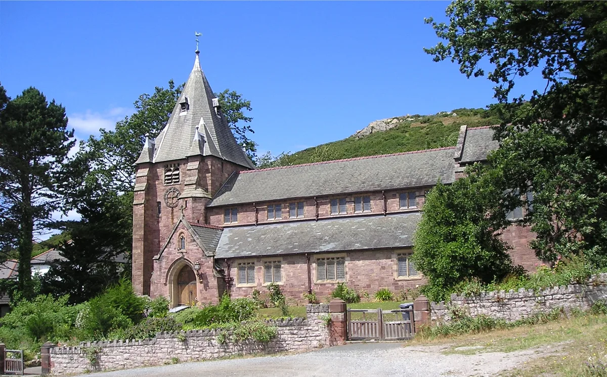
📷 3Historic churches · North Wales
All Saints Church
All Saints Church — Anglican church in Deganwy, Wales.
 📷 3
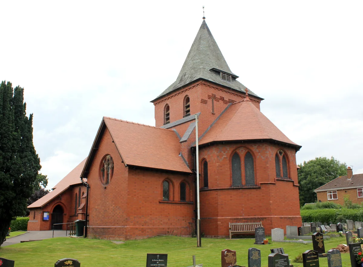
📷 3Historic churches · North Wales
All Saints Church, Great Saughall
All Saints Church, Great Saughall — grade II listed church in Saughall, Cheshire West and Chester, Cheshire, England, UK.
 📷 3
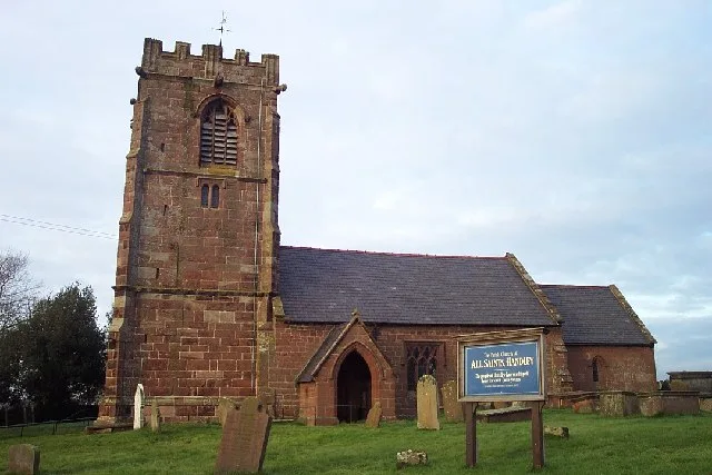
📷 3Historic churches · North Wales
All Saints Church, Handley
All Saints Church, Handley — church in Handley, Cheshire, England, UK.
 📷 3
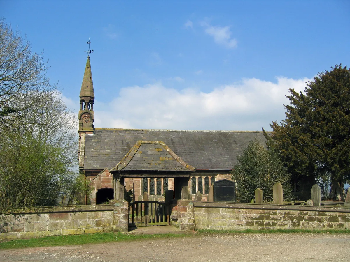
📷 3Historic churches · North Wales
All Saints Church, Harthill
All Saints Church, Harthill — church in Harthill, Cheshire, England, UK.
Frequently asked questions
- Where is Pentir?
- Pentir is in North Wales, United Kingdom (postcode LL57 4EA), in the parish of Pentir.
- Is Pentir free to visit?
- Yes, Pentir is free to enter.
- How do I get to Pentir?
- Drivers can navigate to postcode LL57 4EA. It sits within the Bangor Aberconwy parliamentary constituency.