Hill forts · Yorkshire & the Humber
Penhill Preceptory
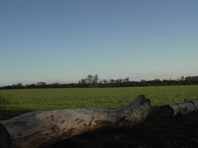
Penhill Preceptory — archaeological site in West Witton, Richmondshire, England, UK.

Wikimedia Commons contributors — see linked file page for photographer and licence licence
Plan your visit
- Typical visit
- 1 h–2 h
- Nearest railway station
- Redmire · 3.0 km
- Free entry
- Dog-friendly
About
Penhill Preceptory is a hill fort in the United Kingdom. Heritage designation: scheduled monument. Wikidata describes it as: "archaeological site in West Witton, Richmondshire, England, UK". Coordinates: 54.2946°, -1.9466°.
Photo gallery
Protected designations
- Site of Special Scientific Interest: River Ure Grasslands SSSI
Designations sourced from Natural England open data under OGL v3.
From the Wikipedia article
Penhill Preceptory was a priory on the northern flanks of Penhill in Wensleydale, North Yorkshire, England, which functioned from about 1142 to 1308–12.
Excerpt from Wikipedia under CC BY-SA 4.0. See the source article linked in Sources below.
- Coordinates
- 54.2946, -1.9466
- District
- North Yorkshire
- Parish
- West Witton
- Postcode
- DL8 4UJ
- Parliamentary constituency
- Richmond and Northallerton
- Nearest railway station
- Redmire — 3 km
- Opening
- 24/7
Sources
- wikidata: Q7162827 (CC0)
- wikipedia: Penhill Preceptory (CC BY-SA 4.0)
- commons: Penhill Preceptory - geograph.org.uk - 1095578.jpg (CC BY-SA 4.0)
Other places nearby
Loading nearby places…
Nearby
 📷 3
📷 3Historic houses · Yorkshire & the Humber
Templars Chapel
Templars Chapel — a historic house in england-yorkshire, United Kingdom.
 📷 4
📷 4Gardens · Yorkshire & the Humber
Belvedere
Belvedere — a garden in england-yorkshire, United Kingdom.
 📷 5
📷 5Historic houses · Yorkshire & the Humber
Swinithwaite Hall
Swinithwaite Hall — house in West Witton, Richmondshire, England, UK.
 📷 3
📷 3Memorials & monuments · Yorkshire & the Humber
Aysgarth Rocket (Folly)
Aysgarth Rocket (Folly) is a memorial in the United Kingdom.
 📷 4
📷 4Memorials & monuments · Yorkshire & the Humber
Aysgarth Folly
Aysgarth Folly is a memorial in the United Kingdom.
 📷 3
📷 3Viewpoints · Yorkshire & the Humber
Lower Falls
Lower Falls is a viewpoint in the United Kingdom.
More places in this region
 📷 3
📷 3Hill forts · Yorkshire & the Humber
Aberford Dykes
Aberford Dykes — series of archaeological earthworks.
 📷 3
📷 3Hill forts · Yorkshire & the Humber
Cataractonium
Cataractonium — Roman fort and settlement in Catterick, located in North Yorkshire, England.
 📷 3
📷 3Hill forts · Yorkshire & the Humber
Cawthorne Camp
Cawthorne Camp — archaeological site in Cropton, Ryedale, England, UK.
 📷 3
📷 3Hill forts · Yorkshire & the Humber
Danes Graves
Danes Graves — archaeological site in Nafferton, East Riding of Yorkshire, England, UK.
Frequently asked questions
- Where is Penhill Preceptory?
- Penhill Preceptory is in Yorkshire, United Kingdom (postcode DL8 4UJ), in the parish of West Witton.
- Is Penhill Preceptory a listed building?
- Penhill Preceptory is officially recognised as scheduled monument listed.
- Is Penhill Preceptory a protected site?
- Yes — Penhill Preceptory is part of the River Ure Grasslands SSSI Site of Special Scientific Interest.
- Is Penhill Preceptory free to visit?
- Yes, Penhill Preceptory is free to enter.
- How do I get to Penhill Preceptory?
- The nearest railway station is Redmire, about 3.0 km away. Drivers can navigate to postcode DL8 4UJ.