Museums · Yorkshire & the Humber
Otley
Otley is a market town and civil parish at a bridging point on the River Wharfe, in the City of Leeds metropolitan borough in West Yorkshire, England. Historically a part of the West Riding of Yorkshi

Mark Anderson — CC BY-SA 2.0 via Wikimedia Commons licence
Plan your visit
- Typical visit
- 1.5 h–3 h
- Best time of year
- Year-round
- Family-friendly
- Limited wheelchair access
About
Otley is a market town and civil parish at a bridging point on the River Wharfe, in the City of Leeds metropolitan borough in West Yorkshire, England. Historically a part of the West Riding of Yorkshire, the population was 13,668 at the 2011 census. It is in two parts: south of the river is the historic town of Otley and to the north is Newall, which was formerly a separate township. The town is in lower Wharfedale on the A660 road which connects it to Leeds. The town is in the Otley and Yeadon ward of Leeds City Council and the Leeds North West parliamentary constituency.
Photo gallery
From the Wikipedia article
Otley is a market town and civil parish at a bridging point on the River Wharfe, in the City of Leeds metropolitan borough in West Yorkshire, England. Historically a part of the West Riding of Yorkshire, the population was 13,668 at the 2011 census. It is in two parts: south of the river is the historic town of Otley and to the north is Newall, which was formerly a separate township. The town is in lower Wharfedale on the A660 road which connects it to Leeds. The town is in the Otley and Yeadon ward of Leeds City Council and the Leeds North West parliamentary constituency.
Excerpt from Wikipedia under CC BY-SA 4.0. See the source article linked in Sources below.
Background
History
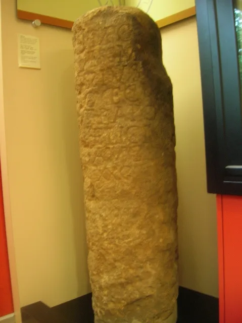
There are pre-historic settlement finds alongside both sides of the River Wharfe and it is believed the valley has been settled at this site since the Bronze Age. There are Bronze Age carvings on rocks situated on top of The Chevin: one such example is the Knotties Stone. West Yorkshire Geology Trust has reference to Otley Chevin and Caley Crags having a rich history of human settlement stretching back into Palaeolithic times. Flint tools, Bronze Age rock carvings and Iron Age earthworks have been found. In medieval times the forest park was used as common pasture land, as a source of wood and sandstones for buildings and walls.
Sourced from Wikipedia under CC BY-SA 4.0.
- Coordinates
- 53.9050, -1.6870
- District
- Leeds
- Parish
- Otley
- Postcode
- LS21 1SN
- Parliamentary constituency
- Leeds North West
- Official site
- war-experience.org
Sources
- wikipedia: Otley (CC BY-SA 4.0)
Other places nearby
Loading nearby places…
Nearby
 📷 5
📷 5Museums · Yorkshire & the Humber
Otley Museum
Otley Museum is in the town of Otley, near Leeds in West Yorkshire, England. Founded in 1961, it holds a collection of objects, artefacts and documentary material relating to the development of Otley
 📷 3
📷 3Museums · Yorkshire & the Humber
The Ron Kitching Library
The Ron Kitching Library — a museum in england-yorkshire, United Kingdom.
 📷 3
📷 3Museums · Yorkshire & the Humber
Second World War Experience Centre
Second World War Experience Centre — a museum in england-yorkshire, United Kingdom.
 📷 3
📷 3Memorials & monuments · Yorkshire & the Humber
Otley War Memorial
Otley War Memorial is a memorial in the United Kingdom.
 📷 3
📷 3Memorials & monuments · Yorkshire & the Humber
Otley War Memorial Cross and Memorial Garden
Otley War Memorial Cross and Memorial Garden — Grade II listed building-listed memorial in england-yorkshire, United Kingdom.
 📷 3
📷 3Theatres · Yorkshire & the Humber
Otley Courthouse
Otley Courthouse is a theatre in the United Kingdom.
More museums in this region
 📷 3
📷 3Museums · Yorkshire & the Humber
Aldborough Roman Town
Aldborough Roman Town — Heritage Museum in Yorkshire, England, UK.
 📷 3
📷 3Museums · Yorkshire & the Humber
Bayle Museum
Bayle Museum — Local museum in Bridlington, England.
Museums · Yorkshire & the Humber
BD1 Gallery
BD1 Gallery — closed gallery in Bradford, West Yorkshire.
 📷 5
📷 5Museums · Yorkshire & the Humber
Beck Isle Museum
Beck Isle Museum — museum in Pickering, North Yorkshire, England, United Kingdom.
Frequently asked questions
- Where is Otley?
- Otley is in Yorkshire & the Humber, in the United Kingdom — coordinates 53.9050°, -1.6870°.
- Is Otley wheelchair accessible?
- Partially — OpenStreetMap notes limited wheelchair access at Otley. Check ahead for specific facilities.