Museums · East Midlands
Ollerton
Ollerton — a museum in england-east-midlands, United Kingdom.

David Howard — CC BY-SA 2.0 via Wikimedia Commons licence
Plan your visit
- Typical visit
- 1.5 h–3 h
- Best time of year
- Year-round
- Family-friendly
- Limited wheelchair access
About
Ollerton is a museum in england-east-midlands, United Kingdom, listed in the Wikipedia register of British heritage and tourism sites. See the linked Wikipedia article for full details.
Photo gallery
Place summary
Ollerton is a museum located in the East Midlands. It showcases local history and culture, providing insights into the region's heritage. The museum features a range of exhibits and artefacts relevant to the community.
AI-generated from the structured facts on this page (operator, designation, listing, era). Not a substitute for visiting.
Background
History
The name Ollerton is derived from the Old English alortūn meaning 'alder settlement'. Ollerton is a settlement listed in Domesday Book, located in the Bassetlaw Wapentake or hundred in the county of Nottinghamshire at a crossing of the River Maun. In 1086 it had a recorded population of 15 households, and is listed in the Domesday Book under two owners. Formerly a rural village with a tradition of hop-growing centred on the parish church of St Giles, the settlement has its origins at a point where three main routes crossed. The A614 linking Nottingham north through Sherwood Forest to Blyth, Nottinghamshire and on to Doncaster; the A6075 linking Mansfield with the ferry crossing of the River…
Description
From the 1920s onwards the main industry was coal mining with Ollerton expanding greatly during the 1960s and 1970s, having the name New Ollerton. The colliery was sunk in the 1920s and completed during the General Strike of 1926, which led to a saying of "Ollerton was ever built with scab labour". The coal mine was established and funded by the Butterley Company, having an historic base of coal and iron ore mining in nearby Derbyshire; they created a model village in Ollerton for the colliery higher management and workers. A hosiery factory was established in 1937 to provide work for the miners' wives. During the expansion of the pit, many miners from closed collieries in north-eastern…
Sourced from Wikipedia under CC BY-SA 4.0.
- Coordinates
- 53.2000, -1.0200
- County
- Nottinghamshire
- District
- Newark and Sherwood
- Parish
- Ollerton and Boughton
- Postcode
- NG22 9BF
- Parliamentary constituency
- Sherwood Forest
Sources
- wikipedia: Ollerton (CC BY-SA 4.0)
Other places nearby
Loading nearby places…
Nearby
 📷 3
📷 3Manor houses · East Midlands
Ollerton Hall
Ollerton Hall — a manor in england-east-midlands, United Kingdom.
 📷 3
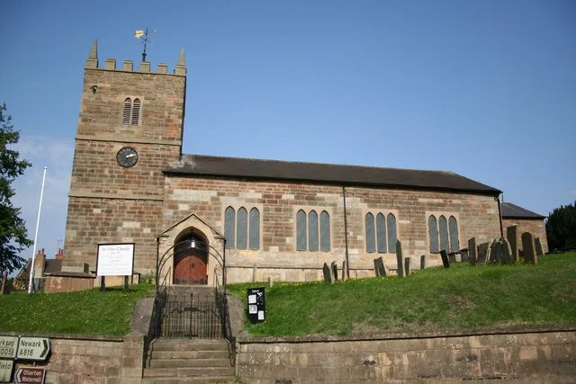
📷 3Historic churches · East Midlands
St Giles' Church, Ollerton
St Giles' Church, Ollerton — Grade II listed church in Ollerton, Nottinghamshire, England, UK.
 📷 3
📷 3Memorials & monuments · East Midlands
Ollerton War Memorial
Ollerton War Memorial — Grade II listed building-listed memorial in england-east-midlands, United Kingdom.
 📷 3
📷 3Watermills · East Midlands
Ollerton Watermill And Adjoining Mill House
Ollerton Watermill And Adjoining Mill House — Grade II listed building-listed watermill in england-east-midlands, United Kingdom.
 📷 3
📷 3Theatres · East Midlands
Ollerton Picture House
Ollerton Picture House in England East Midlands, United Kingdom.
 📷 4
📷 4Historic churches · East Midlands
St Paulinus' Church, New Ollerton
St Paulinus' Church, New Ollerton — Grade II listed building-listed church in england-east-midlands, United Kingdom.
More museums in this region
 📷 3
📷 3Museums · East Midlands
6 Former Filter Beds, Water Tank With Gazebo, And Steps At Swithland Reservoir Water Works
6 Former Filter Beds, Water Tank With Gazebo, And Steps At Swithland Reservoir Water Works — architectural ensemble in Quorndon, Charnwood, Leicestershire, England, UK.
 📷 3
📷 3Museums · East Midlands
Abbeydale Industrial Hamlet
Abbeydale Industrial Hamlet — hamlet and industrial museum in Sheffield, UK.
 📷 3
📷 3Museums · East Midlands
Alstonefield Geohut
Alstonefield Geohut — museum in Alstonefield, Staffordshire, England, UK.
 📷 3
📷 3Museums · East Midlands
Ashby de la Zouch Museum
Ashby de la Zouch Museum — local museum in Ashby de la Zouch, Leicestershire, United Kingdom.
Frequently asked questions
- Where is Ollerton?
- Ollerton is in East Midlands, in the United Kingdom — coordinates 53.2000°, -1.0200°.
- Is Ollerton wheelchair accessible?
- Partially — OpenStreetMap notes limited wheelchair access at Ollerton. Check ahead for specific facilities.