Historic houses · South East England
Olantigh
Olantigh — country house in Wye with Hinxhill, Kent, England, UK.

Wikimedia Commons contributors — see linked file page for photographer and licence licence
Plan your visit
- Typical visit
- 1 h–2 h
- Nearest railway station
- Wye · 1.9 km
- Family-friendly
- Limited wheelchair access
About
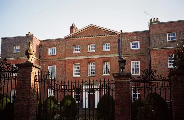
Olantigh is a historic house in the United Kingdom — typically a country seat, manor, or town house with notable architecture or history. Heritage designation: Grade II listed building. Owned by John Erle-Drax. Wikidata describes it as: "country house in Wye with Hinxhill, Kent, England, UK". Coordinates: 51.1985°, 0.9466°.
Photo gallery
Protected designations
- Site of Special Scientific Interest: Wye and Crundale Downs SSSI
- Area of Outstanding Natural Beauty: Kent Downs
Designations sourced from Natural England open data under OGL v3.
From the Wikipedia article
Olantigh is an English house 1 mile (1.6 km) north of Wye in the civil parish of Wye with Hinxhill, in Kent, England. The garden terraces and towered stable block were Grade II listed in 1989 and extend to 20 acres (8.1 ha), beside the Great Stour river. Garden features include a wide variety of trees with woodland walks; rockeries, shrubbery, herbaceous borders and extensive lawns. 51.19862°N 0.94674°E / 51.19862; 0.94674
Excerpt from Wikipedia under CC BY-SA 4.0. See the source article linked in Sources below.
Background
History
The igh in the latter part of the name Olantigh often refers to islands, possibly a reference to the original dwelling being in the vicinity of an isle set in the River Stour. During Julius Caesar's 54 BC invasion of England he established a camp on the River Stour near to the present Olantigh. His forces faced several sharp skirmishe with British forces attacking from their stronghold at Challock Wood.
Description
m to the south-east of the house. It runs north-west across the pleasure grounds to arrive at the forecourt below the north-east front. A second drive branches off Olantigh Road at a point m further to the south; this runs north to the stable block which stands immediately to the south-west of the house. ...Olantigh Towers is a country house built of red brick with ashlar dressings under a plain tiled and hipped roof. It has a two-storey main block, with a seven-bay front and two rear wings off the south-west front. The entrance on the north-east front is marked by a projecting central Ionic pediment, the doors being flanked by niches containing paired sculptures of children. ...Much of the…
Visiting
Author Russell Hoban may have repurposed Olantigh as "The Aulders" in his 1980, post apocalyptic novel Riddley Walker. Wye became "How"; Withersdane, "Widders Dump", and Ashford "Bernt Arse".
Sourced from Wikipedia under CC BY-SA 4.0.
- Coordinates
- 51.1985, 0.9466
- County
- Kent
- District
- Ashford
- Parish
- Wye with Hinxhill
- Postcode
- TN25 5EW
- Parliamentary constituency
- Ashford
- Nearest railway station
- Wye — 1.9 km
Sources
- wikidata: Q7083100 (CC0)
- wikipedia: Olantigh (CC BY-SA 4.0)
- commons: OlantighHouse Kent After1903Fire.jpg (CC BY-SA 4.0)
Other places nearby
Loading nearby places…
Nearby
 📷 5
📷 5Manor houses · South East England
Olantigh House
Olantigh House — a manor in england-south-east, United Kingdom.
 📷 5
📷 5Manor houses · South East England
Trimworth Manor
Trimworth Manor — Grade II listed building-listed manor in england-south-east, United Kingdom.
 📷 5
📷 5Natural landmarks · South East England
Wye School
Wye School — a school heritage in england-south-east, United Kingdom.
 📷 5
📷 5Forts · South East England
Obelisk About 20 Metres East Of Church Of Saint Gregory And Saint Martin
Obelisk About 20 Metres East Of Church Of Saint Gregory And Saint Martin — a martello broad in england-south-east, United Kingdom.
 📷 5
📷 5Historic churches · South East England
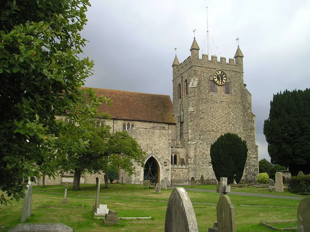
Church of Saint Gregory and Saint Martin, Wye, Kent
Church of Saint Gregory and Saint Martin, Wye, Kent — Grade I listed church in Wye, Kent, England, UK.
 📷 5
📷 5Ironworks & forges · South East England
Wye College
Wye College — college in Wye, Kent, England, UK.
More historic houses in this region
 Flagship📷 9
Historic houses · South East England
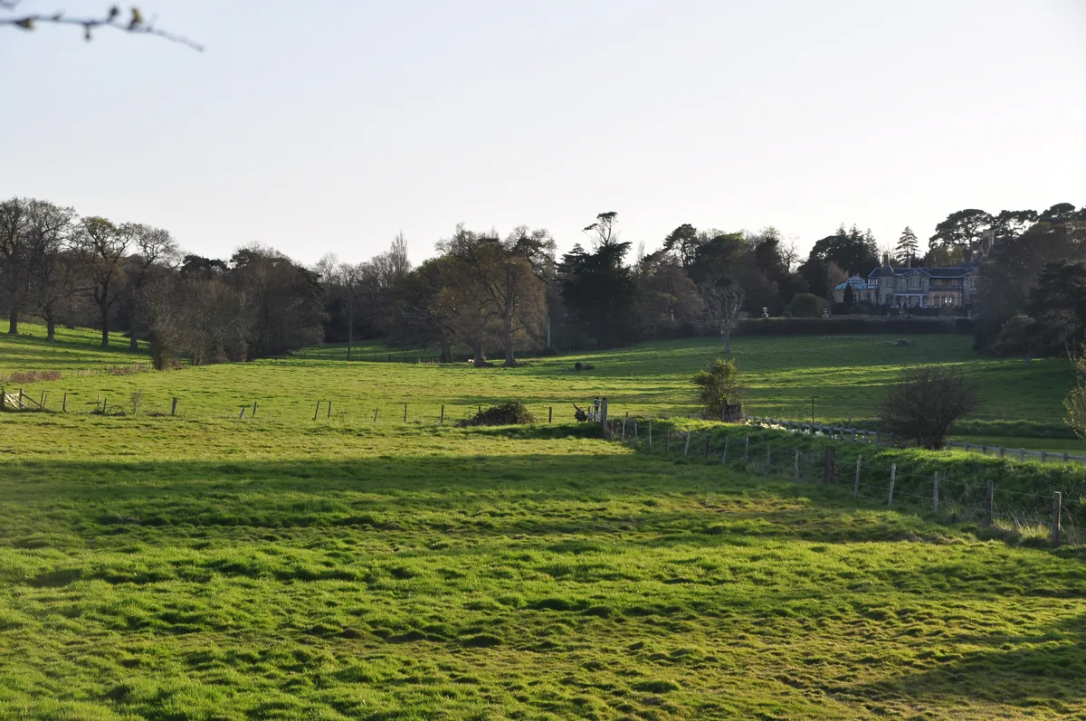
Old Arlesford House
Old Arlesford House — country house in Old Alresford, England.
 Flagship📷 10
Historic houses · South East England
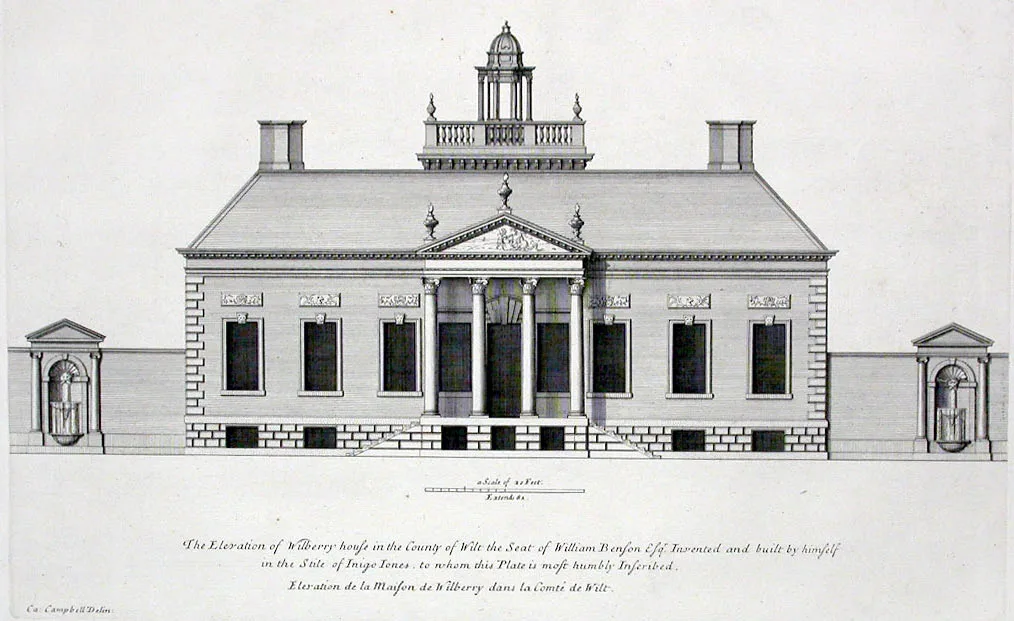
Wilbury House
Wilbury House — Grade I listed house in Newton Tony, Wiltshire, England, UK.
 📷 10
📷 10Historic houses · South East England
Woodlands Vale
Woodlands Vale — house in Seaview, Isle of Wight, England, UK.
 📷 5
📷 5Historic houses · South East England
1 South Parade
1 South Parade — Grade I listed house in Bath, Somerset, England, UK.
Frequently asked questions
- Where is Olantigh?
- Olantigh is in Kent, South-East England, United Kingdom (postcode TN25 5EW), in the parish of Wye with Hinxhill.
- Who owns Olantigh?
- Olantigh is owned by John Erle-Drax.
- Is Olantigh a listed building?
- Olantigh is officially recognised as Grade II listed building listed.
- Is Olantigh a protected site?
- Yes — Olantigh is part of the Wye and Crundale Downs SSSI Site of Special Scientific Interest and the Kent Downs National Landscape (AONB).
- How do I get to Olantigh?
- The nearest railway station is Wye, about 1.9 km away. Drivers can navigate to postcode TN25 5EW.