Viewpoints · London
Observation Point
Observation Point is a viewpoint in the United Kingdom.

John P Reeves — CC BY-SA 2.0 via Wikimedia Commons licence
Plan your visit
- Typical visit
- 20 min–45 min
- Best time of year
- Clear days year-round
- Nearest railway station
- Penshurst · 3.8 km
- Free entry
- Dog-friendly
About
Observation Point is a named viewpoint in Kent, London, marked on Ordnance Survey maps for its outlook. The site is within the Kent Downs National Landscape (AONB). It sits within the Sevenoaks parliamentary constituency. The nearest railway station is Penshurst, about 3.8 km away. Postcode area TN14.
Photo gallery
Protected designations
- Area of Outstanding Natural Beauty: Kent Downs
Designations sourced from Natural England open data under OGL v3.
From the Wikipedia article
Observation Point, also known as Flagstaff Lookout or Flagstaff Hill, and formerly as Flagstaff Point is a large bluff in central Port Chalmers, in New Zealand's South Island. The point, as its name suggests, offers panoramic views covering the town, its deep-water port, and across the Otago Harbour. A road, Aurora Terrace, ascends to near the top of the point, allowing for easy public access. In 1860 the crew of HMS Acheron used Observation Point to make the first detailed cartographical study of Otago Harbour in 1860. A plaque to this effect stands near the flagstaff. In 1864 a flagstaff which had formerly been the mizzen mast on the condemned barque "Cincinnati" was installed on top of the point. The "Cincinnati" had once been owned by the notorious Bully Hayes. In June 1910 it was necessary to replace the original flagstaff (which had rotted) with a new “ironbark” flagstaff. In 1970 the flagstaff was restored and moved to a new location 50-100 yards (45.7 to 91.4 metres) closer to Port Chalmers, but still on Observation Point. In June 1867 the Otago Provincial Council installed a time ball on the flagstaff. The service initially operated at 1 pm on all days of the week except Sundays. The service was discontinued in October 1877, but following concerns raised by 11 shipmasters the service resumed in April 1882 as a weekly service. In 1910 the time keeping service was discontinued but the ball however continued to be used until 1931 as a warning device. It was removed in 1970 but a replacement was restored to service in 2020. When the port's facilities were expanded in 1993, the area contained the former studio of noted artist Ralph Hotere, was removed despite strenuous objection from many of the town's residents. Subsequently, an area accessed from Aurora Terrace close to the removed portion are converted in 2005 by the Hotere Foundation Trust with the assistance of the Otago Harbour Board into the Hotere Garden Oputae containing featuring works by both Hotere…
Excerpt from Wikipedia under CC BY-SA 4.0. See the source article linked in Sources below.
- Coordinates
- 51.2239, 0.1389
- County
- Kent
- District
- Sevenoaks
- Parish
- Sundridge with Ide Hill
- Postcode
- TN14 6LD
- Parliamentary constituency
- Sevenoaks
- Nearest railway station
- Penshurst — 3.8 km
Sources
- osm: n3075075836 (ODbL)
- wikipedia: Observation Point (CC BY-SA 4.0)
Featured in this guide
Other places nearby
Loading nearby places…
Nearby
 📷 5
📷 5Viewpoints · London
Bird Watching
Bird Watching is a viewpoint in the United Kingdom.
 📷 5
📷 5Historic bridges · London
Bridge Over Moat To South Of Henden Manor House
Bridge Over Moat To South Of Henden Manor House — Grade II listed building-listed bridge in england-london, United Kingdom.
 📷 5
📷 5Parks · London
Stubbs Wood Country Park
Stubbs Wood Country Park — park in United Kingdom.
 📷 5
📷 5Towns & cities · London
Ide Hill
Ide Hill — village in Kent, England, UK.
 Flagship📷 5
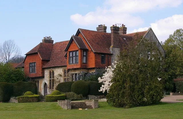
Stately homes · London
Wickhurst Manor
Wickhurst Manor — manor house in Sevenoaks Weald, Kent, England, UK.
 📷 5
📷 5Viewpoints · London
Octavia Hill Well (disused)
Octavia Hill Well (disused) is a viewpoint in the United Kingdom.
More viewpoints in this region
 📷 5
📷 5Viewpoints · London
09L Heathrow Viewpoint
09L Heathrow Viewpoint is a viewpoint in the United Kingdom.
 📷 5
📷 5Viewpoints · London
27L Runway Viewing Area, Myrtle Avenue
27L Runway Viewing Area, Myrtle Avenue is a viewpoint in the United Kingdom.
 📷 5
📷 5Viewpoints · London
Aussichtspunkt H&MV Office
Aussichtspunkt H&MV Office is a viewpoint in the United Kingdom.
 📷 5
📷 5Viewpoints · London
Battleston Hill
Battleston Hill is a viewpoint in the United Kingdom.
Frequently asked questions
- Where is Observation Point?
- Observation Point is in Kent, London, United Kingdom (postcode TN14 6LD), in the parish of Sundridge with Ide Hill.
- Is Observation Point a protected site?
- Yes — Observation Point is part of the Kent Downs National Landscape (AONB).
- Is Observation Point free to visit?
- Yes, Observation Point is free to enter.
- How do I get to Observation Point?
- The nearest railway station is Penshurst, about 3.8 km away. Drivers can navigate to postcode TN14 6LD.