Forests & woodlands · East of England
New Buckenham Common - Open Access Land
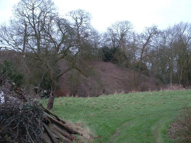
New Buckenham Common - Open Access Land is a forest or woodland in the United Kingdom.

Wikimedia Commons licence
Plan your visit
- Typical visit
- 1 h–3 h
- Nearest railway station
- Attleborough · 5.9 km
- Free entry
- Family-friendly
- Dog-friendly
About
New Buckenham Common - Open Access Land is a named forest, woodland or nature reserve in the United Kingdom. Coordinates: 52.4750°, 1.0796°.
Photo gallery
Protected designations
- Site of Special Scientific Interest: New Buckenham Common SSSI
Designations sourced from Natural England open data under OGL v3.
From the Wikipedia article
New Buckenham Common is a common of which 20.9 hectares (52 acres) is a biological Site of Special Scientific Interest, located in New Buckenham, Norfolk, England. It is managed by the Norfolk Wildlife Trust. The Common is about 100 acres and is divided roughly in half by 'The Turnpike' B1113 road to Norwich. A stream also crosses the Common. It is said to have remained largely unchanged for 800 years, and was the subject of a dispute when in 1597 the neighboring parish of Carleton Rode claimed part of the common which led to a map which records the settlement. The land belongs to and is managed by the Norfolk Wildlife Trust. Much of the north side is a Site of Special Scientific Interest (SSSI) with rare plants including green-winged orchids. There are also clay pits where marl has been historically dug for building. The Common is also an ancient grazing pasture grazed annually by cattle due to the continued tradition of about 79 Common Rights that are actively managed by their owners and pooled for letting to the grazier to continue the tradition. The Common Rights entitle their owners to graze 'a horse, mare or neat beast' (an animal of cloven hoof such as cattle). Historically there was great demand for the annual letting of the Common Rights, which were auctioned for the year's grazing, each Spring, because the grazing of cattle was popular amongst local farmers or householders who might own a beast as a group. Cattle became an important aspect of the region's farming economy after the decline of the wool and sheep trade in the 18th century. Originally the Rights were allocated amongst local houses, in 1770, and are therefore held as whole rights or 14th fractions of rights. By the mid 1960s the demand had fallen; the rightholders formed a group and have continued to let the rights privately to a grazier direct. Some of the rights on the common were lost as they were not registered when required under the Commons Registration Act in the mid 1960s. Another…
Excerpt from Wikipedia under CC BY-SA 4.0. See the source article linked in Sources below.
- Coordinates
- 52.4750, 1.0796
- County
- Norfolk
- District
- Breckland
- Parish
- New Buckenham
- Postcode
- NR16 2BG
- Parliamentary constituency
- Mid Norfolk
- Nearest railway station
- Attleborough — 5.9 km
- Official site
- www.norfolkwildlifetrust.org.uk
Sources
- osm: w198798698 (ODbL)
- wikipedia: New Buckenham Common (CC BY-SA 4.0)
Featured in this guide
Other places nearby
Loading nearby places…
Nearby
 📷 3
📷 3Public art & sculpture · East of England
New Buckenham Village Sign
New Buckenham Village Sign — a public art in england-east, United Kingdom.
 📷 3
📷 3Castles · East of England
Buckenham Castle
Buckenham Castle — Grade I listed castle in Norfolk, England.
Campsites · East of England
Old Buckenham Country Park
Old Buckenham Country Park — a campsite in england east.
 📷 3
📷 3Memorials & monuments · East of England
Old Buckenham War Memorial
Old Buckenham War Memorial — Grade II listed building-listed memorial in england-east, United Kingdom.
 📷 3
📷 3Public art & sculpture · East of England
Old Buckenham Village Sign
Old Buckenham Village Sign — a public art in england-east, United Kingdom.
 📷 4
📷 4Abbeys & priories · East of England
Old Buckenham Priory
Old Buckenham Priory — a Grade II*-listed abbey in england-east, United Kingdom.
More forests in this region
 📷 3
📷 3Forests & woodlands · East of England
Betty's Fen
Betty's Fen is a forest or woodland in the United Kingdom.
 📷 3
📷 3Forests & woodlands · East of England
Bowthorpe Marsh
Bowthorpe Marsh is a forest or woodland in the United Kingdom.
 📷 4
📷 4Forests & woodlands · East of England
Bradfield Woods National Nature Reserve
Bradfield Woods National Nature Reserve is a forest or woodland in the United Kingdom.
 📷 5
📷 5Forests & woodlands · East of England
Captain's Wood Nature Reserve
Captain's Wood Nature Reserve is a forest or woodland in the United Kingdom.
Frequently asked questions
- Where is New Buckenham Common - Open Access Land?
- New Buckenham Common - Open Access Land is in Norfolk, East of England, United Kingdom (postcode NR16 2BG), in the parish of New Buckenham.
- Is New Buckenham Common - Open Access Land a protected site?
- Yes — New Buckenham Common - Open Access Land is part of the New Buckenham Common SSSI Site of Special Scientific Interest.
- Is New Buckenham Common - Open Access Land free to visit?
- Yes, New Buckenham Common - Open Access Land is free to enter.
- How do I get to New Buckenham Common - Open Access Land?
- The nearest railway station is Attleborough, about 5.9 km away. Drivers can navigate to postcode NR16 2BG.