Forts · Northern Ireland
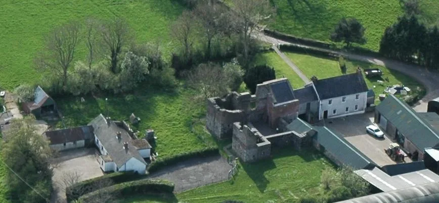
Mountjoy Castle
Mountjoy Castle is a fort in the United Kingdom.

Kenneth Allen — CC BY-SA 2.0 via Wikimedia Commons licence
Plan your visit
- Typical visit
- 45 min–1.5 h
- Nearest railway station
- Peatlands Park Railway · 8.1 km
About
Mountjoy Castle is a historic fort or fortified site in the United Kingdom. Coordinates: 54.5584°, -6.6075°. This entry is part of The Great Britain Guide, a free, ad-free, open-data tourist directory.
Photo gallery
Place summary
Mountjoy Castle is a fort located in Northern Ireland, postcode BT71. Its historical significance is tied to its military architecture, reflecting the region's turbulent past.
AI-generated from the structured facts on this page (operator, designation, listing, era). Not a substitute for visiting.
- Coordinates
- 54.5584, -6.6075
- District
- Mid Ulster
- Postcode
- BT71 5DY
- Parliamentary constituency
- Mid Ulster
- Nearest railway station
- Peatlands Park Railway — 8.1 km
Sources
- osm: w1420439586 (ODbL)
Other places nearby
Loading nearby places…
Nearby
 📷 3
📷 3Castles · Northern Ireland
Mountjoy Castle
Mountjoy Castle is a castle in the United Kingdom.
 📷 5
📷 5Natural landmarks · Northern Ireland
Brockagh
Brockagh in Northern Ireland, United Kingdom.
 📷 3
📷 3Natural landmarks · Northern Ireland
Ballygittle
Ballygittle in Northern Ireland, United Kingdom.
 📷 3
📷 3Natural landmarks · Northern Ireland
Derrylaughan Kevin Barrys GAC
Derrylaughan Kevin Barrys GAC in Northern Ireland, United Kingdom.
📷 3Natural landmarks · Northern Ireland
Washing Bay
Washing Bay in Northern Ireland, United Kingdom.
 📷 3
📷 3Burial mounds & barrows · Northern Ireland
Drumcairne House
Drumcairne House — a burial mound in northern-ireland, United Kingdom.
More forts in this region
 📷 3
📷 3Forts · Northern Ireland
Battle of Antrim 1798
Battle of Antrim 1798 is a fort in the United Kingdom.
.jpg?width=1200) 📷 3
📷 3Forts · Northern Ireland
Battle of Benburb 1646
Battle of Benburb 1646 is a fort in the United Kingdom.
 📷 5
📷 5Forts · Northern Ireland
Battle of Connor 1315
Battle of Connor 1315 is a fort in the United Kingdom.
 📷 3
📷 3Forts · Northern Ireland
Battle of Knockavoe Battlefield
Battle of Knockavoe Battlefield is a fort in the United Kingdom.
Frequently asked questions
- Where is Mountjoy Castle?
- Mountjoy Castle is in Northern Ireland, in the United Kingdom — coordinates 54.5584°, -6.6075°. The nearest railway station is Peatlands Park Railway, around 8.1 km away.