Towns & cities · West Midlands
Moulsoe
Moulsoe — village and civil parish in Buckinghamshire, UK.

Wikimedia Commons contributors — see linked file page for photographer and licence licence
Plan your visit
- Typical visit
- 3 h–6 h
- Nearest railway station
- Woburn Sands · 5.8 km
- Free entry
- Family-friendly
- Dog-friendly
About
Moulsoe is a town, city, village or settlement in the United Kingdom. Recent population estimates put it at around 291 people. Address: MK16. Wikidata describes it as: "village and civil parish in Buckinghamshire, UK". Coordinates: 52.0687°, -0.6733°.
Photo gallery
From the Wikipedia article
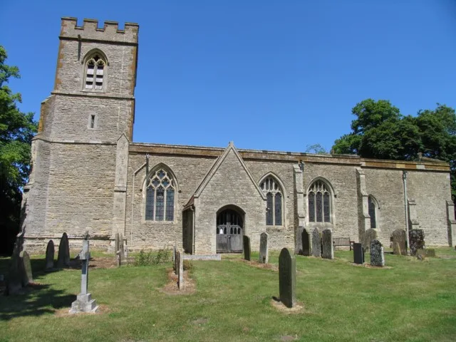
Moulsoe is a village and civil parish in the unitary authority area of the City of Milton Keynes, Buckinghamshire, England. It is on the border with Bedfordshire, and just east of the M1, situated about 2.5 miles (4.0 km) ESE of Newport Pagnell, and about 5 miles (8.0 km) NNE of Central Milton Keynes. The main road through the village is the Newport Road coming from the west, changing to the Cranfield Road going east at a bend by the church. The village name is an Old English language word which means 'Mul's hill spur'. In the Domesday Book of 1086 the village was recorded as Moleshou. There are several old thatched dwellings. Other buildings are of brick apart from some concrete council houses to the west. The parish church dates from the 14th century and is a Grade I listed building. There is an inn, the Carrington Arms, and a village hall, the Millennium Hall.
Excerpt from Wikipedia under CC BY-SA 4.0. See the source article linked in Sources below.
- Coordinates
- 52.0687, -0.6733
- District
- Milton Keynes
- Parish
- Moulsoe
- Postcode
- MK16
- Parliamentary constituency
- Milton Keynes North
- Population
- 291
- Nearest railway station
- Woburn Sands — 5.8 km
Sources
- wikidata: Q1790375 (CC0)
- wikipedia: Moulsoe (CC BY-SA 4.0)
- commons: St Marys Church Moulsoe.jpg (CC BY-SA 4.0)
Other places nearby
Loading nearby places…
Nearby
 📷 3
📷 3Historic churches · West Midlands
St Lawrence's Church, Broughton
St Lawrence's Church, Broughton — Grade I listed church in Broughton, Milton Keynes, Buckinghamshire, England, UK.
Caravan parks · West Midlands
Lovat Meadow Caravan Park
Lovat Meadow Caravan Park — a caravan park in england west midlands.
 📷 3
📷 3Trampoline parks · West Midlands
Top Jump
Top Jump — a trampoline park in england-west-midlands, United Kingdom.
 📷 3
📷 3Towns & cities · West Midlands
North Crawley
North Crawley — village and civil parish in Buckinghamshire, UK.
 📷 5
📷 5Natural landmarks · West Midlands
Cranfield University
Cranfield University — a university in england-west-midlands, United Kingdom.
 📷 3
📷 3Memorials & monuments · West Midlands
North Crawley War Memorial
North Crawley War Memorial — Grade II listed building-listed memorial in england-west-midlands, United Kingdom.
More towns in this region
 Flagship📷 3
Towns & cities · West Midlands
Adderbury
Adderbury — village and civil parish in Cherwell district, Oxfordshire, England.
 Flagship📷 3
Towns & cities · West Midlands
Admington
Admington — village in Warwickshire, England, UK.
 Flagship📷 3
Towns & cities · West Midlands
Aldington
Aldington — village in Worcestershire, United Kingdom.
 Flagship📷 5
Towns & cities · West Midlands
Anstey
Anstey — large village in Leicestershire, England.
Frequently asked questions
- Where is Moulsoe?
- Moulsoe is in the West Midlands, United Kingdom (postcode MK16), in the parish of Moulsoe.
- Is Moulsoe free to visit?
- Yes, Moulsoe is free to enter.
- How do I get to Moulsoe?
- The nearest railway station is Woburn Sands, about 5.8 km away. Drivers can navigate to postcode MK16.