Forests & woodlands · Scottish Highlands
Montrose Basin Local Nature Reserve
Also known as: Montrose Basin;Montrose Basin LNR
Montrose Basin Local Nature Reserve is a forest or woodland in the United Kingdom.

Wikimedia Commons contributors — see linked file page for photographer and licence licence
Plan your visit
- Typical visit
- 1 h–3 h
- Nearest railway station
- Bridge of Dun · 2.4 km
- Free entry
- Family-friendly
- Dog-friendly
About
Montrose Basin Local Nature Reserve is a named forest, woodland or nature reserve in the United Kingdom. Also known as: Montrose Basin;Montrose Basin LNR. Coordinates: 56.7128°, -2.5126°.
Photo gallery
From the Wikipedia article
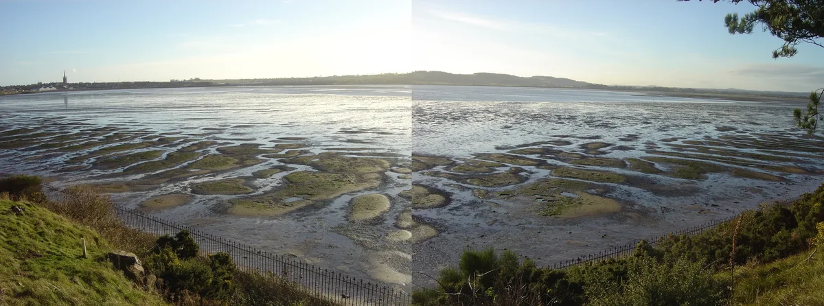
Montrose Basin is a nearly circular tidal basin which makes up part of the estuary of the River South Esk and which sits just inland of the town of Montrose in Angus on the east coast of Scotland. The basin is protected by a number of designations; it is managed by the Scottish Wildlife Trust as a Wildlife Reserve, as well as being designated as a Local Nature Reserve, Site of Special Scientific Interest, a Special Protection Area and a Ramsar Site.
Excerpt from Wikipedia under CC BY-SA 4.0. See the source article linked in Sources below.
Background
History
The Montrose Basin Heritage Society was formed in 1999 to bring together information about the basin, including its history and archaeology. The oldest evidence for humans in the area dating back as far as over 3,000 BCE, this being the linear monument, known as the cursus, which runs from Powis to Old Montrose. The Basin has been exploited for its seafood, especially the Atlantic salmon but commercial fisheries for this species ended in 2018; and mussel cultivation gave it the largest mussel beds in the country during the 19th and early 20th centuries. The Montrose Basin was hit by a tsunami in 6,100 BCE, generated by the massive underwater Storegga Slide, in Norway. It was 70 ft high when…
Sourced from Wikipedia under CC BY-SA 4.0.
- Coordinates
- 56.7128, -2.5126
- District
- Angus
- Postcode
- DD10 9LN
- Parliamentary constituency
- Angus and Perthshire Glens
- Nearest railway station
- Bridge of Dun — 2.4 km
- Official site
- www.montrosebasin.org.uk
Sources
- osm: w210823613 (ODbL)
- wikipedia: Montrose Basin (CC BY-SA 4.0)
- commons: Montrose Basin.jpg (CC BY-SA 4.0)
Other places nearby
Loading nearby places…
Nearby
Archaeological sites · Scottish Highlands
Dronner's Dyke (remains)
Dronner's Dyke (remains) — a archaeological in scotland-highlands, United Kingdom.
 📷 3
📷 3Wildlife reserves · Scottish Highlands
Montrose Basin
Montrose Basin — river estuary and nature reserve in Angus, Scotland, UK.
 📷 5
📷 5Historic bridges · Scottish Highlands
Haugh Bridge, Old Montrose
Haugh Bridge, Old Montrose — category C listed building-listed bridge in scotland-highlands, United Kingdom.
 📷 5
📷 5Historic bridges · Scottish Highlands
Bridge, Gilrivie
Bridge, Gilrivie — category C listed building-listed bridge in scotland-highlands, United Kingdom.
 📷 3
📷 3Manor houses · Scottish Highlands
Old Montrose House
Old Montrose House — a manor in scotland-highlands, United Kingdom.
 📷 5
📷 5Historic bridges · Scottish Highlands
Bridge, Pugeston
Bridge, Pugeston — category C listed building-listed bridge in scotland-highlands, United Kingdom.
More forests in this region
 📷 3
📷 3Forests & woodlands · Scottish Highlands
Abernethy National Nature Reserve
Abernethy National Nature Reserve is a forest or woodland in the United Kingdom.
 📷 5
📷 5Forests & woodlands · Scottish Highlands
Ariundle Oakwood National Nature Reserve
Ariundle Oakwood National Nature Reserve is a forest or woodland in the United Kingdom.
 📷 3
📷 3Forests & woodlands · Scottish Highlands
Balnaguard Glen Nature Reserve
Balnaguard Glen Nature Reserve is a forest or woodland in the United Kingdom.
 📷 5
📷 5Forests & woodlands · Scottish Highlands
Ben Wyvis National Nature Reserve
Ben Wyvis National Nature Reserve is a forest or woodland in the United Kingdom.
Frequently asked questions
- Where is Montrose Basin Local Nature Reserve?
- Montrose Basin Local Nature Reserve is in the Scottish Highlands, United Kingdom (postcode DD10 9LN).
- Is Montrose Basin Local Nature Reserve free to visit?
- Yes, Montrose Basin Local Nature Reserve is free to enter.
- How do I get to Montrose Basin Local Nature Reserve?
- The nearest railway station is Bridge of Dun, about 2.4 km away. Drivers can navigate to postcode DD10 9LN.