Natural landmarks · North Wales
Moel Ysgyfarnogod
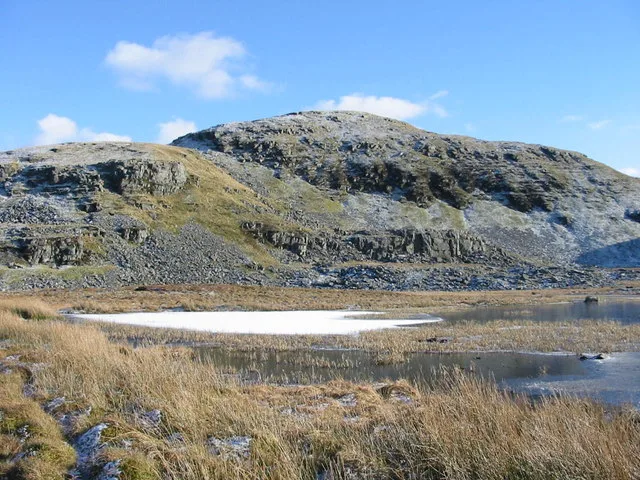
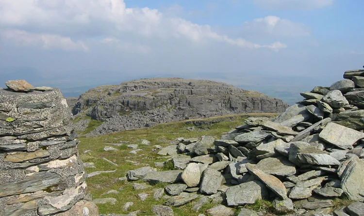
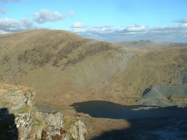
Moel Ysgyfarnogod — mountain (623m) in Gwynedd.

Wikimedia Commons contributors — see linked file page for photographer and licence licence
Plan your visit
- Typical visit
- 1 h–2 h
- Nearest railway station
- Talsarnau · 5.1 km
- Free entry
- Dog-friendly
About
Moel Ysgyfarnogod is a named natural landmark in the United Kingdom. Wikidata describes it as: "mountain (623m) in Gwynedd". Coordinates: 52.8912°, -3.9962°.
Photo gallery
From the Wikipedia article
Moel Ysgyfarnogod (Welsh for 'Bare hill of the hares') is a mountain in Snowdonia, North Wales and is the northernmost of the Rhinogydd. Rhinog Fawr lies directly south. It overlooks Llyn Trawsfynydd, and from the summit it is possible to see the towns of Porthmadog and Blaenau Ffestiniog. It may be climbed from Trawsfynydd in the east, or from Talsarnau in the west. To the north-west of the summit, on an area of moorland and rocky outcrops, lies Bryn Cader Faner, an ancient stone circle. It is one of the finest examples of a Bronze Age cairn in Britain, and has rocky standing stones along its circumference.
Excerpt from Wikipedia under CC BY-SA 4.0. See the source article linked in Sources below.
- Coordinates
- 52.8912, -3.9962
- District
- Gwynedd
- Parish
- Talsarnau
- Postcode
- LL47 6YU
- Parliamentary constituency
- Dwyfor Meirionnydd
- Nearest railway station
- Talsarnau — 5.1 km
Sources
- wikidata: Q6890125 (CC0)
- wikipedia: Moel Ysgyfarnogod (CC BY-SA 4.0)
- commons: Llyn Dywarchen - geograph.org.uk - 331792.jpg (CC BY-SA 4.0)
Other places nearby
Loading nearby places…
Nearby
 📷 3
📷 3Mountains & hills · North Wales
Moel Ysgyfarnogod
Moel Ysgyfarnogod — Named summit at 623 m.
 📷 3
📷 3Mountains & hills · North Wales
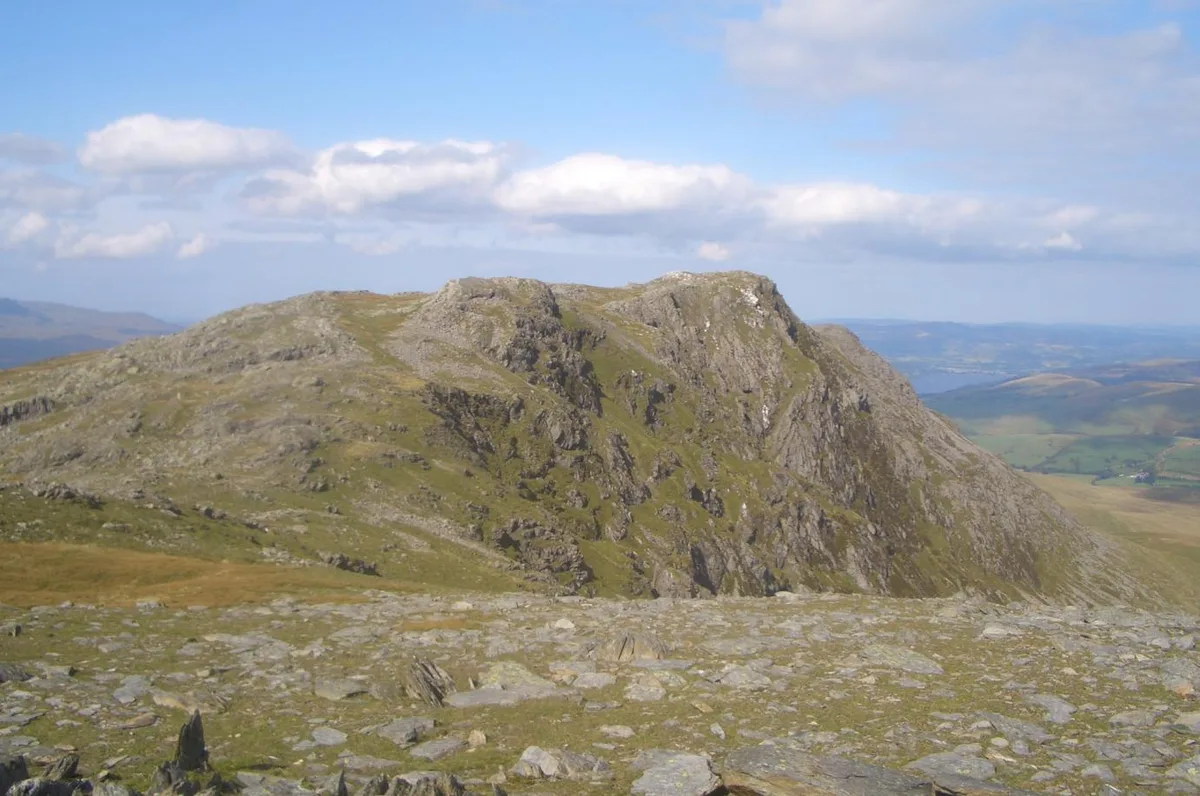
Moel Ysgyfarnogod South Top
Moel Ysgyfarnogod South Top — a mountain in wales-north, United Kingdom, 578 m.
📷 3Archaeological sites · North Wales
Llyn Ddu Bach Manganese Mine (disused)
Llyn Ddu Bach Manganese Mine (disused) — a archaeological in wales-north, United Kingdom.
 📷 3
📷 3Natural landmarks · North Wales
Foel Penolau
Foel Penolau — mountain (614.4m) in Gwynedd.
 📷 3
📷 3Mountains & hills · North Wales
Foel Penolau
Foel Penolau — Named summit at 614 m.
 📷 3
📷 3Archaeological sites · North Wales
Llyn Dywarchen Manganese Mine (disused)
Llyn Dywarchen Manganese Mine (disused) — a archaeological in wales-north, United Kingdom.
More natural landmarks in this region
 Flagship📷 5
Natural landmarks · North Wales
Llyn Llydaw
Llyn Llydaw is a natural landmark in the United Kingdom.
 📷 5
📷 5Natural landmarks · North Wales
Llyn Tegid
Llyn Tegid is a natural landmark in the United Kingdom.
 📷 3
📷 3Natural landmarks · North Wales
Allt-fawr
Allt-fawr — mountain (698m) in Gwynedd, Wales.
 📷 3
📷 3Natural landmarks · North Wales
Aran Benllyn
Aran Benllyn — mountain (885m) in Gwynedd.
Frequently asked questions
- Where is Moel Ysgyfarnogod?
- Moel Ysgyfarnogod is in North Wales, United Kingdom (postcode LL47 6YU), in the parish of Talsarnau.
- Is Moel Ysgyfarnogod free to visit?
- Yes, Moel Ysgyfarnogod is free to enter.
- How do I get to Moel Ysgyfarnogod?
- The nearest railway station is Talsarnau, about 5.1 km away. Drivers can navigate to postcode LL47 6YU.