Natural landmarks · North Wales
Moel-yr-hydd
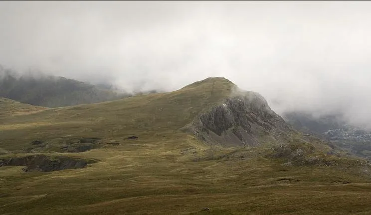
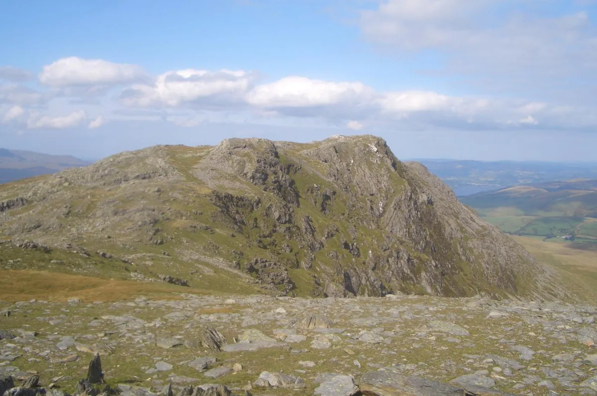
Moel-yr-hydd — mountain (648m) in Gwynedd.

Wikimedia Commons contributors — see linked file page for photographer and licence licence
Plan your visit
- Typical visit
- 1 h–2 h
- Nearest railway station
- Tanygrisiau · 1.2 km
- Free entry
- Dog-friendly
About
Moel-yr-hydd is a named natural landmark in the United Kingdom. Wikidata describes it as: "mountain (648m) in Gwynedd". Coordinates: 52.9894°, -3.9798°.
Photo gallery
From the Wikipedia article
Moel-yr-hydd is a subsidiary summit of Moelwyn Mawr in Snowdonia, North Wales and forms part of the Moelwynion. (Strictly the mountain is not actually in the Snowdonia National Park as it falls within the exclusion "hole" around the former slate town of Blaenau Ffestiniog.) The mountain overlooks the village of Tanygrisiau and Tanygrisiau railway station (a halt on the Ffestiniog Railway) from where the mountain can easily be ascended. From the 1830s until 1946, Wrysgan Quarry was worked on the north east flank of the mountain. Substantial underground chambers were driven beneath the summit.
Excerpt from Wikipedia under CC BY-SA 4.0. See the source article linked in Sources below.
- Coordinates
- 52.9894, -3.9798
- District
- Gwynedd
- Parish
- Ffestiniog
- Postcode
- LL41 3ST
- Parliamentary constituency
- Dwyfor Meirionnydd
- Nearest railway station
- Tanygrisiau — 1.2 km
Sources
- wikidata: Q6890080 (CC0)
- wikipedia: Moel-yr-hydd (CC BY-SA 4.0)
- commons: Hydd.jpg (CC BY-SA 4.0)
Other places nearby
Loading nearby places…
Nearby
 📷 3
📷 3Mountains & hills · North Wales
Moel-yr-hydd
Moel-yr-hydd — Named summit at 648 m.
 📷 3
📷 3Historic houses · North Wales
Level 2 Mill (ruins)
Level 2 Mill (ruins) — a historic house in wales-north, United Kingdom.
 📷 3
📷 3Mountains & hills · North Wales
Craig Stwlan
Craig Stwlan — a mountain in wales-north, United Kingdom, 568 m.
 📷 3
📷 3Historic houses · North Wales
Quarry Incline
Quarry Incline — a historic house in wales-north, United Kingdom.
 📷 3
📷 3Archaeological sites · North Wales
Rhosydd Barracks
Rhosydd Barracks — a archaeological in wales-north, United Kingdom.
 📷 3
📷 3Historic houses · North Wales
Wheel Pit
Wheel Pit — a historic house in wales-north, United Kingdom.
More natural landmarks in this region
 Flagship📷 5
Natural landmarks · North Wales
Llyn Llydaw
Llyn Llydaw is a natural landmark in the United Kingdom.
 📷 5
📷 5Natural landmarks · North Wales
Llyn Tegid
Llyn Tegid is a natural landmark in the United Kingdom.
 📷 3
📷 3Natural landmarks · North Wales
Allt-fawr
Allt-fawr — mountain (698m) in Gwynedd, Wales.
 📷 3
📷 3Natural landmarks · North Wales
Aran Benllyn
Aran Benllyn — mountain (885m) in Gwynedd.
Frequently asked questions
- Where is Moel-yr-hydd?
- Moel-yr-hydd is in North Wales, United Kingdom (postcode LL41 3ST), in the parish of Ffestiniog.
- Is Moel-yr-hydd free to visit?
- Yes, Moel-yr-hydd is free to enter.
- How do I get to Moel-yr-hydd?
- The nearest railway station is Tanygrisiau, about 1.2 km away. Drivers can navigate to postcode LL41 3ST.