Natural landmarks · North Wales
Moel Fferna
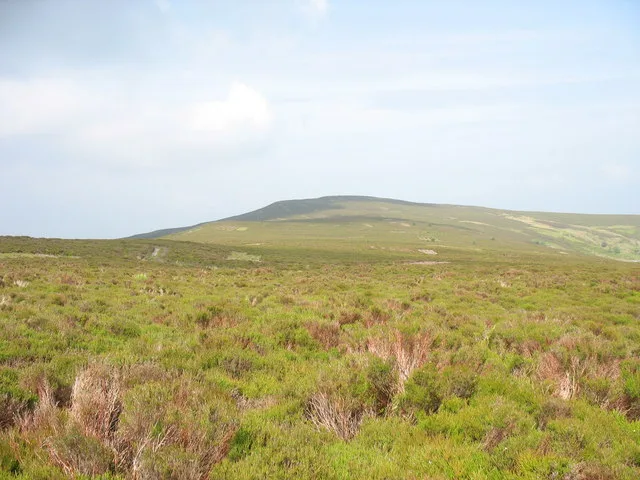
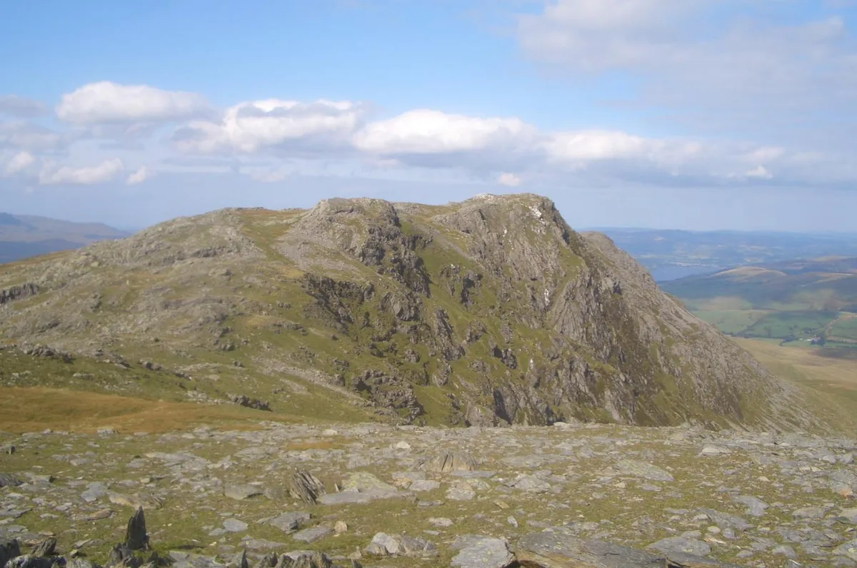
Moel Fferna — mountain (630m) in Denbighshire.

Wikimedia Commons contributors — see linked file page for photographer and licence licence
Plan your visit
- Typical visit
- 1 h–2 h
- Nearest railway station
- Carrog · 3.7 km
- Free entry
- Dog-friendly
About
Moel Fferna is a named natural landmark in the United Kingdom. Part of Berwyn range. Wikidata describes it as: "mountain (630m) in Denbighshire". Coordinates: 52.9483°, -3.3159°.
Photo gallery
From the Wikipedia article
Moel Fferna is a mountain in Denbighshire, Wales and forms part of the Berwyn range. It is the most northern outpost of the range. The summit is covered in deep heather and has a shelter cairn. A trig point was used to mark the summit, but has since been destroyed. To the south is Pen Bwlch Llandrillo, followed by Cadair Bronwen. It is the highest peak in the Clwydian Range and Dee Valley Area of Outstanding Natural Beauty.
Excerpt from Wikipedia under CC BY-SA 4.0. See the source article linked in Sources below.
- Coordinates
- 52.9483, -3.3159
- Address
- Denbighshire / Wrexham, Wales
- Nearest railway station
- Carrog — 3.7 km
Sources
- wikidata: Q6890094 (CC0)
- wikipedia: Moel Fferna (CC BY-SA 4.0)
- commons: View across the upland heath towards Moel Fferna - geograph.org.uk - 481463.jpg (CC BY-SA 4.0)
Other places nearby
Loading nearby places…
Nearby
 📷 3
📷 3Mountains & hills · North Wales
Moel Fferna
Moel Fferna — Named summit at 630 m.
 📷 3
📷 3Mountains & hills · North Wales
Cerrig Coediog
Cerrig Coediog — a mountain in wales-north, United Kingdom, 561 m.
 📷 3
📷 3Quarries · North Wales
Deeside and Moelfferna quarries
Deeside and Moelfferna quarries — former quarries in Wales.
 📷 3
📷 3Archaeological sites · North Wales
Penarth Slate Mine
Penarth Slate Mine — a archaeological in wales-north, United Kingdom.
 📷 2
📷 2Mountains & hills · North Wales
Cefn Perfedd [Pen y Lladron]
Cefn Perfedd [Pen y Lladron] — a mountain in wales-north, United Kingdom, 601 m.
 📷 3
📷 3Mountains & hills · North Wales
Pen Tan-y-graig
Pen Tan-y-graig — a mountain in wales-north, United Kingdom, 476 m.
More natural landmarks in this region
 Flagship📷 5
Natural landmarks · North Wales
Llyn Llydaw
Llyn Llydaw is a natural landmark in the United Kingdom.
 📷 5
📷 5Natural landmarks · North Wales
Llyn Tegid
Llyn Tegid is a natural landmark in the United Kingdom.
 📷 3
📷 3Natural landmarks · North Wales
Allt-fawr
Allt-fawr — mountain (698m) in Gwynedd, Wales.
 📷 3
📷 3Natural landmarks · North Wales
Aran Benllyn
Aran Benllyn — mountain (885m) in Gwynedd.
Frequently asked questions
- Where is Moel Fferna?
- Moel Fferna is in North Wales, United Kingdom.
- Is Moel Fferna free to visit?
- Yes, Moel Fferna is free to enter.
- How do I get to Moel Fferna?
- The nearest railway station is Carrog, about 3.7 km away.