Other places · North East England
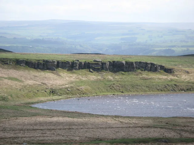
Milecastle 36
Milecastle 36 in England North East, United Kingdom.

Rudi Winter — CC BY-SA 2.0 via Wikimedia Commons licence
Plan your visit
- Typical visit
- 1 h–2 h
About
Milecastle 36 is a place of interest in England North East, United Kingdom — drawn from open-data sources for visitor reference. See the linked Wikipedia article for the full description.
Photo gallery
From the Wikipedia article
Milecastle 36 (King's Hill) was one of the milecastles on Hadrian's Wall (grid reference NY79726931). There is little to see on the ground as most of the walls have been robbed and quarried away.
Excerpt from Wikipedia under CC BY-SA 4.0. See the source article linked in Sources below.
Background
Description
The site of Milecastle 36 is located on King's Hill, 800 metres northeast of Housesteads Roman Fort. The milecastle was robbed of most of its remaining stone in 1831. Part of the east and west walls are indicated by robber-trenches. The remainder of the milecastle has been destroyed by surface quarrying, and the featureless interior is overlain by Wall tumble.
Visiting
The milecastle, and site of Turret 36A, are both accessible via the Hadrian's Wall Path. The excavated foundations of Turret 36B are within Housesteads Fort, and are only accessible by visitors to this English Heritage site.
Sourced from Wikipedia under CC BY-SA 4.0.
- Coordinates
- 55.0180, -2.3186
- District
- Northumberland
- Parish
- Haydon
- Postcode
- NE47 6NL
- Parliamentary constituency
- Hexham
Sources
- wikidata: Q16158064 (CC0)
- wikipedia: Milecastle 36 (CC BY-SA 4.0)
Other places nearby
Loading nearby places…
Nearby
 📷 4
📷 4Other places · North East England
Knag Burn Gateway
Knag Burn Gateway in England North East, United Kingdom.
 📷 3
📷 3Natural landmarks · Scottish Lowlands
Broomlee Lough
Broomlee Lough — lake in the United Kingdom.
 📷 3
📷 3Historic houses · Scottish Lowlands
Angle Tower
Angle Tower — a historic house in scotland-lowlands, United Kingdom.
 📷 3
📷 3Archaeological sites · Scottish Lowlands
Turret 35A (Sewingshields)
Turret 35A (Sewingshields) — a archaeological in scotland-lowlands, United Kingdom.
 📷 3
📷 3Forts · Scottish Lowlands
Vercovicium
Vercovicium is a fort in the United Kingdom.
 📷 3
📷 3Archaeological sites · Scottish Lowlands
Housesteads Roman Fort
Housesteads Roman Fort — a archaeological in scotland-lowlands, United Kingdom.
More places in this region
.jpg?width=1200) 📷 3
📷 3Other places · North East England
Stockton Flyer
Stockton Flyer — Public artwork (installation).
 📷 3
📷 3Other places · North East England
Temenos
Temenos — Public artwork (sculpture) by Anish Kapoor.
 📷 5
📷 5Other places · North East England
Appleby Horse Fair
The Appleby Horse Fair, previously known as Appleby New Fair, is an annual gathering of Romani people (Gypsies) and Travellers in Appleby-in-Westmorland in Cumbria, England. The horse fair is held eac
 📷 5
📷 5Other places · North East England
Locomotion No. 1
Locomotion No. 1 (originally named Active) is an early steam locomotive that was built in 1825 by the pioneering railway engineers George and Robert Stephenson at their manufacturing firm, Robert Step
Frequently asked questions
- Where is Milecastle 36?
- Milecastle 36 is in North East England, in the United Kingdom — coordinates 55.0180°, -2.3186°.