Towns & cities · South East England
Mells
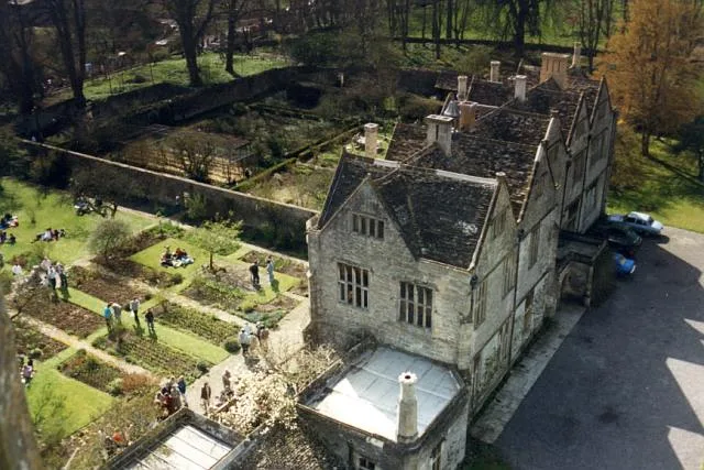
Mells — village and civil parish in Somerset, UK.

Wikimedia Commons contributors — see linked file page for photographer and licence licence
Plan your visit
- Typical visit
- 3 h–6 h
- Nearest railway station
- Frome · 5.6 km
- Free entry
- Family-friendly
- Dog-friendly
About
Mells is a town, city, village or settlement in the United Kingdom. Recent population estimates put it at around 647 people. Address: BA11. Wikidata describes it as: "village and civil parish in Somerset, UK". Coordinates: 51.2397°, -2.3881°.
Photo gallery
From the Wikipedia article
Mells is a village and civil parish in Somerset, England, near the town of Frome.
Excerpt from Wikipedia under CC BY-SA 4.0. See the source article linked in Sources below.
Background
History
In the Domesday Book of 1086 the village was known as "Mulne" meaning several mills. The parish was part of the hundred of Frome. Around 1500 Mells seems to have been known as Iron Burgh, as a result of the iron ore extracted in the area. The village hall was built in the 14th century as a tithe barn for Glastonbury Abbey and now serves as the village hall. During the 19th and early 20th centuries Mells and surrounding villages had several coal mines on the Somerset coalfield, much of which may have supplied the iron works of James Fussell. The Old Ironstone Works is a biological Site of Special Scientific Interest due to the population of Greater and Lesser Horseshoe bats. The site is a…
Visiting
Mells was rated as among the "20 most beautiful villages in the UK and Ireland" by Condé Nast Traveler in 2020. The publication recommends that visitors "marvel at the 15th-century New Street".
Sourced from Wikipedia under CC BY-SA 4.0.
- Coordinates
- 51.2397, -2.3881
- District
- Somerset
- Parish
- Mells
- Postcode
- BA11
- Parliamentary constituency
- Frome and East Somerset
- Population
- 647
- Nearest railway station
- Frome — 5.6 km
- Official site
- neighbourhood.statistics.gov.uk
Sources
- wikidata: Q1863626 (CC0)
- wikipedia: Mells, Somerset (CC BY-SA 4.0)
- commons: StAndrews Mells4.JPG (CC BY-SA 4.0)
Other places nearby
Loading nearby places…
Nearby
 📷 5
📷 5Memorials & monuments · South East England
Mells War Memorial
Mells War Memorial — Grade II* listed building-listed memorial in england-south-east, United Kingdom.
 📷 5
📷 5Historic churches · South East England
St Andrew's Church, Mells
St Andrew's Church, Mells — church in Mells, Somerset, England, UK.
 Flagship📷 10
Stately homes · South East England
Mells Manor
Mells Manor — Grade I listed house in Mells, Somerset, England, UK.
Vineyards · South East England
Wadbury Camp
Wadbury Camp — a UK vineyard in england south east, producing English or Welsh wine from cool-climate grape varieties.
 📷 5
📷 5Historic bridges · South East England
Bridge And Adjacent Ruin Of Mill 20 Metres South West Of Bilboa House
Bridge And Adjacent Ruin Of Mill 20 Metres South West Of Bilboa House — Grade II listed building-listed bridge in england-south-east, United Kingdom.
 📷 5
📷 5Museums · South East England
Old Iron Works, Mells
Old Iron Works, Mells — a museum in england-south-east, United Kingdom.
More towns in this region
 Flagship📷 10
Towns & cities · South East England
Aldermaston
Aldermaston — village and civil parish in West Berkshire in England, UK.
 Flagship📷 10
Towns & cities · South East England
Aldingbourne
Aldingbourne — village and civil parish in Arun, West Sussex, UK.
 Flagship📷 10
Towns & cities · South East England
Aldington
Aldington — village and civil parish in the Ashford District of Kent, England.
 Flagship📷 10
Towns & cities · South East England
Aldworth
Aldworth — village and civil parish in the English county of Berkshire.
Frequently asked questions
- Where is Mells?
- Mells is in South-East England, United Kingdom (postcode BA11), in the parish of Mells.
- Is Mells free to visit?
- Yes, Mells is free to enter.
- How do I get to Mells?
- The nearest railway station is Frome, about 5.6 km away. Drivers can navigate to postcode BA11.