Natural landmarks · Scottish Highlands
Meall a' Bhùiridh
Also known as: Meall a' Bhuiridh (1108m)
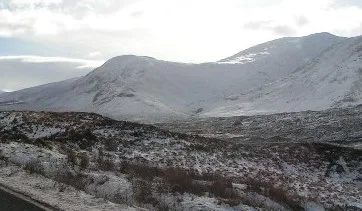
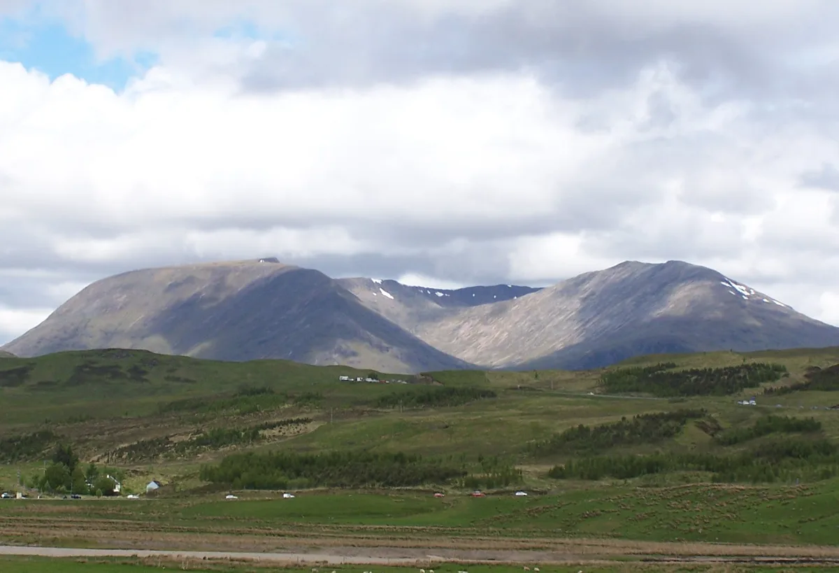
Meall a' Bhùiridh — 1107m high mountain in Highland, Scotland, UK.

Wikimedia Commons contributors — see linked file page for photographer and licence licence
Plan your visit
- Typical visit
- 1 h–2 h
- Free entry
- Dog-friendly
About
Meall a' Bhùiridh is a named natural landmark in the United Kingdom. Wikidata describes it as: "1107m high mountain in Highland, Scotland, UK". Coordinates: 56.6122°, -4.8521°.
Photo gallery
From the Wikipedia article
Meall a' Bhùiridh (IPA:[ˈmauɫ̪ˈaˈvuːɾʲɪʝ]) is a mountain on the edge of Rannoch Moor in the Highlands of Scotland. It lies near the top of Glen Coe and Glen Etive, overlooking the Kings House Hotel inn and the A82 road. The Glencoe Ski area is located on the northern slopes of the peak. Meall a' Bhùiridh is linked by a high bealach to the neighbouring peak of Creise, and the two hills are often climbed in conjunction, starting and finishing at the ski area carpark. The Clachlet Traverse is a 25 km north-to-south route linking the inn at Inveroran with the Kingshouse. Meall a' Bhùiridh is the final of four Munros crossed on this route, the others being (south to north) Stob a' Choire Odhair, Stob Ghabhar and Creise.
Excerpt from Wikipedia under CC BY-SA 4.0. See the source article linked in Sources below.
- Coordinates
- 56.6122, -4.8521
- Address
- Rannoch Moor, Scotland
- Official site
- www.walkhighlands.co.uk
Sources
- wikidata: Q6803540 (CC0)
- wikipedia: Meall a' Bhùiridh (CC BY-SA 4.0)
- commons: Meall a' bhuiridh.jpg (CC BY-SA 4.0)
Other places nearby
Loading nearby places…
Nearby
 📷 3
📷 3Mountains & hills · Scottish Highlands
Meall a' Bhùiridh
Meall a' Bhùiridh — Named summit at 1108 m.
 📷 5
📷 5Mountains & hills · Scottish Highlands
Creise
Creise — Named summit at 1100 m.
 📷 5
📷 5Natural landmarks · Scottish Highlands
Creise
Creise — 1099m high mountain in Highland, Scotland, UK.
 📷 3
📷 3Mountains & hills · Scottish Highlands
Creise - Mam Coire Easain
Creise - Mam Coire Easain — a mountain in scotland-highlands, United Kingdom.
 📷 3
📷 3Mountains & hills · Scottish Highlands
Clach Leathad
Clach Leathad — a mountain in scotland-highlands, United Kingdom.
 📷 3
📷 3Mountains & hills · Scottish Highlands
Stob a' Ghlais Choire
Stob a' Ghlais Choire — a mountain in scotland-highlands, United Kingdom, 996 m.
More natural landmarks in this region
 Flagship📷 3
Natural landmarks · Scottish Highlands
Dunalastair Water
Dunalastair Water — lake in Perth and Kinross, Scotland, UK, on the River Tummel.
 Flagship📷 3
Natural landmarks · Scottish Highlands
Loch Arkaig
Loch Arkaig — lake in Highland, Scotland, UK, outflows east to River Arkaig.
 Flagship📷 3
Natural landmarks · Scottish Highlands
Loch Assynt
Loch Assynt — lake in Highland, Scotland, UK, outflows to the River Inver and Loch na Garbh Uidhe.
 Flagship📷 3
Natural landmarks · Scottish Highlands
Loch Awe
Loch Awe — lake in Argyll and Bute, Scotland, UK, outflows to the River Awe.
Frequently asked questions
- Where is Meall a' Bhùiridh?
- Meall a' Bhùiridh is in Scottish Highlands, in the United Kingdom — coordinates 56.6122°, -4.8521°.
- Is Meall a' Bhùiridh free to visit?
- Yes — admission to Meall a' Bhùiridh is free.