Natural landmarks · East Midlands
Martham Broad
Martham Broad — lake in the United Kingdom.

Wikimedia Commons contributors — see linked file page for photographer and licence licence
Plan your visit
- Typical visit
- 1 h–2 h
- Free entry
- Dog-friendly
About
Martham Broad is a named natural landmark in the United Kingdom. Wikidata describes it as: "lake in the United Kingdom". Coordinates: 52.7242°, 1.6408°.
Photo gallery
Protected designations
- Site of Special Scientific Interest: Upper Thurne Broads and Marshes SSSI
- National Nature Reserve: MARTHAM BROAD
- Area of Outstanding Natural Beauty: Norfolk Coast
- Ramsar wetland: Broadland
Designations sourced from Natural England open data under OGL v3.
From the Wikipedia article
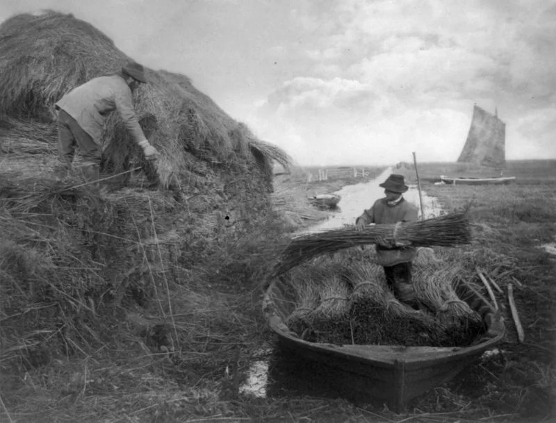
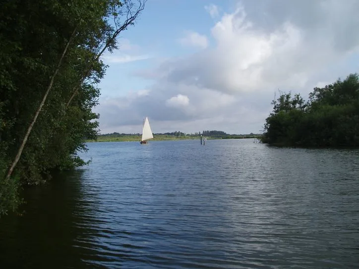
Martham Broad is a 60-hectare (150-acre) national nature reserve north of Great Yarmouth in Norfolk. It is managed by the Norfolk Wildlife Trust, and is part of the Upper Thurne Broads and Marshes Site of Special Scientific Interest. It is also part of the Broadland Ramsar site and Special Protection Area, and The Broads Special Area of Conservation. This reserve is composed of two shallow broads divided by the River Thurne, together with fen, reedbeds and marshes. There are a number of bat species and breeding birds include bearded tits, common terns, Cetti's warblers and marsh harriers. There is public access to the site.
Excerpt from Wikipedia under CC BY-SA 4.0. See the source article linked in Sources below.
- Coordinates
- 52.7242, 1.6408
- County
- Norfolk
- District
- Great Yarmouth
- Parish
- Somerton
- Postcode
- NR29 4DJ
- Parliamentary constituency
- Great Yarmouth
Sources
- wikidata: Q6774636 (CC0)
- wikipedia: Martham Broad (CC BY-SA 4.0)
- commons: The southeastern edge of Martham Broad - geograph.org.uk - 1107374.jpg (CC BY-SA 4.0)
Other places nearby
Loading nearby places…
Nearby
 Flagship📷 5
National parks · East Midlands
The Broads
The Broads is a Network of rivers and lakes in East Anglia.
 📷 3
📷 3Public art & sculpture · East Midlands
West Somerton Village Sign
West Somerton Village Sign — a public art in england-east-midlands, United Kingdom.
 📷 3
📷 3Memorials & monuments · East Midlands
West Somerton War Memorial
West Somerton War Memorial — Grade II listed building-listed memorial in england-east-midlands, United Kingdom.
 Flagship📷 5
Towns & cities · East Midlands
Martham
Martham — village in Great Yarmouth, Norfolk, England, UK.
 📷 3
📷 3Natural landmarks · East Midlands
Horsey Windpump
Horsey Windpump — a other in england-east-midlands, United Kingdom.
 📷 3
📷 3Memorials & monuments · East Midlands
Martham War Memorial, Churchyard of St Mary the Virgin
Martham War Memorial, Churchyard of St Mary the Virgin — Grade II listed building-listed memorial in england-east-midlands, United Kingdom.
More natural landmarks in this region
 📷 3
📷 3Natural landmarks · East Midlands
Alderfen Broad
Alderfen Broad — lake in the United Kingdom.
 📷 3
📷 3Natural landmarks · East Midlands
Barton Broad
Barton Broad — lake in the United Kingdom.
 📷 5
📷 5Natural landmarks · East Midlands
Bleaklow
Bleaklow — mountain in Derbyshire, England, UK.
 📷 5
📷 5Natural landmarks · East Midlands
Brayford Pool
Brayford Pool — lake in the United Kingdom.
Frequently asked questions
- Where is Martham Broad?
- Martham Broad is in Norfolk, the East Midlands, United Kingdom (postcode NR29 4DJ), in the parish of Somerton.
- Who owns Martham Broad?
- Martham Broad is owned by Norfolk Wildlife Trust.
- Is Martham Broad a protected site?
- Yes — Martham Broad is part of the Upper Thurne Broads and Marshes SSSI Site of Special Scientific Interest and the MARTHAM BROAD National Nature Reserve.
- Is Martham Broad free to visit?
- Yes, Martham Broad is free to enter.
- How do I get to Martham Broad?
- Drivers can navigate to postcode NR29 4DJ. It sits within the Great Yarmouth parliamentary constituency.