Natural landmarks · North Wales
Manod Mawr
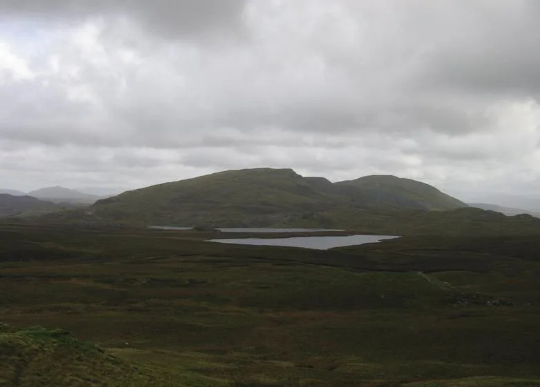
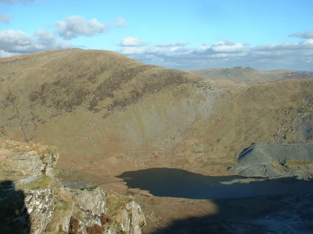
Manod Mawr — mountain (661m) in Gwynedd.

Wikimedia Commons contributors — see linked file page for photographer and licence licence
Plan your visit
- Typical visit
- 1 h–2 h
- Nearest railway station
- Blaenau Ffestiniog · 2.7 km
- Free entry
- Dog-friendly
About
Manod Mawr is a named natural landmark in the United Kingdom. Wikidata describes it as: "mountain (661m) in Gwynedd". Coordinates: 52.9841°, -3.9016°.
Photo gallery
From the Wikipedia article
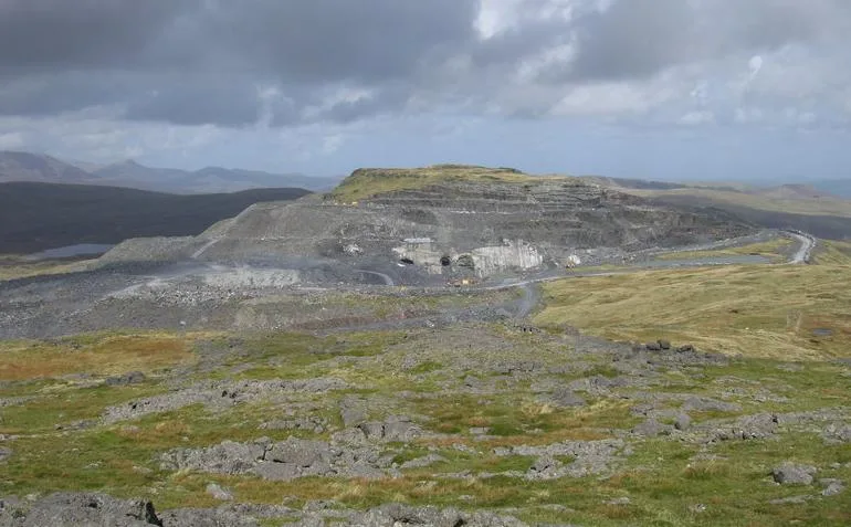
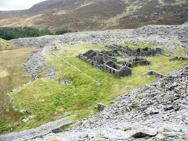
Manod Mawr is a mountain in North Wales and forms part of the Moelwynion. Although known as a mountain in the eastern Moelwyns, it and its sister peaks are sometimes known as the Ffestiniog hills. Manod Mawr is a mountain which has been extensively quarried. The now-closed Graig Ddu Quarry is to be found on the 600-metre (2,000 ft) contour, in the hollow between Manod Mawr's summit and Manod Mawr North Top. Manod Mawr's summit is in the exclusion zone of the Snowdonia National Park around Blaenau Ffestiniog, while Manod Mawr North Top's summit only just misses out on the national park's protection. There were fears the quarry would eventually remove the North Top. During the Second World War, quarry tunnels in the Manod range were used to store and protect, in secret, valuable paintings from the National Gallery in London.
Excerpt from Wikipedia under CC BY-SA 4.0. See the source article linked in Sources below.
- Coordinates
- 52.9841, -3.9016
- District
- Gwynedd
- Parish
- Ffestiniog
- Postcode
- LL41 4BA
- Parliamentary constituency
- Dwyfor Meirionnydd
- Nearest railway station
- Blaenau Ffestiniog — 2.7 km
Sources
- wikidata: Q6751103 (CC0)
- wikipedia: Manod Mawr (CC BY-SA 4.0)
- commons: Manod.jpg (CC BY-SA 4.0)
Other places nearby
Loading nearby places…
Nearby
 📷 3
📷 3Mountains & hills · North Wales
Manod Mawr
Manod Mawr — Named summit at 661 m.
 📷 3
📷 3Mountains & hills · North Wales
Manod Bach
Manod Bach — a mountain in wales-north, United Kingdom, 511 m.
 📷 3
📷 3Quarries · North Wales
Bwlch y Slaters quarry
Bwlch y Slaters quarry — Slate mine near Blaenau Ffestiniog, Gwynedd (formerly Merionethshire), Wales, United Kingdom.
 📷 3
📷 3Natural landmarks · North Wales
Manod Mawr North Top
Manod Mawr North Top — mountain (658m) in Gwynedd.
 📷 3
📷 3Mountains & hills · North Wales
Manod Mawr North Top
Manod Mawr North Top — Named summit at 658 m.
 📷 3
📷 3Heritage railways · North Wales
Rhiwbach Quarry
Rhiwbach Quarry — disused slate quarry in North Wales.
More natural landmarks in this region
 Flagship📷 5
Natural landmarks · North Wales
Llyn Llydaw
Llyn Llydaw is a natural landmark in the United Kingdom.
 📷 5
📷 5Natural landmarks · North Wales
Llyn Tegid
Llyn Tegid is a natural landmark in the United Kingdom.
 📷 3
📷 3Natural landmarks · North Wales
Allt-fawr
Allt-fawr — mountain (698m) in Gwynedd, Wales.
 📷 3
📷 3Natural landmarks · North Wales
Aran Benllyn
Aran Benllyn — mountain (885m) in Gwynedd.
Frequently asked questions
- Where is Manod Mawr?
- Manod Mawr is in North Wales, United Kingdom (postcode LL41 4BA), in the parish of Ffestiniog.
- Is Manod Mawr free to visit?
- Yes, Manod Mawr is free to enter.
- How do I get to Manod Mawr?
- The nearest railway station is Blaenau Ffestiniog, about 2.7 km away. Drivers can navigate to postcode LL41 4BA.