Mountains & hills · Scottish Lowlands
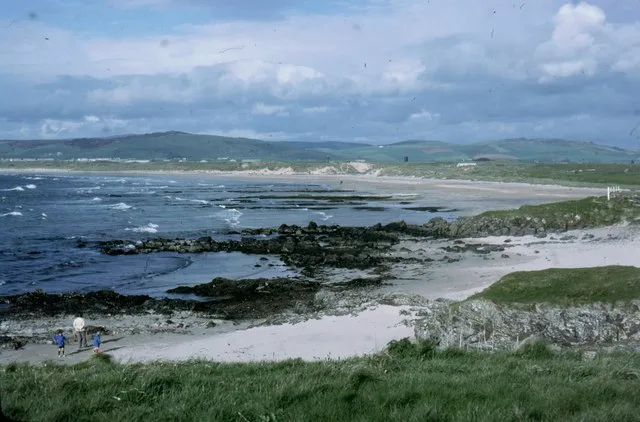
Machrihanish Bay
Machrihanish Bay — bay on the west of Kintyre, Argyll and Bute, Scotland, UK.

Wikimedia Commons contributors — see linked file page for photographer and licence licence
Plan your visit
- Typical visit
- 3 h–8 h
- Best time of year
- Late spring – early autumn (May–Oct)
- Free entry
- Dog-friendly
About
Machrihanish Bay is a named summit in the United Kingdom. Wikidata describes it as: "bay on the west of Kintyre, Argyll and Bute, Scotland, UK". Coordinates: 55.4333°, -5.7333°.
Photo gallery
From the Wikipedia article
Machrihanish Bay is a large remote tidal north by northeast coastal facing embayment, located next to the Campbeltown Airport within Argyll and Bute, Scotland. It is located on the west coast of the Kintyre peninsula. Machrihanish Bay has the longest continuous stretch of sand in Argyll.
Excerpt from Wikipedia under CC BY-SA 4.0. See the source article linked in Sources below.
- Coordinates
- 55.4333, -5.7333
- District
- Argyll and Bute
- Postcode
- PA28 6PY
- Parliamentary constituency
- Argyll, Bute and South Lochaber
Sources
- wikidata: Q24639386 (CC0)
- wikipedia: Machrihanish Bay (CC BY-SA 4.0)
- commons: Machrihanish Bay. - geograph.org.uk - 452582.jpg (CC BY-SA 4.0)
Other places nearby
Loading nearby places…
Nearby
 📷 3
📷 3Beaches · Scottish Lowlands
Machrihanish Beach
Machrihanish Beach — beach in Argyll and Bute, Scotland, UK.
Vineyards · Scottish Lowlands
Machrihanish
Machrihanish — a UK vineyard in scotland lowlands, producing English or Welsh wine from cool-climate grape varieties.
 📷 3
📷 3Hill forts · Scottish Lowlands
Machrihanish Hillfort
Machrihanish Hillfort — a hill fort in scotland-lowlands, United Kingdom.
 📷 3
📷 3Burial mounds & barrows · Scottish Lowlands
Cnocan Sithean Cairn
Cnocan Sithean Cairn — a burial mound in scotland-lowlands, United Kingdom.
📷 3Archaeological sites · Scottish Lowlands
Cnoc Sabhail Dun
Cnoc Sabhail Dun — a archaeological in scotland-lowlands, United Kingdom.
 📷 3
📷 3Historic houses · Scottish Lowlands
Kilkivin Old Parish Church
Kilkivin Old Parish Church — a historic house in scotland-lowlands, United Kingdom.
More mountains in this region
 📷 3
📷 3Mountains & hills · Scottish Lowlands
Andrewhinney Hill
Andrewhinney Hill — Named summit at 677 m.
 📷 3
📷 3Mountains & hills · Scottish Lowlands
Arbory Hill
Arbory Hill — Named summit at 429 m.
 📷 3
📷 3Mountains & hills · Scottish Lowlands
Auchenton Hill ( East Mount Lowther)
Auchenton Hill ( East Mount Lowther) — Named summit at 631 m.
 📷 3
📷 3Mountains & hills · Scottish Lowlands
Bakestall
Bakestall — Named summit at 673.5 m.
Frequently asked questions
- Where is Machrihanish Bay?
- Machrihanish Bay is in the Scottish Lowlands, United Kingdom (postcode PA28 6PY).
- Is Machrihanish Bay free to visit?
- Yes, Machrihanish Bay is free to enter.
- How do I get to Machrihanish Bay?
- Drivers can navigate to postcode PA28 6PY. It sits within the Argyll, Bute and South Lochaber parliamentary constituency.