Castles · West Midlands
Ludlow
Also known as: Llwydlo
Ludlow ( LUD-loh) is a market town and civil parish in south Shropshire, England. It is located 28 miles (45 km) south of Shrewsbury and 23 miles (37 km) north of Hereford, on the A49 road which bypas

Oast House Archive — CC BY-SA 2.0 via Wikimedia Commons licence
Plan your visit
- Typical visit
- 1.5 h–3 h
- Paid entry
- Family-friendly
- Limited wheelchair access
About
Ludlow ( LUD-loh) is a market town and civil parish in south Shropshire, England. It is located 28 miles (45 km) south of Shrewsbury and 23 miles (37 km) north of Hereford, on the A49 road which bypasses the town. The town is near the confluence of the rivers Corve and Teme. The oldest part is the medieval walled town, founded in the late 11th century after the Norman conquest of England. It is centred on a small hill which lies on the eastern bank of a bend of the River Teme. Situated on this hill are Ludlow Castle and the parish church, St Laurence's, the largest in the county. From there the streets slope downward to the rivers Corve and Teme, to the north and south respectively. The town is in a sheltered spot beneath Mortimer Forest and the Clee Hills, which are clearly visible from the town. Ludlow has nearly 500 listed buildings, including examples of medieval and Tudor-style half-timbered buildings. The town was described by Sir John Betjeman as "probably the loveliest town in England".
Photo gallery
From the Wikipedia article
Ludlow ( LUD-loh) is a market town and civil parish in south Shropshire, England. It is located 28 miles (45 km) south of Shrewsbury and 23 miles (37 km) north of Hereford, on the A49 road which bypasses the town. The town is near the confluence of the rivers Corve and Teme. The oldest part is the medieval walled town, founded in the late 11th century after the Norman conquest of England. It is centred on a small hill which lies on the eastern bank of a bend of the River Teme. Situated on this hill are Ludlow Castle and the parish church, St Laurence's, the largest in the county. From there the streets slope downward to the rivers Corve and Teme, to the north and south respectively. The town is in a sheltered spot beneath Mortimer Forest and the Clee Hills, which are clearly visible from the town. Ludlow has nearly 500 listed buildings, including examples of medieval and Tudor-style half-timbered buildings. The town was described by Sir John Betjeman as "probably the loveliest town in England".
Excerpt from Wikipedia under CC BY-SA 4.0. See the source article linked in Sources below.
Background
History
The town is situated close to Wales, and lies near the midpoint of the 257 km England–Wales border; it is also very close to the county border between Shropshire and Herefordshire (neighbouring Ludford remained part of Herefordshire until 1895). This strategic location invested it with national importance in medieval times, and thereafter with the town being the seat of the Council of Wales and the Marches during its existence (1472 to 1689).
Sourced from Wikipedia under CC BY-SA 4.0.
- Coordinates
- 52.3680, -2.7180
- District
- Shropshire
- Parish
- Ludlow
- Postcode
- SY8 1AL
- Parliamentary constituency
- South Shropshire
- Official site
- www.ludlow.org.uk
Sources
- wikipedia: Ludlow (CC BY-SA 4.0)
Other places nearby
Loading nearby places…
Nearby
 📷 3
📷 3Memorials & monuments · Mid Wales
The Tolsey
The Tolsey — a memorial in wales-mid, United Kingdom.
 📷 5
📷 5Historic churches · Mid Wales
St Laurence's Church, Ludlow
St Laurence's Church, Ludlow — a Grade I-listed church in wales-mid, United Kingdom.
.jpg?width=1200) 📷 3
📷 3Historic houses · Mid Wales
The Reader's House
The Reader's House — Grade I listed house in Ludlow, Shropshire, England, UK.
 📷 3
📷 3Memorials & monuments · Mid Wales
Feathers Hotel
Feathers Hotel — a memorial in wales-mid, United Kingdom.
 📷 3
📷 3Museums · Mid Wales
Ludlow Museum
Ludlow Museum — a museum in wales-mid, United Kingdom.
Hotels · Mid Wales
The Feathers Hotel
The Feathers Hotel — a hotel in wales mid.
More castles in this region
 📷 3
📷 3Castles · West Midlands
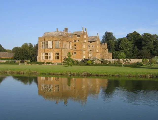
Broughton Castle
Broughton Castle — medieval manor house in Oxfordshire, England, UK.
 📷 3
📷 3Castles · West Midlands
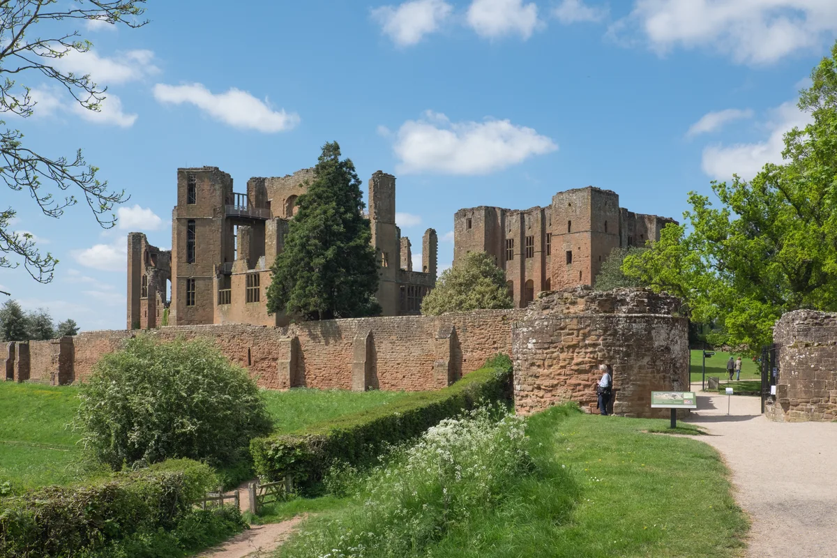
Kenilworth Castle
Kenilworth Castle — castle ruin in the town of Kenilworth, Warwickshire, England, UK.
 📷 3
📷 3Castles · West Midlands
Allesley Castle
Allesley Castle — motte-and-bailey castle in Coventry, West Midlands, England, UK.
 📷 3
📷 3Castles · West Midlands
Ardley Castle
Ardley Castle is a castle in the United Kingdom.
Frequently asked questions
- Where is Ludlow?
- Ludlow is in the West Midlands, United Kingdom (postcode SY8 1AL), in the parish of Ludlow.
- Does Ludlow charge admission?
- Ludlow typically charges admission. Check the official site for current ticket prices and opening hours.
- How do I get to Ludlow?
- Drivers can navigate to postcode SY8 1AL. It sits within the South Shropshire parliamentary constituency.