Castles · West Midlands
Lowton
Lowton is a village within the Metropolitan Borough of Wigan, in Greater Manchester, England. It is around 2 miles (3 km) from Leigh, 7 miles (11 km) south of Wigan and 12 miles (19 km) west of Manche

Glyn Drury — CC BY-SA 2.0 via Wikimedia Commons licence
Plan your visit
- Typical visit
- 1.5 h–3 h
- Family-friendly
- Limited wheelchair access
About
Lowton is a village within the Metropolitan Borough of Wigan, in Greater Manchester, England. It is around 2 miles (3 km) from Leigh, 7 miles (11 km) south of Wigan and 12 miles (19 km) west of Manchester city centre. The settlement lies across the A580 East Lancashire Road. Within the boundaries of the historic county of Lancashire, Lowton's history is closely connected with Byrom Manor, the ancestral home of the Byroms, a family which included poet John Byrom, the inventor of a system of shorthand. During the Industrial Revolution Lowton was associated with coal mining and manufacturing: it was close to several collieries and factories. At the 2011 census, the population of Lowton was split between two wards: Lowton East, and Golborne and Lowton West. The latter partially counted the entire population of Golborne, and partially the population of Lowton's western half, with the boundary between them roughly being at Scott Road to the north and Windsor Road to the south.
Photo gallery
From the Wikipedia article
Lowton is a village within the Metropolitan Borough of Wigan, in Greater Manchester, England. It is around 2 miles (3 km) from Leigh, 7 miles (11 km) south of Wigan and 12 miles (19 km) west of Manchester city centre. The settlement lies across the A580 East Lancashire Road. Within the boundaries of the historic county of Lancashire, Lowton's history is closely connected with Byrom Manor, the ancestral home of the Byroms, a family which included poet John Byrom, the inventor of a system of shorthand. During the Industrial Revolution Lowton was associated with coal mining and manufacturing: it was close to several collieries and factories. At the 2011 census, the population of Lowton was split between two wards: Lowton East, and Golborne and Lowton West. The latter partially counted the entire population of Golborne, and partially the population of Lowton's western half, with the boundary between them roughly being at Scott Road to the north and Windsor Road to the south.
Excerpt from Wikipedia under CC BY-SA 4.0. See the source article linked in Sources below.
Background
History
Lowton has an unclear toponymy: the second element is from Old English tun "farm, village" with an uncertain first element. (It is suggested that the first element is from hlāw, an old English word for hill: Wornoth Low near Stockport is the highest hill in the area, and Lowton is the highest point locally.) A record of the name as Liewetune in 1176 suggests Old English hleowe "lee", although this is not a certain etymology. Lowton was one of the berewicks of the royal manor of Newton, later being one of the members of the Barony of Makerfield. Byrom Manor, later to feature the ancestral home of the poet John Byrom which was built in the 18th century, is recorded as early as 1212; The Hare…
Sourced from Wikipedia under CC BY-SA 4.0.
- Coordinates
- 53.4710, -2.5690
- District
- Wigan
- Parish
- Wigan, unparished area
- Postcode
- WA3 2PJ
- Parliamentary constituency
- Leigh and Atherton
- Official site
- www.ukcensusdata.com
Sources
- wikipedia: Lowton (CC BY-SA 4.0)
Other places nearby
Loading nearby places…
Nearby
 📷 3
📷 3Historic churches · West Midlands
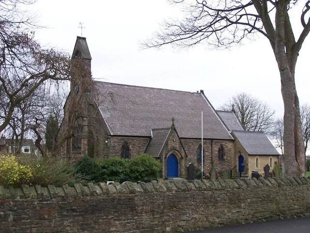
St Mary's Church, Lowton
St Mary's Church, Lowton — church in United Kingdom.
 📷 3
📷 3Archaeological sites · West Midlands
Beard's Battery
Beard's Battery — a archaeological in england-west-midlands, United Kingdom.
 📷 3
📷 3Archaeological sites · West Midlands
Mossley Hall moat (site of)
Mossley Hall moat (site of) — a archaeological in england-west-midlands, United Kingdom.
 📷 5
📷 5Castles · West Midlands
Golborne
Golborne — a castle in england-west-midlands, United Kingdom.
 📷 3
📷 3Public art & sculpture · West Midlands
Willow feature
Willow feature — a public art in england-west-midlands, United Kingdom.
📷 3Memorials & monuments · West Midlands
Golborne Colliery Memorial
Golborne Colliery Memorial — a memorial in england-west-midlands, United Kingdom.
More castles in this region
 📷 3
📷 3Castles · West Midlands
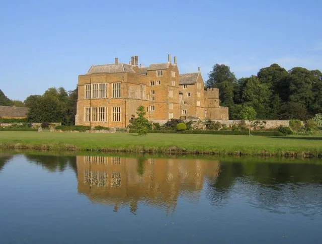
Broughton Castle
Broughton Castle — medieval manor house in Oxfordshire, England, UK.
 📷 3
📷 3Castles · West Midlands
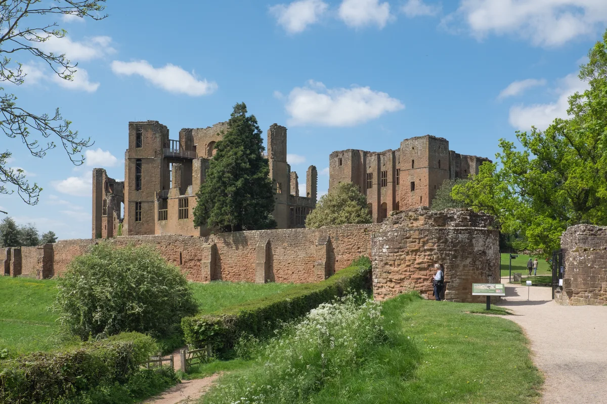
Kenilworth Castle
Kenilworth Castle — castle ruin in the town of Kenilworth, Warwickshire, England, UK.
 📷 3
📷 3Castles · West Midlands
Allesley Castle
Allesley Castle — motte-and-bailey castle in Coventry, West Midlands, England, UK.
 📷 3
📷 3Castles · West Midlands
Ardley Castle
Ardley Castle is a castle in the United Kingdom.
Frequently asked questions
- Where is Lowton?
- Lowton is in the West Midlands, United Kingdom (postcode WA3 2PJ), in the parish of Wigan, unparished area.
- Does Lowton charge admission?
- Lowton typically charges admission. Check the official site for current ticket prices and opening hours.
- How do I get to Lowton?
- Drivers can navigate to postcode WA3 2PJ. It sits within the Leigh and Atherton parliamentary constituency.