Mountains & hills · Central Scotland
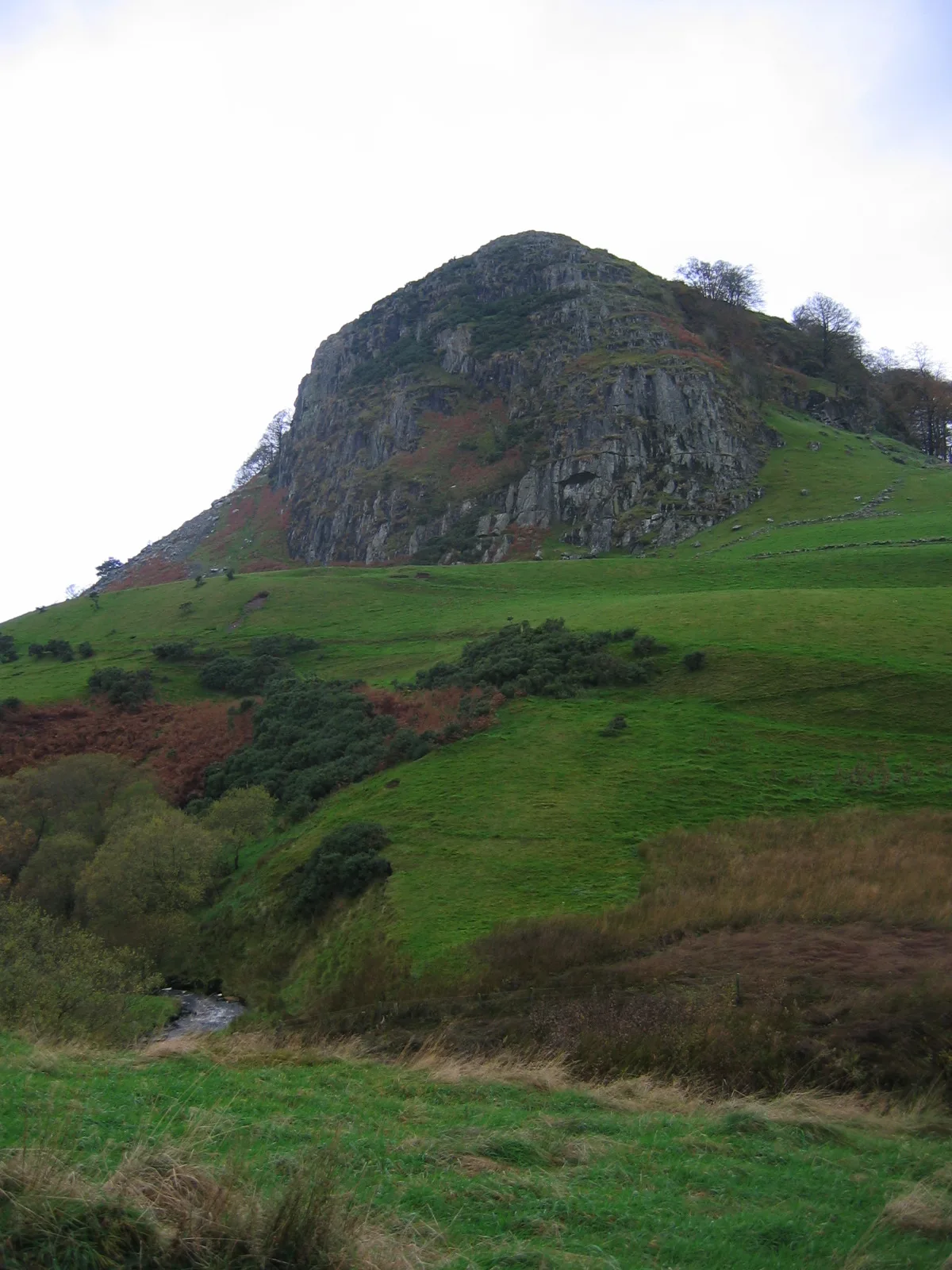
Loudoun Hill
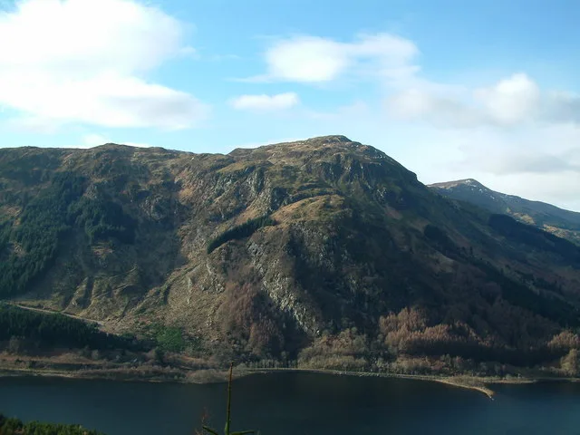
Loudoun Hill — Named summit at 316 m.

Wikimedia Commons contributors — see linked file page for photographer and licence licence
Plan your visit
- Typical visit
- 3 h–8 h
- Best time of year
- Late spring – early autumn (May–Oct)
- Free entry
- Dog-friendly
About
Loudoun Hill is a named summit in the United Kingdom. Wikidata describes it as: "Named summit at 316 m.". Coordinates: 55.6147°, -4.2105°.
Photo gallery
From the Wikipedia article
Loudoun Hill (Scottish Gaelic: Beinn Lùghdain; also commonly Loudounhill) is a volcanic plug in East Ayrshire, Scotland. It is located near the head of the River Irvine, east of Darvel.
Excerpt from Wikipedia under CC BY-SA 4.0. See the source article linked in Sources below.
Background
Description
The historic Battle of Loudoun Hill took place in 1307. Robert the Bruce, following his time in hiding after the Battle of Methven, had begun his campaign to wrest his kingdom back from Edward I of England. He claimed his first major victory over the English at the Battle of Glen Trool in April 1307. Robert Bruce adopted almost the same site, although slightly further east, and similar tactics, for another encounter with English forces, this time under Aymer de Valence, 2nd Earl of Pembroke. On 10 May, Bruce's men dug a series of trenches, forcing the English towards boggy ground around Loch Gait. This allowed the 500–600 Scots to repulse an army of 3000. The first attack broke, and the…
Sourced from Wikipedia under CC BY-SA 4.0.
- Coordinates
- 55.6147, -4.2105
- District
- East Ayrshire
- Postcode
- KA17 0LU
- Parliamentary constituency
- Kilmarnock and Loudoun
Sources
- osm: n242933740 (ODbL)
- wikipedia: Loudoun Hill (CC BY-SA 4.0)
- commons: LoudounHill.jpg (CC BY-SA 4.0)
Other places nearby
Loading nearby places…
Nearby
 📷 5
📷 5Natural landmarks · Central Scotland
Loudoun Hill
Loudoun Hill — mountain in East Ayrshire, Scotland, UK.
 📷 3
📷 3Forts · Central Scotland
Battle Of Loudoun Hill
Battle Of Loudoun Hill is a fort in the United Kingdom.
 📷 3
📷 3Archaeological sites · Central Scotland
The Beg (Roman Camp (site))
The Beg (Roman Camp (site)) — a archaeological in scotland-central, United Kingdom.
 📷 5
📷 5Historic bridges · Central Scotland
Mill Bridge, Ryeyard
Mill Bridge, Ryeyard — category C listed building-listed bridge in scotland-central, United Kingdom.
 📷 3
📷 3Natural landmarks · Central Scotland
Loch Gate
Loch Gate — lake, mostly drained, in East Ayrshire and South Lanarkshire, Scotland, UK, outflows south via a drain to Avon Water.
 📷 5
📷 5Historic bridges · Central Scotland
Passford Bridge
Passford Bridge — category C listed building-listed bridge in scotland-central, United Kingdom.
More mountains in this region
 📷 3
📷 3Mountains & hills · Central Scotland
Abbey Hill
Abbey Hill — Named summit at 278 m.
 📷 3
📷 3Mountains & hills · Central Scotland
Aberlady Bay
Aberlady Bay — bay on the north coast of East Lothian, Scotland, UK.
 📷 3
📷 3Mountains & hills · Central Scotland
Allermuir Hill
Allermuir Hill — Named summit at 493 m.
 📷 3
📷 3Mountains & hills · Central Scotland
Ardnandave
Ardnandave — Named summit at 715 m.
Frequently asked questions
- Where is Loudoun Hill?
- Loudoun Hill is in central Scotland, United Kingdom (postcode KA17 0LU).
- Is Loudoun Hill free to visit?
- Yes, Loudoun Hill is free to enter.
- How do I get to Loudoun Hill?
- Drivers can navigate to postcode KA17 0LU. It sits within the Kilmarnock and Loudoun parliamentary constituency.