Historic churches · South East England
Lock up, 40m north east of Church Farm
Lock up, 40m north east of Church Farm — a Grade II*-listed church in england-south-east, United Kingdom.

Michael Dibb — CC BY-SA 2.0 via Wikimedia Commons licence
_-_geograph.org.uk_-_6812163.jpg)
Plan your visit
- Typical visit
- 30 min–1 h
- Free entry
About
Lock up, 40m north east of Church Farm is a Grade II*-listed building in england-south-east, United Kingdom. Grade II* status is conferred by Historic England (or Cadw, Historic Environment Scotland or NIEA equivalents) on buildings of exceptional national interest. See the linked Wikipedia article for full historical and architectural details.
Photo gallery
Place summary
The Lock up, located 40 metres north-east of Church Farm in South-East England, is a Grade II* listed structure. This designation reflects its historical significance and architectural interest within the region.
AI-generated from the structured facts on this page (operator, designation, listing, era). Not a substitute for visiting.
- Coordinates
- 51.3324, -2.1847
- District
- Wiltshire
- Parish
- Hilperton
- Postcode
- BA14 7RH
- Parliamentary constituency
- South West Wiltshire
Sources
- wikidata: Q17663943 (CC0)
Other places nearby
Loading nearby places…
Nearby
📷 5Memorials & monuments · South East England
Hilperton War Memorial
Hilperton War Memorial — Grade II listed building-listed memorial in england-south-east, United Kingdom.
_(geograph_6813118).jpg?width=1200) 📷 5
📷 5Historic houses · South East England
Hilperton House
Hilperton House — house in Hilperton, Wiltshire, England, UK.
 📷 5
📷 5Memorials & monuments · South East England
Hooper Monument In The Churchyard About 7 Metres South West Of Tower Of Church Of St Michael And All Angels
Hooper Monument In The Churchyard About 7 Metres South West Of Tower Of Church Of St Michael And All Angels — Grade II listed building-listed memorial in england-south-east, United Kingdom.
_(geograph_6813114).jpg?width=1200) 📷 5
📷 5Historic houses · South East England
Oriel House
Oriel House — house in Hilperton, Wiltshire, England, UK.
 📷 5
📷 5Towns & cities · South East England
Hilperton
Hilperton — village in Wiltshire, England, UK.
Hotels · South East England
Hilbury Court Hotel
Hilbury Court Hotel — a hotel in england south east.
More places in this region
 Flagship📷 10
Historic churches · South East England
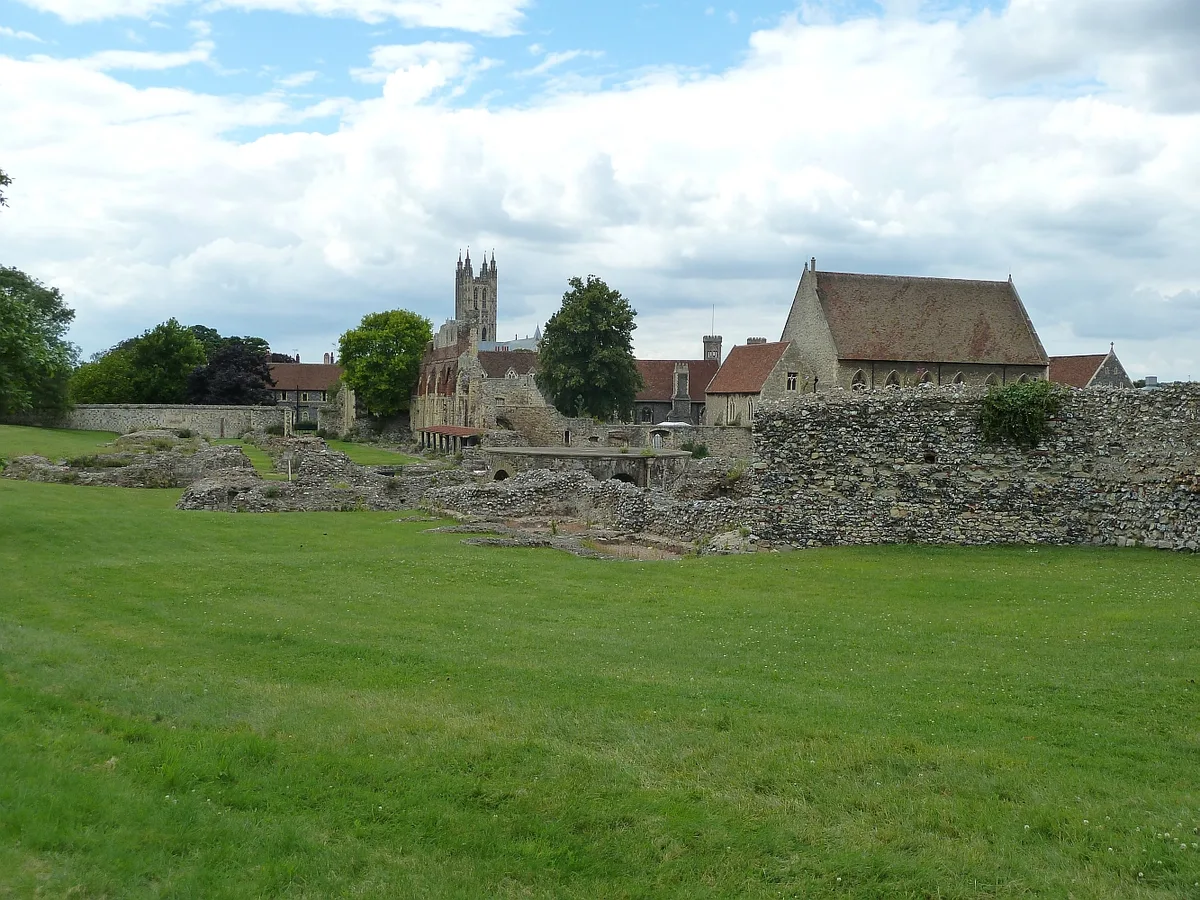
St Augustine's Abbey
St Augustine's Abbey — monastery in Canterbury, Kent, England, UK.
 📷 5
📷 5Historic churches · South East England
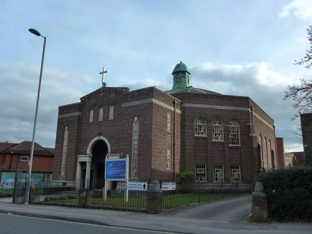
286
286 — church building in Swaythling, Southampton, England.
 📷 5
📷 5Historic churches · South East England
Abbey Church of St Gregory the Great, Downside Abbey
Abbey Church of St Gregory the Great, Downside Abbey — church in Stratton-on-the-Fosse, Somerset, England, UK.
 📷 5
📷 5Historic churches · South East England
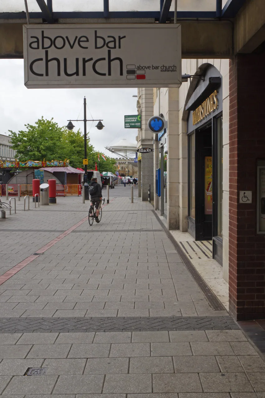
Above Bar Church, Southampton
Above Bar Church, Southampton — church in Southampton, UK.
Frequently asked questions
- Where is Lock up, 40m north east of Church Farm?
- Lock up, 40m north east of Church Farm is in South-East England, United Kingdom (postcode BA14 7RH), in the parish of Hilperton.
- Is Lock up, 40m north east of Church Farm a listed building?
- Lock up, 40m north east of Church Farm is officially recognised as Grade II* listed.
- Is Lock up, 40m north east of Church Farm free to visit?
- Yes, Lock up, 40m north east of Church Farm is free to enter.
- How do I get to Lock up, 40m north east of Church Farm?
- Drivers can navigate to postcode BA14 7RH. It sits within the South West Wiltshire parliamentary constituency.