Natural landmarks · Scottish Highlands
Loch Garry
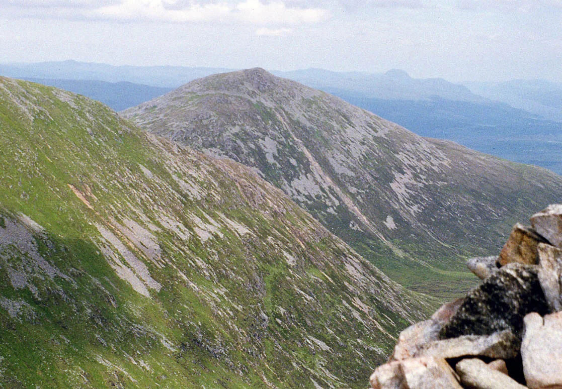
Loch Garry — lake and reservoir in Highland, Scotland, UK, on the River Garry.

Wikimedia Commons contributors — see linked file page for photographer and licence licence
Plan your visit
- Typical visit
- 1 h–2 h
- Free entry
- Dog-friendly
About
Loch Garry is a named natural landmark in the United Kingdom. It covers approximately 7 km². Wikidata describes it as: "lake and reservoir in Highland, Scotland, UK, on the River Garry". Coordinates: 57.0765°, -4.9175°.
Photo gallery
From the Wikipedia article
Loch Garry (Scottish Gaelic: Loch Garraidh) is a freshwater loch 25 km north of Fort William, Lochaber, Scotland. Loch Garry is 11 km long and 50 m deep. It is fed by waters from Loch Quoich 10 km upstream on the River Garry, and drains into Loch Oich in the Great Glen just 5 km downstream. Loch Garry is much photographed from the A87 for its romantic setting and also because a quirk of perspective makes it appear like a map of Scotland. Both lochs have been dammed for the production of hydroelectricity, the dam on Loch Quoich being the largest rockfill dam in Scotland at 320 m long and 38 m high. Water is fed by tunnel to the two power stations each producing 20MW, and the scheme was completed in 1962. The Glen used to be home of the Clan MacDonell of Glengarry, but since the Highland Clearances the population has been reduced to a handful of estates. The main activities are deer stalking and forestry, with little tourism apart from Munro-baggers seeking some spectacularly remote mountains at the head of the glen. The minor road along the north side of Loch Garry continues past Loch Quoich to Kinlochhourn from where a footpath continues to Knoydart. There is another Loch Garry in Glengarry County, Ontario, Canada. This loch is named by Clan MacDonell of Glengarry, after their previous home loch, Loch Garry in Scotland, after their emigration to the county from Scotland in result of the Highland Clearances
Excerpt from Wikipedia under CC BY-SA 4.0. See the source article linked in Sources below.
- Coordinates
- 57.0765, -4.9175
- Address
- Scotland
Sources
- wikidata: Q6979172 (CC0)
- wikipedia: Loch Garry (CC BY-SA 4.0)
- commons: Loch Garry by Kenny Barker.jpg (CC BY-SA 4.0)
Other places nearby
Loading nearby places…
Nearby
 📷 3
📷 3Natural landmarks · Scottish Highlands
Daingean Deserted Settlement
Daingean Deserted Settlement — a other in scotland-highlands, United Kingdom.
 📷 3
📷 3Memorials & monuments · Scottish Highlands
Bill Muirhead memorial
Bill Muirhead memorial — a memorial in scotland-highlands, United Kingdom.
 📷 3
📷 3Viewpoints · Scottish Highlands
Glengarry Viewpoint
Glengarry Viewpoint is a viewpoint in the United Kingdom.
 📷 3
📷 3Archaeological sites · Scottish Highlands
Eilean Nan Mhuilchean, Crannog
Eilean Nan Mhuilchean, Crannog — a archaeological in scotland-highlands, United Kingdom.
 📷 3
📷 3Natural landmarks · Scottish Highlands
Ben Tee
Ben Tee — mountain in Highland, Scotland, UK.
 📷 3
📷 3Mountains & hills · Scottish Highlands
Ben Tee
Ben Tee — Named summit at 904 m.
More natural landmarks in this region
 Flagship📷 3
Natural landmarks · Scottish Highlands
Dunalastair Water
Dunalastair Water — lake in Perth and Kinross, Scotland, UK, on the River Tummel.
 Flagship📷 3
Natural landmarks · Scottish Highlands
Loch Arkaig
Loch Arkaig — lake in Highland, Scotland, UK, outflows east to River Arkaig.
 Flagship📷 3
Natural landmarks · Scottish Highlands
Loch Assynt
Loch Assynt — lake in Highland, Scotland, UK, outflows to the River Inver and Loch na Garbh Uidhe.
 Flagship📷 3
Natural landmarks · Scottish Highlands
Loch Awe
Loch Awe — lake in Argyll and Bute, Scotland, UK, outflows to the River Awe.
Frequently asked questions
- Where is Loch Garry?
- Loch Garry is in Scottish Highlands, in the United Kingdom — coordinates 57.0765°, -4.9175°.
- Is Loch Garry free to visit?
- Yes — admission to Loch Garry is free.