Natural landmarks · North West England
Lingmoor Fell
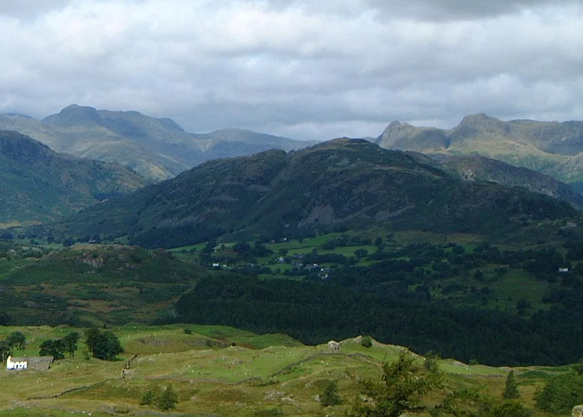
Lingmoor Fell — mountain in United Kingdom.

Wikimedia Commons contributors — see linked file page for photographer and licence licence
Plan your visit
- Typical visit
- 1 h–2 h
- Free entry
- Dog-friendly
About
Lingmoor Fell is a named natural landmark in the United Kingdom. Wikidata describes it as: "mountain in United Kingdom". Coordinates: 54.4350°, -3.0790°.
Photo gallery
From the Wikipedia article
Lingmoor Fell is a fell in the English Lake District, situated eight kilometres (five miles) west of Ambleside. The fell reaches a height of 469 m (1,540 ft) and divides the valleys of Great Langdale and Little Langdale. The fell's name originates from the Old Norse word lyng meaning “heather covered”. The actual summit of the fell is named as Brown How on Ordnance Survey maps.
Excerpt from Wikipedia under CC BY-SA 4.0. See the source article linked in Sources below.
- Coordinates
- 54.4350, -3.0790
- District
- Westmorland and Furness
- Parish
- Lakes
- Postcode
- LA22 9PG
- Parliamentary constituency
- Westmorland and Lonsdale
Sources
- wikidata: Q6553901 (CC0)
- wikipedia: Lingmoor Fell (CC BY-SA 4.0)
- commons: Lingmoor Fell from Black Fell.jpg (CC BY-SA 4.0)
Other places nearby
Loading nearby places…
Nearby
 📷 4
📷 4Mountains & hills · North West England
Lingmoor Fell
Lingmoor Fell — Named summit at 469.9 m.
Campsites · North West England
Baysbrown Farm
Baysbrown Farm — a campsite in england north west.
 📷 3
📷 3Archaeological sites · North West England
Copt Howe Artwork Carvings
Copt Howe Artwork Carvings — a archaeological in england-north-west, United Kingdom.
 📷 3
📷 3Archaeological sites · North West England
Cup mark artworks
Cup mark artworks — a archaeological in england-north-west, United Kingdom.
Campsites · North West England
Great Langdale Campsite
Great Langdale Campsite — a campsite in england north west.
 📷 3
📷 3Castles · North West England
Castle Howe Hillfort
Castle Howe Hillfort — a castle in england-north-west, United Kingdom.
More natural landmarks in this region
 ★ Iconic📷 4
Natural landmarks · North West England
Coniston Water
Lake District lake — Swallows and Amazons setting and Donald Campbell water-speed history.
 📷 3
📷 3Natural landmarks · North West England
Elter Water
Elter Water — lake in the United Kingdom.
 📷 3
📷 3Natural landmarks · North West England
Esthwaite Water
Esthwaite Water — lake in the United Kingdom.
 Flagship📷 5
Natural landmarks · North West England
Semerwater
Semerwater — lake in North Yorkshire, England, UK.
Frequently asked questions
- Where is Lingmoor Fell?
- Lingmoor Fell is in North-West England, United Kingdom (postcode LA22 9PG), in the parish of Lakes.
- Is Lingmoor Fell free to visit?
- Yes, Lingmoor Fell is free to enter.
- How do I get to Lingmoor Fell?
- Drivers can navigate to postcode LA22 9PG. It sits within the Westmorland and Lonsdale parliamentary constituency.