Museums · North West England
Leyland, Lancashire
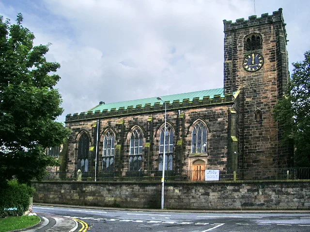
Leyland, Lancashire — a museum in england-north-west, United Kingdom.

Ann Cook — CC BY-SA 2.0 via Wikimedia Commons licence
Plan your visit
- Typical visit
- 1.5 h–3 h
- Best time of year
- Year-round
- Family-friendly
- Limited wheelchair access
About
Leyland, Lancashire is a museum in england-north-west, United Kingdom, listed in the Wikipedia register of British heritage and tourism sites. See the linked Wikipedia article for full details.
Photo gallery
Place summary
Leyland, located in Lancashire, is home to a museum dedicated to preserving the area's industrial heritage. The museum showcases a range of exhibits related to local manufacturing and transport history.
AI-generated from the structured facts on this page (operator, designation, listing, era). Not a substitute for visiting.
Background
History
The name Leyland derives from the Old English lǣgeland meaning 'unploughed land'. Leyland was an area of fields, with Roman roads passing through, from ancient Wigan to Walton-le-Dale. It is mentioned in the Domesday Book (1085). In 1066, King Edward the Confessor presided over the whole of Leyland. The manor was divided into three large ploughlands, which were controlled by local noblemen. In the 12th century, it came under the barony of Penwortham. The area of Worden, which is now Worden Park, was one of nine oxgangs of land granted to the Knights Hospitaller, by Roger de Lacy, in Lancashire, but the land was not assigned to any individual and a local man, who was a very close friend of…
Architecture
The Anglican church of St Ambrose, on Moss Lane, is a Grade II listed building dating from 1882 to 1885 by Charles Aldridge and Charles Deacon. It is constructed of stone and has green slate roofs with red ridge tiles. It is in a mixed Early English and early French Gothic style. From 1962 to 1964, St Mary's Catholic Church in Leyland was built. It was founded by the Benedictines from Ampleforth Abbey and replaced a smaller church built in 1854. It was designed by Jerzy Faczynski and according to Historic England it is a "building of outstanding importance for its architectural design, advanced liturgical planning and artistic quality of the fixtures and fittings". In 1998, it was…
Sourced from Wikipedia under CC BY-SA 4.0.
- Coordinates
- 53.6903, -2.6992
- County
- Lancashire
- District
- South Ribble
- Parish
- South Ribble, unparished area
- Postcode
- PR25 2EX
- Parliamentary constituency
- South Ribble
- Official site
- south-ribble.co.uk
Sources
- wikipedia: Leyland, Lancashire (CC BY-SA 4.0)
Other places nearby
Loading nearby places…
Nearby
 📷 3
📷 3Memorials & monuments · North West England
Leyland War Memorial
Leyland War Memorial — a memorial in england-north-west, United Kingdom.
📷 3Memorials & monuments · North West England
Leyland War Memorial Garden
Leyland War Memorial Garden — a memorial in england-north-west, United Kingdom.
 📷 3
📷 3Historic churches · North West England
St Andrew's Church, Leyland
St Andrew's Church, Leyland — church in South Ribble, Lancashire, England, UK.
 📷 3
📷 3Memorials & monuments · North West England
Walker Monument Approximately 20 Metres South Of Chancel Of Church Of St Andrew
Walker Monument Approximately 20 Metres South Of Chancel Of Church Of St Andrew — Grade II* listed building-listed memorial in england-north-west, United Kingdom.
📷 3Museums · North West England
South Ribble Museum & Exhibition Centre
South Ribble Museum & Exhibition Centre — a museum in england-north-west, United Kingdom.
 📷 3
📷 3Memorials & monuments · North West England
Tower Of Roman Catholic Church Of St Mary
Tower Of Roman Catholic Church Of St Mary — Grade II listed building-listed memorial in england-north-west, United Kingdom.
More museums in this region
 📷 3
📷 3Museums · North West England
Abbot Hall Art Gallery
Abbot Hall Art Gallery — Grade I listed art museum in Kendal, United Kingdom.
 📷 4
📷 4Museums · North West England
Bancroft Shed
Bancroft Shed — mill museum in Barnoldswick, Pendle, Lancashire, England, UK.
 📷 3
📷 3Museums · North West England
Blackburn Museum and Art Gallery
Blackburn Museum and Art Gallery — museum in Lancashire, England.
 📷 5
📷 5Museums · North West England
Bolton Steam Museum
Bolton Steam Museum — industrial museum in England, United Kingdom.
Frequently asked questions
- Where is Leyland, Lancashire?
- Leyland, Lancashire is in North West England, in the United Kingdom — coordinates 53.6903°, -2.6992°.
- Is Leyland, Lancashire wheelchair accessible?
- Partially — OpenStreetMap notes limited wheelchair access at Leyland, Lancashire. Check ahead for specific facilities.